
-
Federal
AIRS/Aqua L2 Near Real Time (NRT) Cloud-Cleared Infrared Radiances (AIRS-only) V006 (AIRS2CCF_NRT) at GES DISC
National Aeronautics and Space Administration —
The Atmospheric Infrared Sounder (AIRS) Level 2 Near Real Time (NRT) Cloud-Cleared Infrared Radiances (AIRS-only) product (AIRS2CCF_NRT_006) differs from the routine... -
Federal
TROPICS06 L2A Unified Resolution Brightness Temperatures V1.0
National Aeronautics and Space Administration —
The "Time-Resolved Observations of Precipitation structure and storm Intensity with a Constellation of Smallsats" (TROPICS) mission has a goal of providing nearly... -
Federal
TROPICS03 L2A Unified Resolution Brightness Temperatures V1.0
National Aeronautics and Space Administration —
The "Time-Resolved Observations of Precipitation structure and storm Intensity with a Constellation of Smallsats" (TROPICS) mission has a goal of providing nearly... -
Federal
TRMM Microwave Imager Precipitation Profile L3 1 month 0.5 degree x 0.5 degree V7 (TRMM_3A12) at GES DISC
National Aeronautics and Space Administration —
The new equivalent for this dataset should be searched for as "GPM_3GPROFTRMMTMI_CLIM". This product contains global monthly means of surface precipitation rate, rain... -
Federal
TROPICS01 Pathfinder L2A Unified Resolution Brightness Temperatures V1.0
National Aeronautics and Space Administration —
The "Time-Resolved Observations of Precipitation structure and storm Intensity with a Constellation of Smallsats" (TROPICS) mission has a goal of providing nearly... -
Federal
TROPICS07 L2A Unified Resolution Brightness Temperatures V0.2
National Aeronautics and Space Administration —
The "Time-Resolved Observations of Precipitation structure and storm Intensity with a Constellation of Smallsats" (TROPICS) mission has a goal of providing nearly... -
Federal
ESMR/Nimbus-5 Images of Brightness Temperature on 70 mm Film V001 (ESMRN5IM) at GES DISC
National Aeronautics and Space Administration —
ESMRN5IM is the Nimbus-5 Electrically Scanning Microwave Radiometer (ESMR) data product containing daily brightness temperature images from 70-mm photofacsimile film... -
Federal
TROPICS03 L2B Deep Multispectral INtensity (DMIN) of Tropical cyclones estimator Algorithm V1.0
National Aeronautics and Space Administration —
The "Time-Resolved Observations of Precipitation structure and storm Intensity with a Constellation of Smallsats" (TROPICS) mission has a goal of providing nearly... -
Federal
TROPICS05 L2B Deep Multispectral INtensity (DMIN) of Tropical Cyclones Estimator Algorithm V0.2
National Aeronautics and Space Administration —
The "Time-Resolved Observations of Precipitation structure and storm Intensity with a Constellation of Smallsats" (TROPICS) mission has a goal of providing nearly... -
Federal
TROPICS07 L2B Tropical Cyclone Intensity Estimate (TCIE) Algorithm V1.0
National Aeronautics and Space Administration —
The "Time-Resolved Observations of Precipitation structure and storm Intensity with a Constellation of Smallsats" (TROPICS) mission has a goal of providing nearly... -
Federal
TROPICS01 L2B Deep Multispectral INtensity (DMIN) of Tropical Cyclones Estimator Algorithm V1.0
National Aeronautics and Space Administration —
The "Time-Resolved Observations of Precipitation structure and storm Intensity with a Constellation of Smallsats" (TROPICS) mission has a goal of providing nearly... -
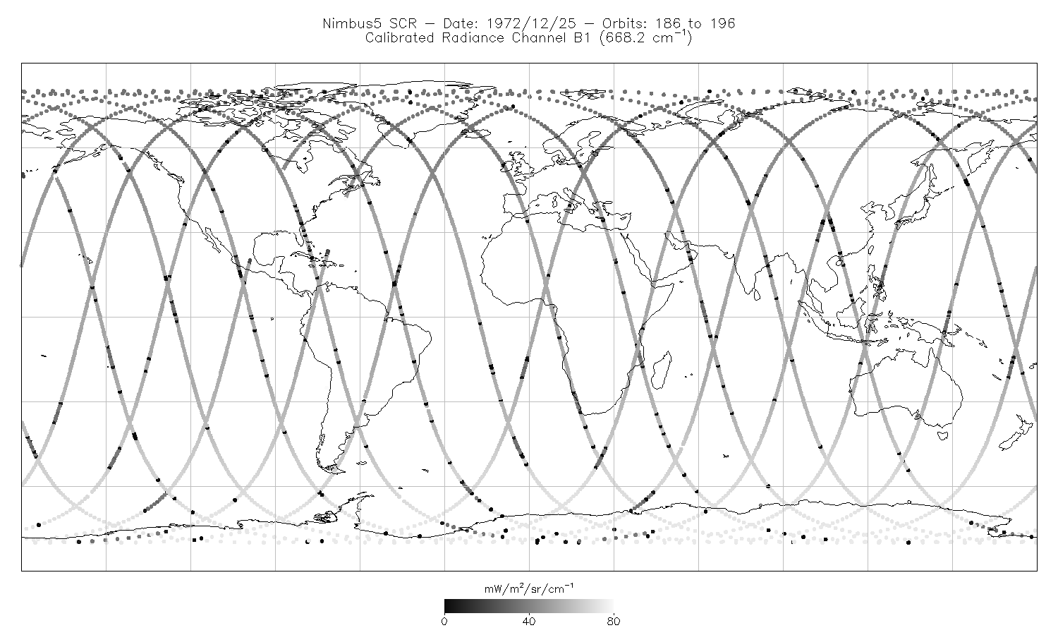
Federal
SCR/Nimbus-5 Level 1 Calibrated Radiances V001 (SCRN5L1RAD) at GES DISC
National Aeronautics and Space Administration —
SCRN5L1RAD is the Nimbus-5 Selective Chopper Radiometer (SCR) Level 1 Calibrated Radiances data product. The calibrated radiances are measured at 16 channels from 2.3... -
Federal
TROPICS01 Pathfinder L1B Orbital Geolocated Native-Resolution Brightness Temperatures V1.0
National Aeronautics and Space Administration —
The "Time-Resolved Observations of Precipitation structure and storm Intensity with a Constellation of Smallsats" (TROPICS) mission has a goal of providing nearly... -
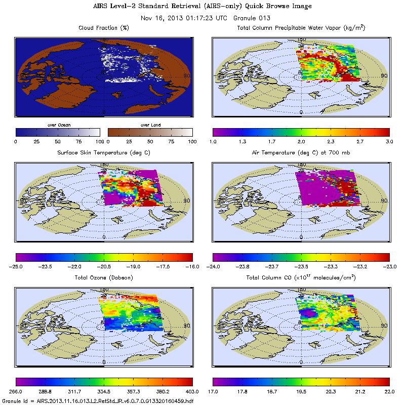
Federal
AIRS/Aqua L2 Near Real Time (NRT) Support Retrieval (AIRS-only) V006 (AIRS2SUP_NRT) at GES DISC
National Aeronautics and Space Administration —
The Atmospheric Infrared Sounder (AIRS) Level 2 Near Real Time (NRT) Support Retrieval (AIRS-only) product (AIRS2SUP_NRT_006) differs from the routine product... -
Federal
TROPICS05 L2B Tropical Cyclone Intensity Estimate (TCIE) Algorithm V1.0
National Aeronautics and Space Administration —
The "Time-Resolved Observations of Precipitation structure and storm Intensity with a Constellation of Smallsats" (TROPICS) mission has a goal of providing nearly... -
Federal
MODIS/Aqua Clouds 1km and 5km 5-Min L2 Wide Swath Subset along CloudSat V002 (MAC06S1) at GES DISC NGDA
National Aeronautics and Space Administration —
This is the wide-swath MODIS/Aqua subset along CloudSat field of view track. The goal of the wide-swath subset is to select and return MODIS data that are within... -
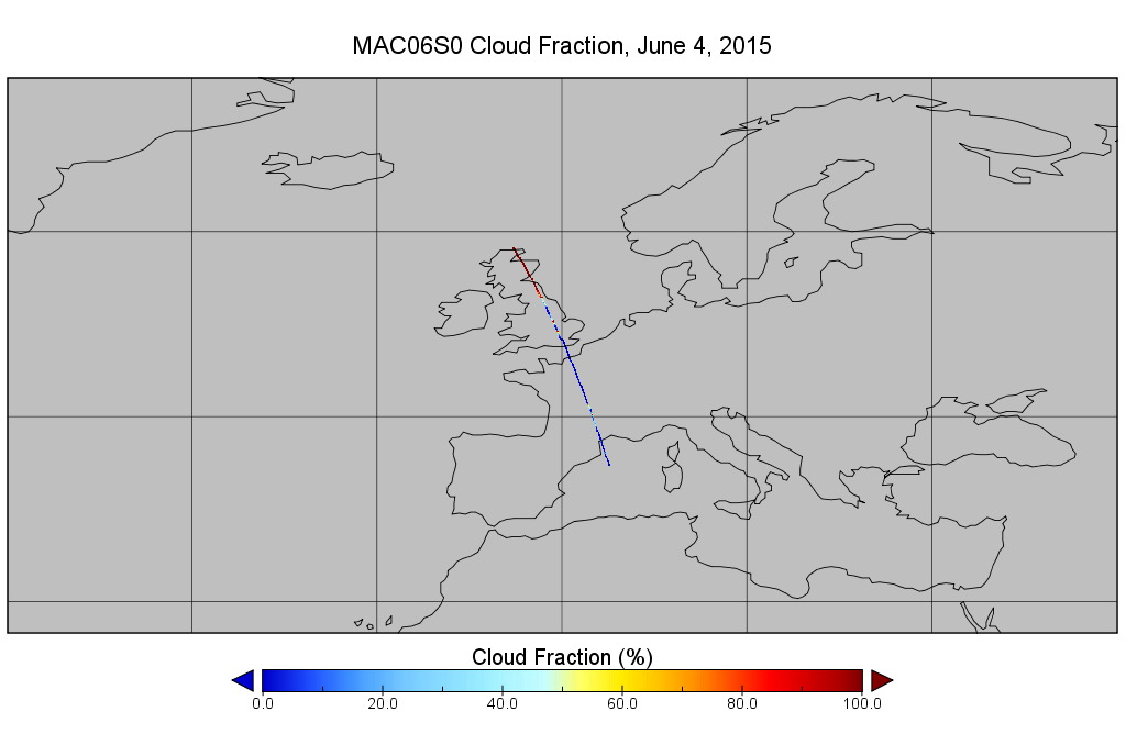
Federal
MODIS/Aqua Clouds 1km and 5km 5-Min L2 Narrow Swath Subset along CloudSat V002 (MAC06S0) at GES DISC NGDA
National Aeronautics and Space Administration —
This is the narrow-swath MODIS/Aqua subset along CloudSat field of view track. The goal of the narrow-swath subset is to select and return MODIS data that are within... -
Federal
AIRS/Aqua L2 Near Real Time (NRT) Standard Physical Retrieval (AIRS-only) V006 (AIRS2RET_NRT) at GES DISC
National Aeronautics and Space Administration —
The Atmospheric Infrared Sounder (AIRS) Level 2 Near Real Time (NRT) Standard Physical Retrieval (AIRS-only) product (AIRS2RET_NRT_006) differs from the routine... -
Federal
TROPICS05 L2A Unified Resolution Brightness Temperatures V0.2
National Aeronautics and Space Administration —
The "Time-Resolved Observations of Precipitation structure and storm Intensity with a Constellation of Smallsats" (TROPICS) mission has a goal of providing nearly... -
Federal
TRMM TMI/PR Combined Precipitation L3 1 month 0.5 degree x 0.5 degree V7 (TRMM_3B31) at GES DISC
National Aeronautics and Space Administration —
This is a combined rainfall product. 3B31 uses the high quality retrievals done for the narrow swath in 2B31 to calibrate the wide swath retrievals generated in 2A12....

Official websites use .gov
A
.gov website belongs to an official government
organization in the United States.
Secure .gov websites use HTTPS
A
lock (
) or https:// means you’ve safely connected to
the .gov website. Share sensitive information only on official,
secure websites.