
-
Federal
MODIS/Terra+Aqua L3 Value-added Aerosol Optical Depth - NRT NGDA recent views
National Aeronautics and Space Administration —
MODIS was launched aboard the Terra satellite on December 18, 1999 (10:30 am equator crossing time) as part of NASA's Earth Observing System (EOS) mission. MODIS with... -
Federal
MODIS/Terra Clouds 5-Min L2 Swath 1km and 5km NGDA recent views
National Aeronautics and Space Administration —
The MODIS/Terra Clouds 5-Min L2 Swath 1km and 5km product (MOD06_L2) consists of cloud optical and physical parameters. These parameters are derived using remotely... -
Federal
Global Fire Emissions Database, Version 4.1 (GFEDv4) NGDA recent views
National Aeronautics and Space Administration —
This dataset provides global estimates of monthly burned area, monthly emissions and fractional contributions of different fire types, daily or 3-hourly fields to... -
Federal
ISLSCP II Ecosystem Rooting Depths NGDA recent views
National Aeronautics and Space Administration —
The goal of this study was to predict the global distribution of plant rooting depths based on data about global aboveground vegetation structure and climate.... -
Federal
MODIS/Aqua Clouds 1km and 5km 5-Min L2 Wide Swath Subset along CloudSat V002 (MAC06S1) at GES DISC NGDA recent views
National Aeronautics and Space Administration —
This is the wide-swath MODIS/Aqua subset along CloudSat field of view track. The goal of the wide-swath subset is to select and return MODIS data that are within... -
Federal
MODIS/Aqua Cloud Properties 5-min L2 Swath 1km NGDA recent views
National Aeronautics and Space Administration —
The MODIS/Aqua Cloud Properties 5-min L2 Swath 1km product is designed to facilitate continuity in cloud properties between the MODIS (Moderate Resolution Imaging... -
Federal
MODIS/Terra+Aqua Land Aerosol Optical Depth Daily L2G Global 1km SIN Grid V061 NGDA recent views
National Aeronautics and Space Administration —
The MCD19A2 Version 6.1 data product is a Moderate Resolution Imaging Spectroradiometer (MODIS) Terra and Aqua combined Multi-angle Implementation of Atmospheric... -
Federal
MODIS/Aqua Cloud Mask and Spectral Test Results 5-Min L2 Swath 250m and 1km - NRT NGDA recent views
National Aeronautics and Space Administration —
The MODIS level-2 cloud mask product is a global product generated for both daytime and nighttime conditions at 1-km spatial resolution (at nadir) and for daytime at... -
Federal
MODIS/Aqua Clouds 5-Min L2 Swath 1km and 5km NGDA recent views
National Aeronautics and Space Administration —
The MODIS/Aqua Clouds 5-Min L2 Swath 1km and 5km product consists of cloud optical and physical parameters. The cloud optical parameters are generated at 1km and... -
Federal
Global Annual PM2.5 Grids from MODIS, MISR and SeaWiFS Aerosol Optical Depth (AOD), 1998-2019, V4.GL.03 NGDA recent views
National Aeronautics and Space Administration —
The Global Annual PM2.5 Grids from MODIS, MISR and SeaWiFS Aerosol Optical Depth (AOD), 1998-2019, V4.GL.03 consists of annual concentrations (micrograms per cubic... -
Federal
MODIS/Terra Total Precipitable Water Vapor 5-Min L2 Swath 1km and 5km - NRT NGDA recent views
National Aeronautics and Space Administration —
The MODIS Adaptive Processing System (MODAPS) is currently generating an improved Collection 6.1 (061) for all MODIS Level-1 (L1) and higher-level Level-2 (L2) &... -
Federal
MODIS/Terra Aerosol Optical Thickness Daily L3 Global 0.05Deg CMA NRT NGDA recent views
National Aeronautics and Space Administration —
The MODIS/Terra Aerosol Optical Thickness Daily L3 Global 0.05Deg CMA Neal Real Time (NRT) Product (MOD09CMA) is a daily level 3 and global product. It is in linear... -
Federal
MODIS/Aqua Cloud Properties Level 3 monthly, 1x1 degree grid NGDA recent views
National Aeronautics and Space Administration —
The Cloud Properties Level-3 gridded product is designed to facilitate continuity in cloud property statistics between the MODIS on the Aqua and Terra platforms and... -
Federal
MODIS/Terra Clear Sky Radiance 8-Day Composite Daily L3 Global 25km Equal Area NGDA recent views
National Aeronautics and Space Administration —
The MODIS/Terra Clear Sky Radiance 8-Day Composite Daily L3 Global 25km Equal Area (MODCSR_8) product is created from composited MODCSR_D files. Nine clear-sky... -
Federal
MODIS/Terra Temperature and Water Vapor Profiles 5-Min L2 Swath 5km NGDA recent views
National Aeronautics and Space Administration —
The MODIS/Terra Temperature and Water Vapor Profiles 5-Min L2 Swath 5km (MOD07_L2) product consists of a numbers of parameters related to atmospheric stability,... -
Federal
CERES A-Train Integrated CALIPSO, CloudSat, CERES, and MODIS (CCCM) Merged Release B1 NGDA recent views
National Aeronautics and Space Administration —
CER-NEWS_CCCM_Aqua-FM3-MODIS-CAL-CS_RelB1 is the Clouds and the Earth's Radiant Energy System (CERES) NASA Energy and Water cycle Study (NEWS) A-Train Integrated... -
Federal
MODIS/Aqua Total Precipitable Water Vapor 5-Min L2 Swath 1km and 5km - NRT NGDA recent views
National Aeronautics and Space Administration —
The MODIS Adaptive Processing System (MODAPS) is currently generating an improved Collection 6.1 (061) for all MODIS Level-1 (L1) and higher-level Level-2 (L2) and... -
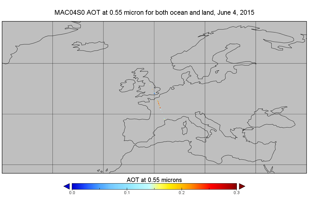
Federal
MODIS/Aqua Aerosol 10km 5-Min L2 Narrow Swath Subset along CloudSat V002 (MAC04S0) at GES DISC NGDA recent views
National Aeronautics and Space Administration —
This is the narrow-swath MODIS/Aqua subset along CloudSat field of view track. The goal of the narrow-swath subset is to select and return MODIS data that are within... -
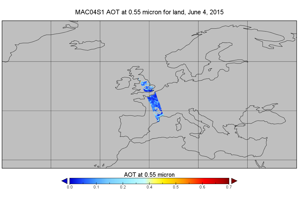
Federal
MODIS/Aqua Aerosol 10km 5-Min L2 Wide Swath Subset along CloudSat V002 (MAC04S1) at GES DISC NGDA recent views
National Aeronautics and Space Administration —
This is the wide-swath MODIS/Aqua subset along CloudSat field of view track. The goal of the wide-swath subset is to select and return MODIS data that are within... -
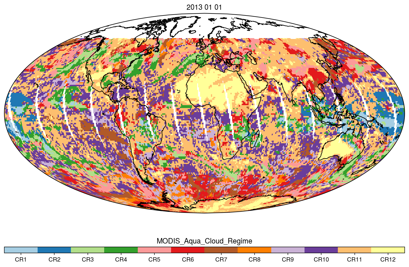
Federal
MODIS_CR_Equal_Angle_Daily NGDA recent views
National Aeronautics and Space Administration —
The MODIS Collection 6.1 Equal-Angle Three-Hourly Cloud Regime product. This product is a discrete classification of cloud fields at the mesoscale as observed by the...

Official websites use .gov
A
.gov website belongs to an official government
organization in the United States.
Secure .gov websites use HTTPS
A
lock (
) or https:// means you’ve safely connected to
the .gov website. Share sensitive information only on official,
secure websites.