
-
Federal
SWOT Level 2 Water Mask Raster Image 100m Data Product, Version 2.0
National Aeronautics and Space Administration —
The SWOT Level 2 Water Mask Raster Image 100m Data Product from the Surface Water Ocean Topography (SWOT) mission provides global surface water elevation and... -
Federal
ACE Electron Proton Alpha Monitor (EPAM) CA60-Z Channels, Spacecraft Frame, Sectored Ion Count Rates, 5 min Averages
National Aeronautics and Space Administration —
5min-averaged sectored count rates from CA60 - Channels Z2, Z2A, Z3, and Z4. -
Federal
Explorer-7 Thermal Radiation Experiment Selected White Sensor Temperature (Nighttime) Values V001 (EXP7L1TRTWHT) at GES DISC
National Aeronautics and Space Administration —
Explorer-7 Thermal Radiation Experiment Selected White Sensor Temperature (Nighttime) Values product contains the temperatures measured by the white sensor at night.... -
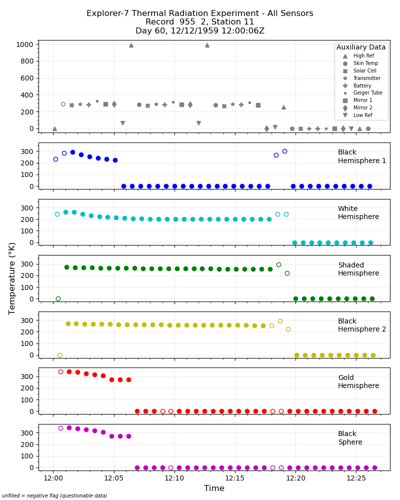
Federal
Explorer-7 Thermal Radiation Experiment Temperature Values from All Sensors V001 (EXP7L1TRTALL) at GES DISC
National Aeronautics and Space Administration —
Explorer-7 Thermal Radiation Experiment Temperature Values from All Sensors product contains temperature readings from all five bolometers in order to measure solar,... -
Federal
OLCI/Sentinel-3B L1 Full Resolution Top of Atmosphere Reflectance
National Aeronautics and Space Administration —
The OLCI/Sentinel-3B L1 Full Resolution Top of Atmosphere Reflectance product, S3B_OL_1_EFR is generated from the data aquired by the Ocean and Land Colour Instrument... -
Federal
Global Landslide Mortality Risks and Distribution
National Aeronautics and Space Administration —
The Global Landslide Mortality Risks and Distribution is a 2.5 minute grid of global landslide mortality risks. Gridded Population of the World, Version 3 (GPWv3)... -
Federal
SMAPVEX12 Probe-Based In Situ Soil Moisture Data for Agricultural Area V001
National Aeronautics and Space Administration —
This data set contains in situ soil moisture data collected at several agricultural sites as part of the Soil Moisture Active Passive Validation Experiment 2012... -
Federal
RTA & IFASD June-July 2011
National Aeronautics and Space Administration —
Information that was shared at the meetings held in Paris is located in this resource page Paper that was published in magazine is linked directly -
Federal
MMS 3 Energetic Particle Detector, Energetic Ion Spectrometer (EPD-EIS) Pulse Height by Time of Flight, Level 2 (L2), Survey Mode, 2.42 s Data
National Aeronautics and Space Administration —
Energetic Particle Detector (EPD), Energetic Ion Spectrometer (EPD EIS) Pulse Height by Time of Flight, Level 2, Quick-Look Survey, 2.42 s Data. The EIS provides ion... -
Federal
Towards a Framework for Evaluating and Comparing Diagnosis Algorithms
National Aeronautics and Space Administration —
Diagnostic inference involves the detection of anomalous system behavior and the identification of its cause, possibly down to a failed unit or to a parameter of a... -
Federal
Global High Resolution Daily Extreme Urban Heat Exposure (UHE-Daily), 1983-2016
National Aeronautics and Space Administration —
The Global High Resolution Daily Extreme Urban Heat Exposure (UHE-Daily), 1983-2016 data set contains a high-resolution, longitudinal global record of geolocated... -
Federal
OrbView-2 SeaWiFS 4M Global Mapped Garver-Siegel-Maritorena Model (GSM) Data, version R2022.0
National Aeronautics and Space Administration —
The SeaWiFS instrument was launched by Orbital Sciences Corporation on the OrbView-2 (a.k.a. SeaStar) satellite in August 1997, and collected data from September 1997... -
Federal
First ISCCP Regional Experiment (FIRE) Cirrus Phase II National Oceanic and Atmospheric Administration (NOAA) Wind Profiler Data
National Aeronautics and Space Administration —
The First ISCCP Regional Experiments have been designed to improve data products and cloud/radiation parameterizations used in general circulation models (GCMs).... -
Federal
STS-68_METADATA_SLC
National Aeronautics and Space Administration —
Metadata for STS-68 SIR-C Slant Range Product -
Federal
LVIS Facility L2 Geolocated Surface Elevation and Canopy Height Product V001
National Aeronautics and Space Administration —
This data set contains Level-2 geolocated surface elevation and canopy height measurements collected by the NASA Land, Vegetation, and Ice Sensor (LVIS) Facility, an... -
Federal
SBUV2/NOAA-11 Level 2 Daily Ozone Profile and Total Column from CD-ROM V008 (SBUV2N11O3) at GES DISC
National Aeronautics and Space Administration —
The version 8 SBUV/2 NOAA-11 ozone data were first released at the 2004 Quadrennial Ozone Symposium on DVD. The DVD contained all of the SBUV/2 data from NOAA-9,... -
Federal
miRNA signature detection and countermeasures against HZE radiation exposure for tissue degeneration-Soleus muscle
National Aeronautics and Space Administration —
Biological risks associated with space radiation and microgravity are major concerns for long-term space travel. Through a Systems Biology approach our previous NASA... -
Federal
ROSETTA-ORBITER EARTH SWING-BY 1 OSINAC 3 RDR V1.4
National Aeronautics and Space Administration —
This data set contains images acquired by the OSIRIS Narrow Angle Camera during the EARTH SWING-BY 1 mission phase -
Federal
MODIS/Aqua Snow Cover Daily L3 Global 500m SIN Grid V061 NGDA
National Aeronautics and Space Administration —
This global Level-3 (L3) data set provides a daily composite of snow cover and albedo derived from the 'MODIS/Aqua Snow Cover 5-Min L2 Swath 500m' data set...

Official websites use .gov
A
.gov website belongs to an official government
organization in the United States.
Secure .gov websites use HTTPS
A
lock (
) or https:// means you’ve safely connected to
the .gov website. Share sensitive information only on official,
secure websites.