
-
Federal
LUH1: Harmonized Global Land Use for Years 1500-2100, V1
National Aeronautics and Space Administration —
These data represent fractional land use and land cover patterns annually for the years 1500 - 2100 for the globe at 0.5-degree (~50-km) spatial resolution. Land use... -
Federal
ECOSTRESS Tiled Ancillary NDVI and Albedo L2 Global 70 m V002
National Aeronautics and Space Administration —
The ECOsystem Spaceborne Thermal Radiometer Experiment on Space Station (ECOSTRESS) mission measures the temperature of plants to better understand how much water... -
Federal
EMIT L4 Earth System Model Products V001
National Aeronautics and Space Administration —
The Earth Surface Mineral Dust Source Investigation (EMIT) instrument measures surface mineralogy, targeting the Earth’s arid dust source regions. EMIT is installed... -
Federal
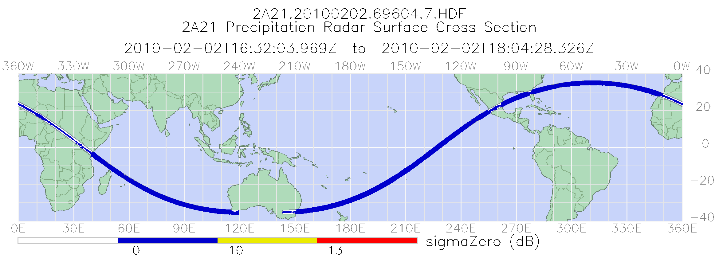
TRMM Precipitation Radar Surface Cross-Section L2 1.5 hours V7 (TRMM_2A21) at GES DISC
National Aeronautics and Space Administration —
The new version of these data is in GPM-like format (consistent with the GPM Dual-frequency Radar data format), and can be found under the name GPM_2APR. This is the... -
Federal
A Compilation of Global Soil Microbial Biomass Carbon, Nitrogen, and Phosphorus Data
National Aeronautics and Space Administration —
This data set provides the concentrations of soil microbial biomass carbon (C), nitrogen (N) and phosphorus (P), soil organic carbon, total nitrogen, and total... -
Federal
EMIT L2B Estimated Mineral Identification and Band Depth and Uncertainty 60 m V001
National Aeronautics and Space Administration —
The Earth Surface Mineral Dust Source Investigation (EMIT) instrument measures surface mineralogy, targeting the Earth’s arid dust source regions. EMIT is installed... -
Federal
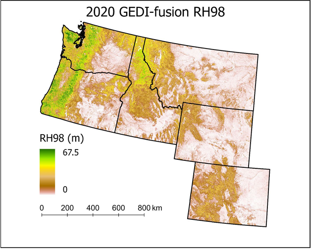
Gridded GEDI-Fusion Forest Structure Metrics across Six Western US States, 2016-2020
National Aeronautics and Space Administration —
This dataset provides eight GEDI forest structure metrics relevant to wildlife habitat modeling and biodiversity assessments at 30-m resolutions across Washington,... -
Federal
ECOSTRESS Tiled Land Surface Temperature and Emissivity Instantaneous L2 Global 70 m V002
National Aeronautics and Space Administration —
The ECOsystem Spaceborne Thermal Radiometer Experiment on Space Station (ECOSTRESS) mission measures the temperature of plants to better understand how much water... -
Federal
EMIT L2A Estimated Surface Reflectance and Uncertainty and Masks 60 m V001
National Aeronautics and Space Administration —
The Earth Surface Mineral Dust Source Investigation (EMIT) instrument measures surface mineralogy, targeting the Earth’s arid dust source regions. EMIT is installed... -
Federal
EMIT L3 Aggregated Mineral Spectral Abundance and Uncertainty 0.5 Deg V001
National Aeronautics and Space Administration —
The Earth Surface Mineral Dust Source Investigation (EMIT) instrument measures surface mineralogy, targeting the Earth’s arid dust source regions. EMIT is installed... -
Federal
CARVE: Alaskan Fire Emissions Database (AKFED), 2001-2013
National Aeronautics and Space Administration —
This data set provides estimates of annual carbon emissions (kg carbon per square meter) from boreal fires at 450-m resolution for the state of Alaska between 2001... -
Federal
THIR/Nimbus-6 Level 1 Meteorological Radiation Data at 6.7 microns V001 (THIRN6L1CH67) at GES DISC
National Aeronautics and Space Administration —
THIRN6L1CH67 is the Nimbus-6 Temperature-Humidity Infrared Radiometer (THIR) Level 1 Meteorological Radiation Data at 6.7 microns product and contains radiances... -
Federal
Vulcan: High-Resolution Hourly Fossil Fuel CO2 Emissions in USA, 2010-2015, Version 3
National Aeronautics and Space Administration —
The Vulcan version 3.0 hourly dataset quantifies hourly emissions at a 1-km resolution for the 2010-2015 time period. Estimates are provided of hourly carbon dioxide... -
Federal
OPERA Land Surface Disturbance Annual from Harmonized Landsat Sentinel-2 product (Version 1)
National Aeronautics and Space Administration —
The Observational Products for End-Users from Remote Sensing Analysis (OPERA) Land Surface Disturbance Annual from Harmonized Landsat Sentinel-2 (HLS) product Version... -
Federal
LBA Regional River Discharge Data (Coe and Olejniczak)
National Aeronautics and Space Administration —
This data set is a subset of a global river discharge data set by Coe and Olejniczak (1999). The subset was created for the study area of the Large Scale Biosphere-... -
Federal
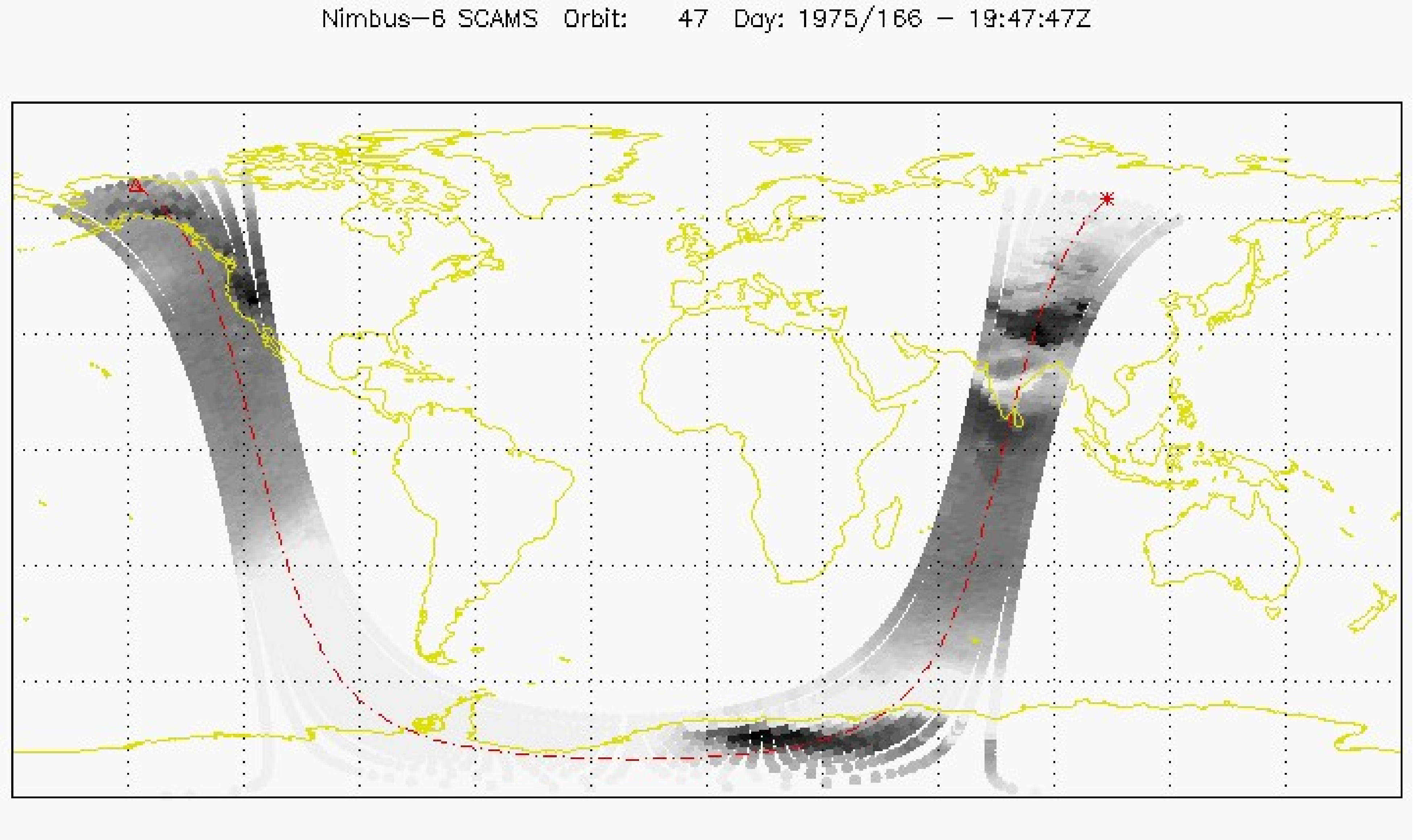
SCAMS/Nimbus-6 Level 2 Water Vapor and Temperature, as well as Antenna and Brightness Temperature V001 (SCAMSN6L2) at GES DISC
National Aeronautics and Space Administration —
The Nimbus-6 Scanning Microwave Spectrometer (SCAMS) Level 2 data product contains water vapor and temperature profiles, as well as antenna and brightness... -
Federal
HRIR/Nimbus-3 Level 1 Meteorological Radiation Data V001 (HRIRN3L1) at GES DISC
National Aeronautics and Space Administration —
HRIRN3L1 is the High Resolution Infrared Radiometer (HRIR) Nimbus-3 Level 1 Meteorological Radiance Data (NMRT) product and contains infrared radiances converted to... -
Federal
NACP Aboveground Biomass and Carbon Baseline Data, V.2 (NBCD 2000), U.S.A., 2000
National Aeronautics and Space Administration —
The NBCD 2000 (National Biomass and Carbon Dataset for the Year 2000) data set provides a high-resolution (30 m) map of year-2000 baseline estimates of basal area-... -
Federal
IRIS/Nimbus-4 Level 1 Radiance Data V001 (IRISN4RAD) at GES DISC
National Aeronautics and Space Administration —
The Nimbus-4 Infrared Interferometer Spectrometer (IRIS) Level 1 Radiance Data contain thermal emissions of the Earth's atmosphere at wave numbers between 400 and... -
Federal
CALIPSO Lidar Level 1B profile data, V4-10
National Aeronautics and Space Administration —
CAL_LID_L1-Standard-V4-10 is the Cloud-Aerosol Lidar and Infrared Pathfinder Satellite Observation (CALIPSO) Lidar Level 1B profile data, Version 4-10 data product....

Official websites use .gov
A
.gov website belongs to an official government
organization in the United States.
Secure .gov websites use HTTPS
A
lock (
) or https:// means you’ve safely connected to
the .gov website. Share sensitive information only on official,
secure websites.