
-
Federal
NASA-SSH ENSO Sea Surface Height Indicator
National Aeronautics and Space Administration —
This file contains an indicator for the El Nino-Southern Oscillation (ENSO), based on satellite observations of sea surface height anomaly, measured by radar... -
Federal
High Resolution Empirical Tide Prediction Software Version 14
National Aeronautics and Space Administration —
This dataset provides sea surface height and ocean surface currents associated with the predictable astronomical tide at the M2, S2, N2, K1, and O1 frequencies. The... -
Federal
SWOT Simulated Level-2 Nadir SSH from MITgcm ECCO LLC4320 for Science Version 1
National Aeronautics and Space Administration —
This dataset provides simulated sea surface height (SSH) in a format similar to the future SWOT Level 2 (L2) altimetry data stream from the Poseidon 3C nadir... -
Federal
Hourly Ocean Bottom Pressure at the North Pole from the Arctic Bottom Pressure Recorder Follow On Version 1.0
National Aeronautics and Space Administration —
This dataset provides the first year of hourly ocean bottom pressure measurements at the North Pole from the Arctic Bottom Pressure Recorder - Follow On (ABPR-FO)... -
Federal
SWOT Postlaunch Oceanography Field Campaign L2 Moorings
National Aeronautics and Space Administration —
The SWOT Postlaunch Oceanography Field Campaign L2 Moorings collection provides the surface air pressure, GPS, current velocity, and conductivity, temperature and... -
Federal
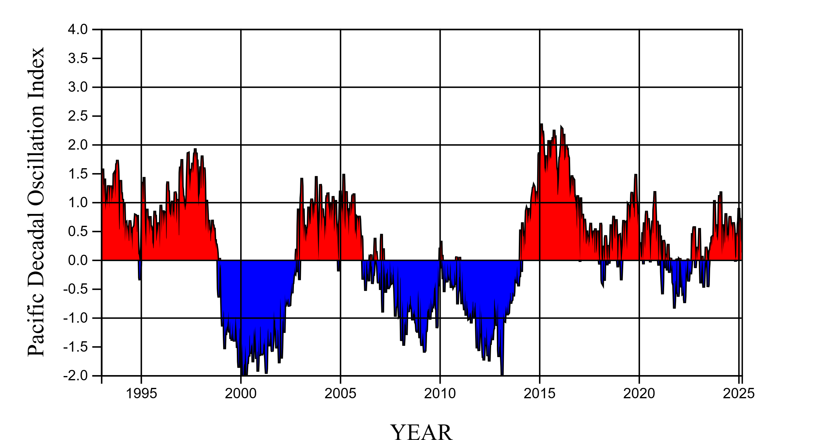
NASA-SSH PDO Sea Surface Height Indicator
National Aeronautics and Space Administration —
This file contains an indicator for the Pacific Decadal Oscillation (PDO), based on satellite observations of sea surface height anomaly, measured by radar altimeter... -
Federal
SWOT Simulated Level-2 KaRIn SSH from GLORYS for Cal/Val Version 1
National Aeronautics and Space Administration —
This dataset provides simulated sea surface height data product that resembles data which will be collected by KaRIn. Swaths span 60 km on both sides of nadir with a... -
Federal
The Lake Observations by Citizen Scientists & Satellites (LOCSS) Level 1 Version 1.0
National Aeronautics and Space Administration —
This dataset contains data from the Lake Observations by Citizen Science and Satellites project, LOCSS which is a lake monitoring network. The data represent the... -
Federal
SWOT Simulated Level-2 Nadir SSH from GLORYS for Science Version 1
National Aeronautics and Space Administration —
This dataset provides simulated sea surface height (SSH) in a format similar to the future SWOT Level 2 (L2) altimetry data from the Poseidon 3C nadir altimeter. The... -
Federal
SWOT Simulated Level-2 Nadir SSH from MITgcm ECCO LLC4320 for Cal/Val Version 1
National Aeronautics and Space Administration —
This dataset provides simulated sea surface height (SSH) in a format similar to the future SWOT Level 2 (L2) altimetry data stream from the Poseidon 3C nadir... -
Federal
SWOT Simulated Level-2 KaRIn SSH from MITgcm ECCO LLC4320 for Science Version 1
National Aeronautics and Space Administration —
This dataset provides simulated sea surface height (SSH) in a format similar to the future SWOT Level 2 (L2) SSH data from KaRIn. The simulated data were generated by... -
Federal
Adaptive Sampling of Rain and Ocean Salinity from Autonomous Seagliders (Guam 2019-2020)
National Aeronautics and Space Administration —
This dataset was produced by the Adaptive Sampling of Rain and Ocean Salinity from Autonomous Seagliders (NASA grant NNX17AK07G) project, an investigation to develop... -
Federal
NASA-SSH IOD Sea Surface Height Indicator
National Aeronautics and Space Administration —
This file contains an indicator for the Indian Ocean Dipole (IOD), based on satellite observations of sea surface height anomaly, measured by radar altimeter missions... -
Federal
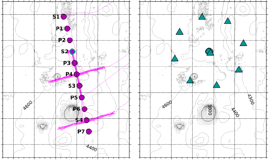
SWOT Postlaunch Oceanography Field Campaign Shipboard CTD and Water Sample Data
National Aeronautics and Space Administration —
The SWOT Postlaunch Oceanography Field Campaign Shipboard CTD and Water Sample Data collection provides the conductivity, temperature and depth (CTD) measurements and... -
Federal
SWOT Simulated Level 2 North America Continent KaRIn High Rate Water Mask Pixel Cloud Product Version 1.0
National Aeronautics and Space Administration —
This dataset includes simulated water surface elevations that resemble the Ka-band Interferometer (KaRIn) measurements by the Surface Water and Ocean Topography... -
Federal
OPERA Dynamic Surface Water Extent from Harmonized Landsat Sentinel-2 provisional product (Version 1)
National Aeronautics and Space Administration —
This dataset contains Level-3 Dynamic OPERA provisional surface water extent product version 1. The data are provisional surface water extent observations beginning... -
Federal
Harmonic Constants for Baroclinic Tide Prediction
National Aeronautics and Space Administration —
This dataset of Harmonic Constants for Baroclinic Tide Prediction was produced by Edward Zaron (Oregon State University) and Shane Elipot (University of Miami). It...

Official websites use .gov
A
.gov website belongs to an official government
organization in the United States.
Secure .gov websites use HTTPS
A
lock (
) or https:// means you’ve safely connected to
the .gov website. Share sensitive information only on official,
secure websites.