

NASA-SSH PDO Sea Surface Height Indicator
Access & Use Information
Public: This dataset is intended for public access and use.
License:
See this page for license information.
Downloads & Resources
-
Web ResourceBIN
-
Web ResourceBIN
-
PDF FilePDF
NASA-SSH_Indicators_UserGuide.pdf
-
Web ResourceBIN
-
Web ResourceBIN
-
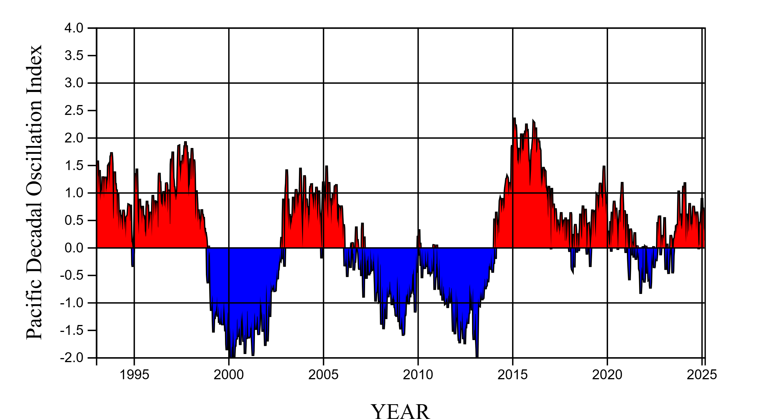
PNG Image FilePNG
NASA_SSH_PDO_INDICATOR.png
-
Web ResourceBIN
-
Original MetadataISO
The metadata's original source.
Dates
| Metadata Created Date | April 29, 2025 |
|---|---|
| Metadata Updated Date | March 12, 2026 |
Metadata Source
- Data.json Data.json Metadata
Harvested from NASA Data.json
Additional Metadata
| Resource Type | Dataset |
|---|---|
| Metadata Created Date | April 29, 2025 |
| Metadata Updated Date | March 12, 2026 |
| Publisher | NASA/JPL/PODAAC |
| Maintainer | |
| Identifier | 10.5067/NSIND-PDOV1 |
| Data Last Modified | 2026-03-10 |
| Category | Earth Science |
| Public Access Level | public |
| Bureau Code | 026:00 |
| Metadata Context | https://project-open-data.cio.gov/v1.1/schema/catalog.jsonld |
| Schema Version | https://project-open-data.cio.gov/v1.1/schema |
| Catalog Describedby | https://project-open-data.cio.gov/v1.1/schema/catalog.json |
| Harvest Object Id | b0e77a82-0bc0-4aa6-ad09-cf41720b9cae |
| Harvest Source Id | 58f92550-7a01-4f00-b1b2-8dc953bd598f |
| Harvest Source Title | NASA Data.json |
| License | https://www.usa.gov/government-works |
| Old Spatial | {"NorthBoundingCoordinate":66,"SouthBoundingCoordinate":-66,"EastBoundingCoordinate":180,"WestBoundingCoordinate":-180},"CARTESIAN" |
| Program Code | 026:000 |
| Source Datajson Identifier | True |
| Source Hash | 2b556f6a34e36ad284acecdad10ccb33ac659b68a2f51c92c0247d601aa0ce0f |
| Source Schema Version | 1.1 |
| Spatial |
Didn't find what you're looking for? Suggest a dataset here.