
-
Federal
Global Man-made Impervious Surface (GMIS) Dataset From Landsat
National Aeronautics and Space Administration —
The Global Man-made Impervious Surface (GMIS) Dataset From Landsat consists of global estimates of fractional impervious cover derived from the Global Land Survey... -
Federal
Global Flood Hazard Frequency and Distribution
National Aeronautics and Space Administration —
The Global Flood Hazard Frequency and Distribution is a 2.5 minute grid derived from a global listing of extreme flood events between 1985 and 2003 (poor or missing... -
Federal
Last of the Wild Project, Version 2, 2005 (LWP-2): Global Human Influence Index (HII) Dataset (Geographic)
National Aeronautics and Space Administration —
The Global Human Influence Index Dataset of the Last of the Wild Project, Version 2, 2005 (LWP-2) is a global dataset of 1-kilometer grid cells, created from nine... -
Federal
USGS Digital Orthophoto Quadrangles
National Aeronautics and Space Administration —
A Digital Orthophoto Quadrangle (DOQ) is a computer-generated image of an aerial photograph in which the image displacement caused by terrain relief and camera tilt... -
Federal
HANPP Collection: Global Patterns in Net Primary Productivity (NPP)
National Aeronautics and Space Administration —
The HANPP Collection: Global Patterns in Net Primary Productivity (NPP) maps the net amount of solar energy converted to plant organic matter through photosynthesis.... -
Federal
Last of the Wild Project, Version 2, 2005 (LWP-2): Global Human Footprint Dataset (Geographic)
National Aeronautics and Space Administration —
The Global Human Footprint Dataset of the Last of the Wild Project, Version 2, 2005 (LWP-2) is the Human Influence Index (HII) normalized by biome and realm. The HII... -
Federal
Global Agricultural Lands: Croplands, 2000
National Aeronautics and Space Administration —
The Global Croplands data set represents the proportion of land areas used as cropland (land used for the cultivation of food) in the year 2000. Satellite data from... -
Federal
RADARSAT-1_LEVEL1
National Aeronautics and Space Administration —
RADARSAT-1 Level 1 Amplitude Images -
Federal
IPCC Fourth Assessment Report (AR4) Observed Climate Change Impacts Database
National Aeronautics and Space Administration —
The Intergovernmental Panel on Climate Change (IPCC) Fourth Assessment Report (AR4) Observed Climate Change Impacts Database contains observed responses to climate... -
Federal
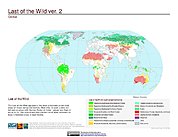
Last of the Wild Project, Version 2, 2005 (LWP-2): Last of the Wild Dataset (Geographic)
National Aeronautics and Space Administration —
The Last of the Wild Dataset of the Last of the Wild Project, Version 2, 2005 (LWP-2) is derived from the LWP-2 Human Footprint Dataset. The gridded data are... -
Federal
Last of the Wild Project, Version 2, 2005 (LWP-2): Global Human Influence Index (HII) Dataset (IGHP)
National Aeronautics and Space Administration —
The Global Human Influence Index Dataset of the Last of the Wild Project, Version 2, 2005 (LWP-2) is a global dataset of 1-kilometer grid cells, created from nine... -
Federal
Last of the Wild Project, Version 1, 2002 (LWP-1): Last of the Wild Dataset (Geographic)
National Aeronautics and Space Administration —
The Last of the Wild Dataset of the Last of the Wild Project, Version 1, 2002 (LWP-1) is derived from the LWP-1 Human Footprint Dataset. The gridded data are... -
Federal
NOAA-20 VIIRS Global Mapped Inherent Optical Properties (IOP) - Near Real-time (NRT) Data, version R2022.0
National Aeronautics and Space Administration —
The Ocean Biology DAAC produces near real-time (quicklook) products using the best-available combination of ancillary data from meteorological and ozone data. As... -
Federal
USGS Global Forest Observations Initiative (GFOI) Colombia
National Aeronautics and Space Administration —
The Global Forest Observations Initiative (GFOI) is an initiative of the inter-governmental Group on Earth Observations (GEO) that aims to: foster the sustained... -
Federal
SENTINEL-1A_SINGLE_POL_GRD_HIGH_RES
National Aeronautics and Space Administration —
Sentinel-1A Single-pol ground projected high and full resolution images -
Federal
HANPP Collection: Human Appropriation of Net Primary Productivity as a Percentage of Net Primary Productivity
National Aeronautics and Space Administration —
The HANPP Collection: Human Appropriation of Net Primary Productivity as a Percentage of Net Primary Productivity represents a map identifying regions in which human... -
Federal
Anthropogenic Biomes of the World, Version 2: 1700
National Aeronautics and Space Administration —
The Anthropogenic Biomes of the World, Version 2: 1700 data set describes anthropogenic transformations within the terrestrial biosphere caused by sustained direct...

Official websites use .gov
A
.gov website belongs to an official government
organization in the United States.
Secure .gov websites use HTTPS
A
lock (
) or https:// means you’ve safely connected to
the .gov website. Share sensitive information only on official,
secure websites.