
-
Aquarius Official Release Level 3 Ancillary Reynolds Sea Surface Temperature Standard Mapped Image Ascending Seasonal Climatology Data V5.0 recent views
Aquarius Level 3 ancillary sea surface temperature (SST) standard mapped image data are the ancillary SST data used in the Aquarius calibration for salinity retrieval. They are... -
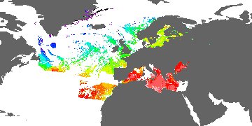
GHRSST Level 3C North Atlantic Regional (NAR) subskin Sea Surface Temperature from SNPP/VIIRS (GDS V2) produced by OSI SAF recent views
A regional Group for High Resolution Sea Surface Temperature (GHRSST) Level 3 Collated (L3C) dataset for the North Atlantic Region (NAR) based on retrievals from the Visible... -
ECCO Ocean Temperature and Salinity - Monthly Mean llc90 Grid (Version 4 Release 4) recent views
This dataset provides monthly-averaged ocean potential temperature and salinity on the native Lat-Lon-Cap 90 (LLC90) model grid from the ECCO Version 4 Release 4 (V4r4) ocean... -
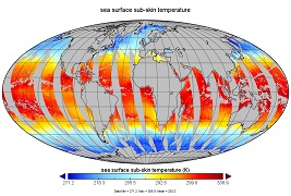
GHRSST Level 3U Global Subskin Sea Surface Temperature from the Advanced Scanning Microwave Radiometer - Earth Observing System (AMSR-E) on the NASA Aqua Satellite recent views
The Advanced Microwave Scanning Radiometer (AMSR-E) was launched on 4 May 2002, aboard NASA's Aqua spacecraft. The National Space Development Agency of Japan (NASDA) provided... -
GHRSST Level 2P 1 m Depth Global Sea Surface Temperature from VIIRS on Suomi NPP (GDS2) V1 recent views
A global Group for High Resolution Sea Surface Temperature (GHRSST) Level 2P dataset based on retrievals from the Visible Infrared Imaging Radiometer Suite (VIIRS). This sensor... -
GHRSST Level 2P Regional 1m Sea Surface Temperature from the Advanced Very High Resolution Radiometer (AVHRR) on the NOAA-19 satellite produced by NAVO recent views
A regional Group for High Resolution Sea Surface Temperature (GHRSST) Level 2P dataset based on multi-channel sea surface temperature (SST) retrievals generated in real-time... -
GHRSST Level 3U Global Subskin Sea Surface Temperature version 8.2 from the Advanced Microwave Scanning Radiometer 2 on the GCOM-W satellite by REMSS recent views
This product contains a “Final” (Refined) Level-3U Sea Surface Temperature (SST) (currently identified by "v8.2" within the file name) for the Group for High Resolution Sea... -
MODIS Terra Level 3 SST Thermal IR Daily 9km Nighttime V2019.0 NGDA recent views
Day and night spatially gridded (L3) global NASA skin sea surface temperature (SST) products from the Moderate-resolution Imaging Spectroradiometer (MODIS) onboard the Terra... -
MODIS Aqua Level 3 SST MID-IR 8 Day 9km Nighttime V2019.0 NGDA recent views
Day and night spatially gridded (L3) global NASA skin sea surface temperature (SST) products from the Moderate-resolution Imaging Spectroradiometer (MODIS) onboard the Aqua... -
MODIS Aqua Level 3 SST Thermal IR Daily 4km Daytime V2019.0 NGDA recent views
Day and night spatially gridded (L3) global NASA skin sea surface temperature (SST) products from the Moderate-resolution Imaging Spectroradiometer (MODIS) onboard the Aqua... -
GHRSST Level 2P NOAA ACSPO SST v2.80 from VIIRS on NOAA-21 Satellite recent views
The N21-VIIRS-L2P-ACSPO-v2.80 dataset produced by the NOAA ACSPO system derives the Subskin Sea Surface Temperature (SST) from the Visible Infrared Imaging Radiometer Suite... -
GHRSST Level 2P Global skin Sea Surface Temperature from the Infrared Atmospheric Sounding Interferometer (IASI) on the Metop-B satellite (GDS V2) produced by OSI SAF recent views
A Group for High Resolution Sea Surface Temperature (GHRSST) Level 2P dataset based on multi-channel sea surface temperature (SST) retrievals generated in real-time from the... -
NOAA GHRSST Level 2P Indian Ocean Regional Skin Sea Surface Temperature v1.0 from the Spinning Enhanced Visible and InfraRed Imager (SEVIRI) on the Meteosat Second Generation-1 (MSG-1) satellite recent views
The GHRSST L2P MSG01 SST v1.0 dataset is produced by the US National Oceanic and Atmospheric Administration (NOAA) National Environmental Satellite, Data, and Information... -
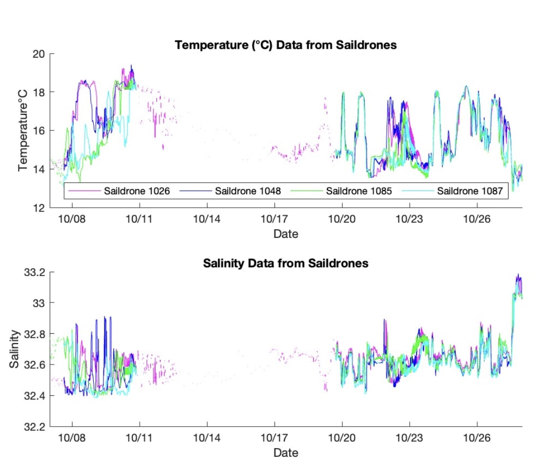
S-MODE L2 Temperature and Salinity from Saildrones Version 1 recent views
This dataset contains Saildrone in-situ measurements taken during the Sub-Mesoscale Ocean Dynamics Experiment (S-MODE) conducted approximately 300 km offshore of San Francisco... -
GHRSST Level 2P sub-skin Sea Surface Temperature from the Advanced Very High Resolution Radiometer (AVHRR) on Metop satellites (currently Metop-B) (GDS V2) produced by OSI SAF recent views
A global 1 km Group for High Resolution Sea Surface Temperature (GHRSST) Level 2P dataset based on multi-channel sea surface temperature (SST) retrievals generated in real-time... -
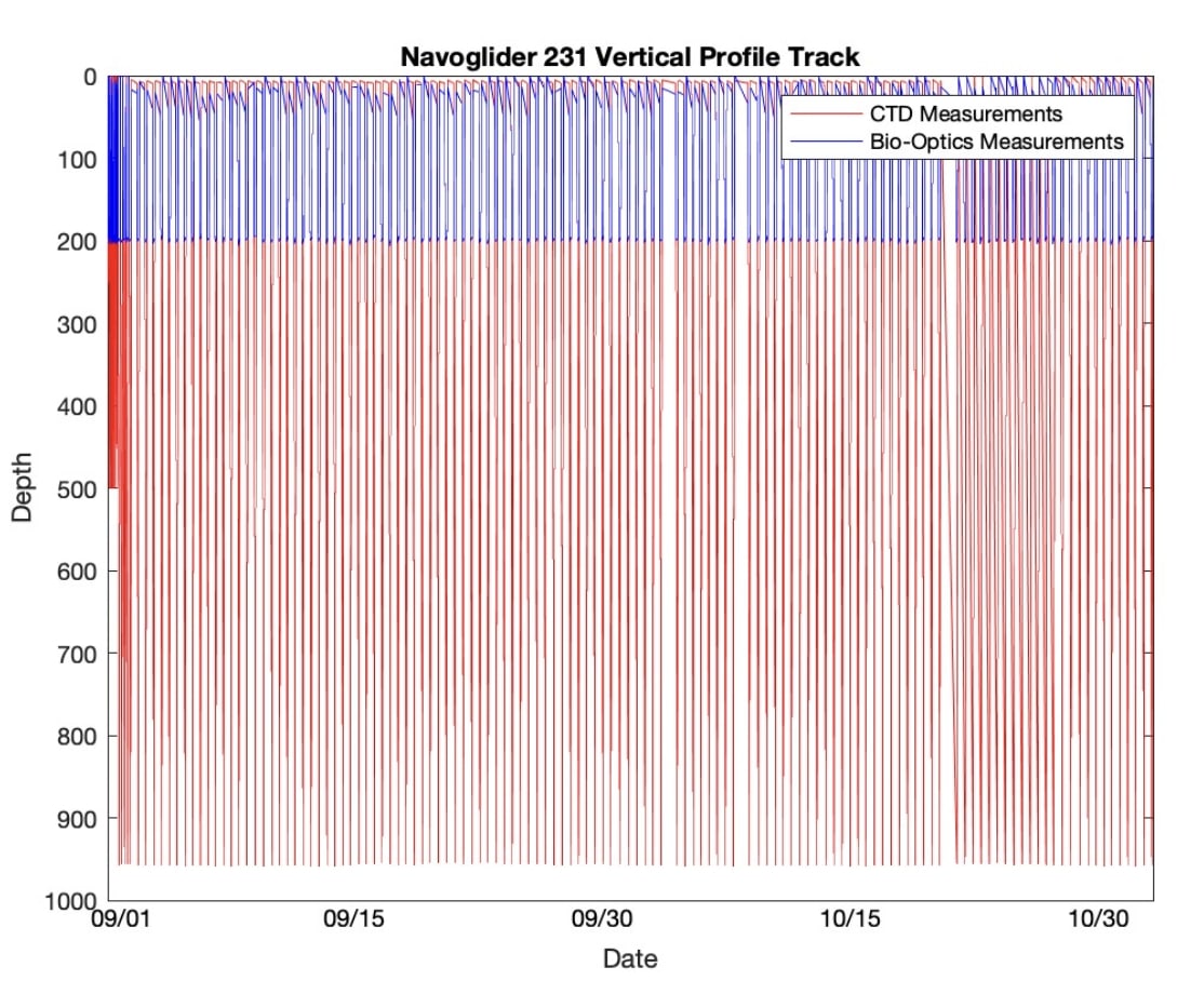
S-MODE Temperature and Salinity from Slocum Gliders Version 1 recent views
This dataset contains Slocum glider in-situ measurements taken during the Sub-Mesoscale Ocean Dynamics Experiment (S-MODE) field campaign. The experiment was conducted... -
S-MODE L2 Shipboard Acoustic Doppler Current Profiler Measurements Version 1 recent views
This dataset contains shipboard Acoustic Doppler Current Profiler (ADCP) measurements from the Sub-Mesoscale Ocean Dynamics Experiment (S-MODE) during a pilot campaign and two... -
GHRSST Level 4 MUR 0.25deg Global Foundation Sea Surface Temperature Analysis (v4.2) NGDA recent views
A Group for High Resolution Sea Surface Temperature (GHRSST) Level 4 sea surface temperature analysis produced as a retrospective dataset at the JPL Physical Oceanography DAAC... -
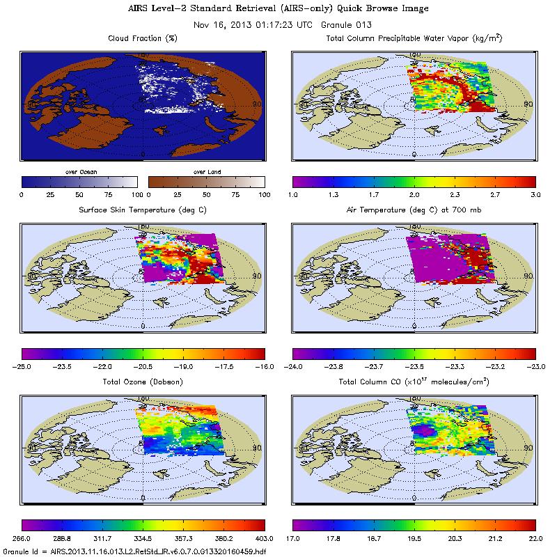
AIRS/Aqua L2 Standard Physical Retrieval (AIRS-only) V006 (AIRS2RET) at GES DISC recent views
The Atmospheric Infrared Sounder (AIRS) is a grating spectrometer (R = 1200) aboard the second Earth Observing System (EOS) polar-orbiting platform, EOS Aqua. In combination... -
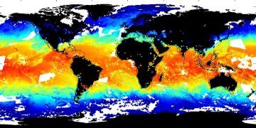
NOAA Smith and Reynolds Extended Reconstructed Sea Surface Temperature (ERSST) Level 4 Monthly Version 5 Dataset in netCDF recent views
The Smith & Reynolds Extended Reconstructed Sea Surface Temperature (ERSST) Level 4 dataset provides a historical reconstruction of monthly global ocean surface temperatures...

Official websites use .gov
A
.gov website belongs to an official government
organization in the United States.
Secure .gov websites use HTTPS
A
lock (
) or https:// means you’ve safely connected to
the .gov website. Share sensitive information only on official,
secure websites.