
-
CALIPSO Lidar Level 2 5 km Aerosol Layer Data, V4-21 recent views
CAL_LID_L2_05kmALay-Standard-V4-21 is the Cloud-Aerosol Lidar and Infrared Pathfinder Satellite Observation (CALIPSO) Lidar Level 2 5 km Aerosol Layer Data, Version 4-21 data... -
SEAC4RS DC-8 Aircraft Remotely Sensed Differential Absorption Lidar Data recent views
SEAC4RS_AircraftRemoteSensing_DIAL_DC8_Data are remotely sensed data collected by the Differential Absorption Lidar (DIAL) onboard the DC8 aircraft during the Studies of... -
SBU Doppler LiDAR IMPACTS V1 recent views
The SBU Doppler LiDAR IMPACTS dataset consists of Doppler velocity and backscatter intensity from the Stony Brook University (SBU) Doppler LiDAR. These data were collected... -
KORUS-AQ DC-8 Aircraft Remotely Sensed Differential Absorption Lidar (DIAL) Data recent views
KORUSAQ_AircraftRemoteSensing_DIAL_DC8_Data features remotely sensed data collected by the Differential Absorption Lidar (DIAL) onboard the DC-8 aircraft during the KORUS-AQ... -
CALIPSO Lidar Level 2 5km Aerosol Layer data, Provisional V3-30 recent views
CAL_LID_L2_05kmALay-Prov-V3-30 data are Cloud-Aerosol Lidar and Infrared Pathfinder Satellite Observation (CALIPSO) Lidar Level 2 5km aerosol layer data, Provisional Version... -
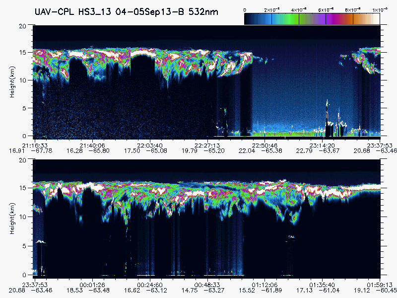
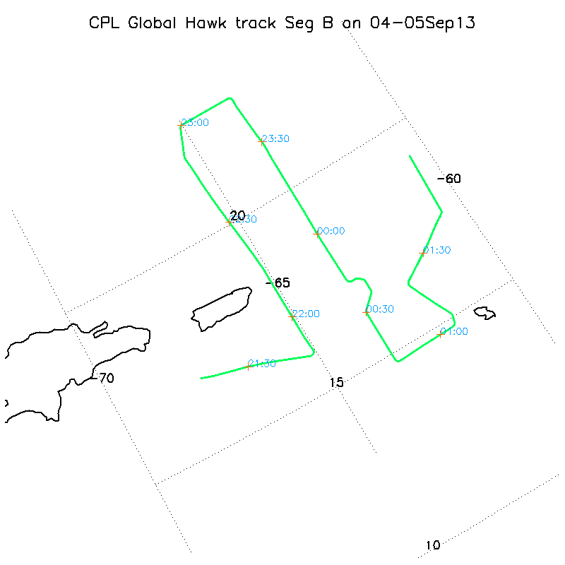
HURRICANE AND SEVERE STORM SENTINEL (HS3) GLOBAL HAWK CLOUD PHYSICS LIDAR (CPL) V1 recent views
The Hurricane and Severe Storm Sentinel (HS3) Global Hawk Cloud Physics Lidar (CPL) dataset includes measurements gathered by the CPL instrument during the HS3 campaign which... -
Cloud Physics LiDAR (CPL) IMPACTS V1 recent views
The Cloud Physics LiDAR (CPL) IMPACTS dataset consists of backscatter coefficient, lidar depolarization ratio, layer top/base height, layer type, particulate extinction... -
GEDI L4A Footprint Level Aboveground Biomass Density, Golden Weeks, Version 1 recent views
This dataset contains Global Ecosystem Dynamics Investigation (GEDI) Level 4A (L4A) predictions of the aboveground biomass density (AGBD; in Mg/ha) and estimates of the... -
CMS: LiDAR Data for Forested Areas in Paragominas, Para, Brazil, 2012-2014 recent views
This data set provides raw LiDAR point cloud data and derived Digital Terrain Models (DTMs) for five forested areas in the municipality of Paragominas, Para, Brazil, for the... -
CALIPSO Lidar Level 1B profile data, V4-10 recent views
CAL_LID_L1-Standard-V4-10 is the Cloud-Aerosol Lidar and Infrared Pathfinder Satellite Observation (CALIPSO) Lidar Level 1B profile data, Version 4-10 data product. This data... -
ACTIVATE Merged MODIS and MERRA-2 Dataset NGDA recent views
ACTIVATE-MODIS-MERRA2 is the merged CERES MODIS and MERRA-2 dataset (pixel-level geostationary cloud products) produced by SatCORPS group at NASA Langley Research Center in... -
DC3 Remotely Sensed DC-8 Differential Absorption Lidar (DIAL) Data recent views
DC3_AircraftRemoteSensing_DIAL_DC8_Data are remotely sensed data collected by the Differential Absorption Lidar (DIAL) onboard the DC-8 aircraft during the Deep Convective... -
CALIPSO Lidar Level 2 Cloud Profile, V4-21 recent views
CAL_LID_L2_05kmCPro-Standard-V4-21 is the Cloud-Aerosol Lidar and Infrared Pathfinder Satellite Observations (CALIPSO) Lidar Level 2 Cloud Profile, Version 4-21 data product.... -
CALIPSO Lidar Level 2 1 km Cloud Layer, V4-21 recent views
CAL_LID_L2_01kmCLay-Standard-V4-21 is the Cloud-Aerosol Lidar and Infrared Pathfinder Satellite Observations (CALIPSO) Lidar Level 2 1 km Cloud Layer, Version 4-21 data product.... -
DISCOVER-AQ Maryland Deployment Fairhill Ground Site Data recent views
DISCOVERAQ_Maryland_Ground_Fairhill_Data contains data collected at the Fairhill ground site during the Maryland (Baltimore-Washington) deployment of NASA's DISCOVER-AQ field... -
DISCOVER-AQ Maryland Deployment NOAA Delaware II Ship Data recent views
DISCOVERAQ_Maryland_Ship_NOAA-DelawareII_Data contains data collected onboard the NOAA Delaware II Ship during the Maryland (Baltimore-Washington) deployment of NASA's DISCOVER-... -
SASS (Subsonics Assessment) Ozone and NOx Experiment (SONEX) Differential Absorption Lidar (DIAL) Remotely Sensed Data recent views
SONEX_AircraftRemoteSensing_DC8_DIAL_Data_1 is the Differential Absorption Lidar (DIAL) remotely sensed data collected onboard the DC-8 aircraft during the SONEX suborbital... -
CALIPSO Lidar Level 2 5km Aerosol Layer data, Provisional V3-02 recent views
CAL_LID_L2_05kmALay-Prov-V3-02 data are Cloud-Aerosol Lidar and Infrared Pathfinder Satellite Observation (CALIPSO) Lidar Level 2 5km aerosol layer data. Within the Lidar...

Official websites use .gov
A
.gov website belongs to an official government
organization in the United States.
Secure .gov websites use HTTPS
A
lock (
) or https:// means you’ve safely connected to
the .gov website. Share sensitive information only on official,
secure websites.