
-
NACP Regional: National Greenhouse Gas Inventories and Aggregated Gridded Model Data recent views
This data set provides two products that were derived from the recently published North American Carbon Program (NACP) Regional Synthesis 1-degree terrestrial biosphere model... -
Global Man-made Impervious Surface (GMIS) Dataset From Landsat recent views
The Global Man-made Impervious Surface (GMIS) Dataset From Landsat consists of global estimates of fractional impervious cover derived from the Global Land Survey (GLS) Landsat... -
Landsat-Derived Global Rainfed and Irrigated-Cropland Product 30 m V001 recent views
The Landsat-Derived Global Rainfed and Irrigated-Cropland Product (LGRIP) provides high resolution, global cropland data to assist and address food and water security issues of... -
Forest Inventory and Biophysical Measurements, Brazilian Amazon, 2009-2018 recent views
This dataset provides the complete catalog of forest inventory and biophysical measurements collected over selected forest research sites across the Amazon rainforest in Brazil... -
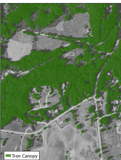
NACP North American Forest Dynamics Project: Forest Disturbance and Regrowth Data recent views
This data set provides the results of time-series analyses of Landsat imagery for 55 selected forested sites across the conterminous U.S.A. The output is a pair of disturbance... -
NOAA-20 VIIRS Global Binned Inherent Optical Properties (IOP) Data, version R2022.0 recent views
The Visible and Infrared Imager/Radiometer Suite (VIIRS) is a multi-disciplinary instrument that is being flown on the Joint Polar Satellite System (JPSS) series of spacecraft,... -
NOAA-20 VIIRS Regional Inherent Optical Properties (IOP) Data, version R2022.0 recent views
The Visible and Infrared Imager/Radiometer Suite (VIIRS) is a multi-disciplinary instrument that is being flown on the Joint Polar Satellite System (JPSS) series of spacecraft,... -
OrbView-2 SeaWiFS Global Binned Inherent Optical Properties (IOP) Data, version R2022.0 recent views
The SeaWiFS instrument was launched by Orbital Sciences Corporation on the OrbView-2 (a.k.a. SeaStar) satellite in August 1997, and collected data from September 1997 until the... -
Aboveground Biomass Density for High Latitude Forests from ICESat-2, 2020 recent views
This dataset provides estimates of Aboveground dry woody Biomass Density (AGBD) for high northern latitude forests at a 30-m spatial resolution. It is designed both for boreal-... -
Global Aboveground and Belowground Biomass Carbon Density Maps for the Year 2010 recent views
This dataset provides temporally consistent and harmonized global maps of aboveground and belowground biomass carbon density for the year 2010 at a 300-m spatial resolution. The... -
ABoVE: Lake and Wetland Classification from L-band SAR, Alaska and Canada, 2017-2019 recent views
This dataset contains a high-resolution land cover classification focused on water and wetland vegetation classes over three NASA ABoVE Campaign regions: Yukon Flats, Alaska,... -
Global Forest Ecosystem Structure and Function Data For Carbon Balance Research recent views
A comprehensive global database has been assembled to quantify CO2 fluxes and pathways across different levels of integration (from photosynthesis up to net ecosystem... -
PalEON: Terrestrial Ecosystem Model Drivers for the Northeastern U.S., 0850-2010 recent views
This dataset from the PalEON Ecosystem Model Intercomparison Project (PEMIP) provides harmonized regional environmental and meteorological drivers at a resolution of 0.5 degrees... -
Delta-X: Real-Time Kinematic Elevation Measurements for Coastal Wetlands, LA, 2021 recent views
This dataset provides real-time kinematic (RTK) GPS elevation measurements, along with horizontal and vertical precision errors, obtained along transects near Louisiana's... -
Sentinel-3A OLCI Global Mapped CyAN Project, True Color (TC) - Near Real-Time (NRT) Data, version 5.0 recent views
The Ocean Biology DAAC produces near real-time (quicklook) products using the best-available combination of ancillary data from meteorological and ozone data. As such, the...

Official websites use .gov
A
.gov website belongs to an official government
organization in the United States.
Secure .gov websites use HTTPS
A
lock (
) or https:// means you’ve safely connected to
the .gov website. Share sensitive information only on official,
secure websites.