
-
Landsat 8 22 recent views
The Operational Land Imager (OLI) and Thermal Infrared Sensor (TIRS) are onboard the Landsat 8 satellite, have acquired images of the Earth since February 2013. The sensors... -
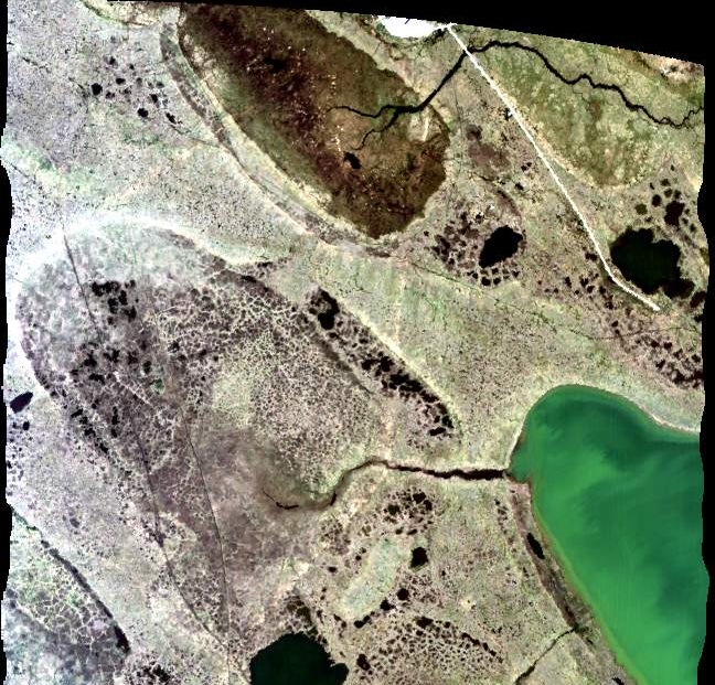
SMEX04 Airborne Visible/Infrared Imaging Spectrometer (AVIRIS) Data: Arizona, Version 1
Notice to Data Users: The documentation for this data set was provided solely by the Principal Investigator(s) and was not further developed, thoroughly reviewed, or edited by... -
EO-1 Hyperion
The Earth-Observing One (EO-1) satellite was decommissioned March 2017. The EO-1 satellite was launched on November 21, 2000 with the NASA's New Millennium Program (NMP). The... -
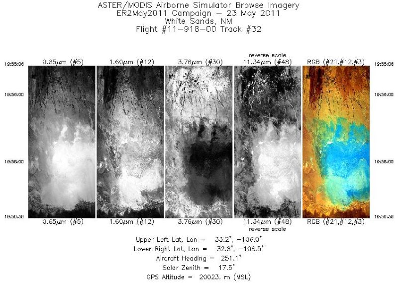
BOREAS Daedalus TMS Level-0 Imagery: Digital Counts in BIL Format
The level-0 Daedalus TMS imagery, along with the other remotely sensed images, was collected to provide spatially extensive information about radiant energy over the primary... -
ABoVE: Lake Growing Season Green Surface Reflectance Trends, AK and Canada, 1984-2019
This dataset provides an annual time series of Landsat green surface reflectance and the derived annual trend during the growing season (June and July) for 472,890 lakes across... -
CLPX-Satellite: MODIS Radiances, Reflectances, Snow Cover and Related Grids, Version 1 NGDA
This data set provides Moderate Resolution Imaging Spectroradiometer (MODIS) data as part of the Cold Land Processes Field Experiment (CLPX). Parameters include radiances,... -
EO-1 (Earth Observing-1) Advanced Land Imager (ALI) Instrument Level 1R, Level 1Gs, Level 1Gst Data
Advanced Land Imager (ALI) provides image data from ten spectral bands (band designations). The instrument operates in a pushbroom fashion, with a spatial resolution of 30... -
ABoVE: Hyperspectral Imagery AVIRIS-NG, Alaskan and Canadian Arctic, 2017-2019 V2
This dataset provides Level 1 radiance and Level 2 surface reflectance measured by the Airborne Visible/Infrared Imaging Spectrometer-Next Generation (AVIRIS-NG) instrument...

Official websites use .gov
A
.gov website belongs to an official government
organization in the United States.
Secure .gov websites use HTTPS
A
lock (
) or https:// means you’ve safely connected to
the .gov website. Share sensitive information only on official,
secure websites.