
-
VEMAP 2: Annual Ecosystem Model Responses to U.S. Climate Change, 1994-2100 recent views
Phase 2 of the VEMAP Project developed historical (1895-1993) gridded data sets of climate (temperature, precipitation, solar radiation, humidity, and wind speed) and projected... -
Global Vegetation Greenness (NDVI) from AVHRR GIMMS-3G+, 1981-2022 recent views
This dataset holds the Global Inventory Modeling and Mapping Studies-3rd Generation V1.2 (GIMMS-3G+) data for the Normalized Difference Vegetation Index (NDVI). NDVI was based... -
Global Land Cover Characterization Program recent views
The Global Land Cover Characterization Project was established to meet science data requirements identified by the International Geosphere and Biosphere Programme (IGBP), and... -
MODIS-derived Annual Vegetation Resilience, 2000-2019 NGDA recent views
This dataset provides estimates of vegetation resilience in the Arctic Boreal Vulnerability Experiment (ABoVE) core domain at annual time steps for 2000-2019 and at 300-m... -
AMSR2/GCOM-W1 surface soil moisture (LPRM) L3 1 day 10 km x 10 km ascending V001 (LPRM_AMSR2_DS_A_SOILM3) at GES DISC recent views
AMSR2/GCOM-W1 surface soil moisture (LPRM) L3 1 day 10 km x 10 km ascending V001 is a Level 3 (gridded) data set. Its land surface parameters, surface soil moisture, land... -
USGS Digital Orthophoto Quadrangles recent views
A Digital Orthophoto Quadrangle (DOQ) is a computer-generated image of an aerial photograph in which the image displacement caused by terrain relief and camera tilt has been... -
Forest Inventory and Biophysical Measurements, Brazilian Amazon, 2009-2018 recent views
This dataset provides the complete catalog of forest inventory and biophysical measurements collected over selected forest research sites across the Amazon rainforest in Brazil... -
BigFoot Field Data for North American Sites, 1999-2003 recent views
The BigFoot project gathered field data for selected EOS Land Validation Sites in North America from 1999 to 2003. Data collected and derived for varying intervals at the... -
Global Forest Ecosystem Structure and Function Data For Carbon Balance Research recent views
A comprehensive global database has been assembled to quantify CO2 fluxes and pathways across different levels of integration (from photosynthesis up to net ecosystem... -
LBA-ECO LC-08 Soil, Vegetation, and Land Cover Maps for Brazil and South America recent views
This data set provides (1) soil maps for Brazil that are digital versions of the MAPA DE SOLOS DO BRASIL (EMBRAPA, 1981) classified at three levels of detail, 19-class, 70-class... -
MODIS/Terra Vegetation Indices 16-Day L3 Global 250m SIN Grid V061 NGDA recent views
The Terra Moderate Resolution Imaging Spectroradiometer (MODIS) Vegetation Indices (MOD13Q1) Version 6.1 data are generated every 16 days at 250 meter (m) spatial resolution as... -
Global Land Cover Mapping and Estimation Yearly 30 m V001 recent views
NASA’s Making Earth System Data Records for Use in Research Environments (MEaSUREs) Global Land Cover Mapping and Estimation (GLanCE) annual 30 meter (m) Version 1 data product... -
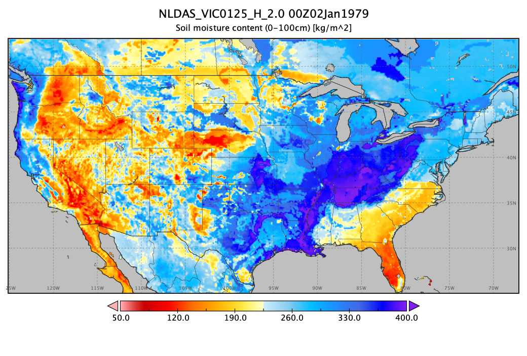
NLDAS VIC Land Surface Model L4 Hourly 0.125 x 0.125 degree V2.0 (NLDAS_VIC0125_H) at GES DISC recent views
This data set contains forty-four fields simulated from the VIC land-surface model (LSM) for Phase 2 of the North American Land Data Assimilation System (NLDAS-2). The data are... -
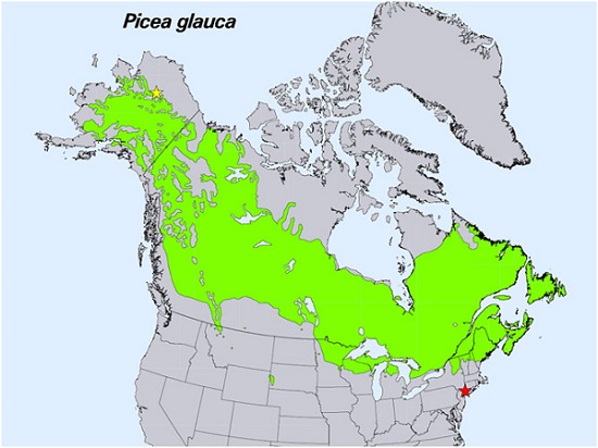
Spruce Leaf, Tree Traits, and Respiration at Range Extremes, AK and NY, USA, 2018 recent views
This dataset provides in situ measurements of needle-level gas-exchange and leaf traits from Picea glauca (white spruce) from a field site located in the northern latitudinal... -
AMSR2/GCOM-W1 surface soil moisture (LPRM) L3 1 day 25 km x 25 km descending V001 (LPRM_AMSR2_D_SOILM3) at GES DISC recent views
AMSR2/GCOM-W1 surface soil moisture (LPRM) L3 1 day 25 km x 25 km descending V001 is a Level 3 (gridded) data set. Its land surface parameters, surface soil moisture, land... -
ISLSCP II Ecosystem Rooting Depths NGDA recent views
The goal of this study was to predict the global distribution of plant rooting depths based on data about global aboveground vegetation structure and climate. Vertical root... -
MISR L2 Surface Product subset for the SAMUM region V002 recent views
This Level 2 Land Surface product contains information on land directional reflectance properties,albedos(spectral & PAR integrated),FPAR,asssociated radiation parameters...

Official websites use .gov
A
.gov website belongs to an official government
organization in the United States.
Secure .gov websites use HTTPS
A
lock (
) or https:// means you’ve safely connected to
the .gov website. Share sensitive information only on official,
secure websites.