
-
Soil Organic Carbon Stock Estimates with Uncertainty across Latin America recent views
This dataset provides 5 x 5 km gridded estimates of soil organic carbon (SOC) across Latin America that were derived from existing point soil characterization data and compiled... -
Earth Radiation Budget Experiment (ERBE) S-10 Medium Field of View (MFOV) Shape Factor (SF) Radiant Flux and Albedo recent views
ERBE_S10_MFOV_SF_NAT_1 is the Earth Radiation Budget Experiment (ERBE) S-10 Medium Field of View (MFOV) Shape Factor (SF) Radiant Flux and Albedo data product. Data collection... -
Aquarius Official Release Level 3 Sea Surface Salinity Standard Mapped Image Descending Daily Data V5.0 recent views
Aquarius Level 3 sea surface salinity (SSS) standard mapped image data contains gridded 1 degree spatial resolution SSS averaged over daily, 7 day, monthly, and seasonal time... -
CERES A-Train Integrated CALIPSO, CloudSat, CERES, and MODIS (CCCM) Merged Release B1 NGDA recent views
CER-NEWS_CCCM_Aqua-FM3-MODIS-CAL-CS_RelB1 is the Clouds and the Earth's Radiant Energy System (CERES) NASA Energy and Water cycle Study (NEWS) A-Train Integrated Cloud-Aerosol... -
CERES and GEO-Enhanced TOA, Within-Atmosphere, and Surface Fluxes Clouds and Aerosols Monthly Terra Edition4A NGDA recent views
CER_SYN1deg-Month_Terra-MODIS_Edition4A is the Clouds and the Earth's Radiant Energy System (CERES) and and geostationary (GEO)-Enhanced Top of Atmosphere (TOA), Within-... -
Aquarius Official Release Level 3 Sea Surface Salinity Standard Mapped Image Seasonal Data V5.0 recent views
Aquarius Level 3 sea surface salinity (SSS) standard mapped image data contains gridded 1 degree spatial resolution SSS averaged over daily, 7 day, monthly, and seasonal time... -
CERES Bidirectional Scans Aqua FM4 Edition4 recent views
CER_BDS_Aqua-FM4_Edition4 is the Clouds and the Earth's Radiant Energy System (CERES) Bidirectional Scans (BDS) Aqua Flight Model 4 (FM4) Edition 4 data product, which is... -
Aquarius Official Release Level 3 Wind Speed Standard Mapped Image Descending Mission Cumulative Data V5.0 recent views
Aquarius Level 3 ocean surface wind speed standard mapped image data contains gridded 1 degree spatial resolution wind speed data averaged over daily, 7 day, monthly, and... -
Aquarius Official Release Level 3 Ancillary Reynolds Sea Surface Temperature Standard Mapped Image Descending Seasonal Data V5.0 recent views
Aquarius Level 3 ancillary sea surface temperature (SST) standard mapped image data are the ancillary SST data used in the Aquarius calibration for salinity retrieval. They are... -
Aquarius Official Release Level 3 Ancillary Reynolds Sea Surface Temperature Standard Mapped Image Descending Mission Cumulative Data V5.0 recent views
Aquarius Level 3 ancillary sea surface temperature (SST) standard mapped image data are the ancillary SST data used in the Aquarius calibration for salinity retrieval. They are... -
Aquarius Official Release Level 3 Sea Surface Salinity Standard Mapped Image Monthly Climatology Data V5.0 recent views
Aquarius Level 3 sea surface salinity (SSS) standard mapped image data contains gridded 1 degree spatial resolution SSS averaged over daily, 7 day, monthly, and seasonal time... -
ABoVE: Reflectance Spectra of Tundra Plant Communities across Northern Alaska recent views
This dataset reports full-spectrum (350-2500 nm) reflectance measurements of diverse plant communities at the plot-level and individual plant species at the leaf-level, at... -
ABoVE: Environmental Conditions and Subsistence Resource Access, Alaska, 2016-2017 recent views
This dataset provides descriptions and photos of environmental conditions that impacted availability to subsistence resources by residents in nine rural communities within the... -
BigFoot Field Data for North American Sites, 1999-2003 recent views
The BigFoot project gathered field data for selected EOS Land Validation Sites in North America from 1999 to 2003. Data collected and derived for varying intervals at the... -
Aquarius Official Release Level 3 Sea Surface Density Standard Mapped Image Ascending Daily Data V5.0 recent views
Aquarius Level 3 sea surface density standard mapped image data contains gridded 1 degree spatial resolution density data averaged over daily, 7 day, monthly, and seasonal time... -
BOREAS Scanning Lidar Imager of Canopies by Echo Recovery (SLICER): Level-3 Data recent views
Scanning Lidar Imager of Canopies by Echo Recovery (SLICER) data were acquired in support of BOReal Ecosystem-Atmosphere Study (BOREAS) at all of the Tower Flux (TF) sites in... -
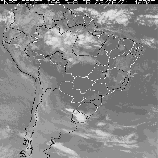
LBA-ECO CD-01 Meteorological Data, Tapajos and Amazon Rivers, Santarem, Brazil: 2001 recent views
This data set contains meteorological data collected around the confluence of the Tapajos River with the Amazon River in the Amazon Basin near Santarem, Brazil, in July and... -
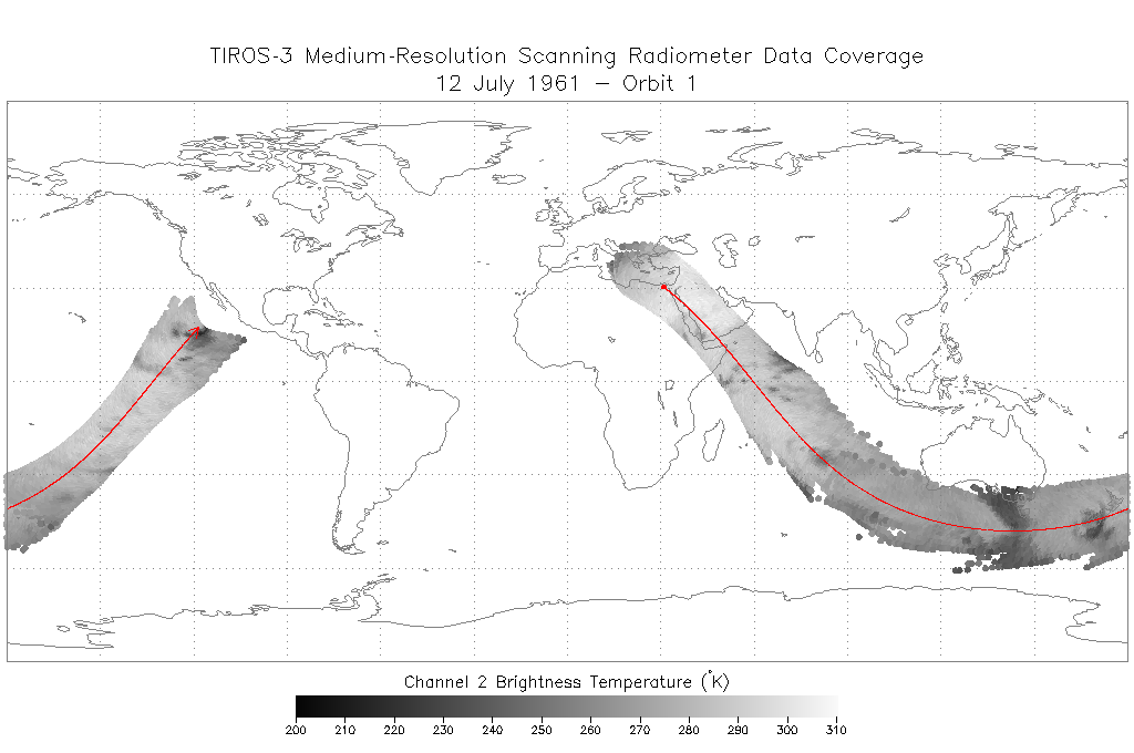
TIROS-3 Medium-Resolution Scanning Radiometer Level 1 Final Meteorological Radiation Data V001 (TIROS3L1FMRT) at GES DISC recent views
TIROS-3 Medium-Resolution Scanning Radiometer Level 1 Final Meteorological Radiation Data (FMRT) product contains radiances expressed in five infrared/visible wavelength... -
SAFARI 2000 Global Burned Area Map, 1-km, Southern Africa, 2000 recent views
The Global Burned Area 2000 initiative (GBA2000) was launched by the Global Vegetation Mapping Unit of the Joint Research Centre of the European Commission, in partnership with... -
MODIS-based GPP, PAR, fC4, and SANIRv estimates from SLOPE for CONUS, 2000-2019 NGDA recent views
This dataset contains estimated gross primary productivity (GPP), photosynthetically active radiation (PAR), soil adjusted near infrared reflectance of vegetation (SANIRv), the...

Official websites use .gov
A
.gov website belongs to an official government
organization in the United States.
Secure .gov websites use HTTPS
A
lock (
) or https:// means you’ve safely connected to
the .gov website. Share sensitive information only on official,
secure websites.