
-
CORONA Satellite Photography recent views
On February 24, 1995, President Clinton signed an Executive Order, directing the declassification of intelligence imagery acquired by the first generation of United States... -
Shuttle Radar Topography Mission DTED Level 1 (3-arc second) Data (DTED-1) recent views
The Shuttle Radar Topography Mission (SRTM) successfully collected Interferometric Synthetic Aperture Radar (IFSAR) data over 80 percent of the landmass of the Earth between 60... -
Landsat 8 recent views
The Operational Land Imager (OLI) and Thermal Infrared Sensor (TIRS) are onboard the Landsat 8 satellite, have acquired images of the Earth since February 2013. The sensors... -
CYGNSS Level 1 Science Data Record Version 3.2 recent views
This CYGNSS Level 1 (L1) science data record dataset contains the version 3.2 geo-located Delay Doppler Maps (DDMs) calibrated into Power Received (Watts) and Bistatic Radar... -
CALIPSO Lidar Level 2 Cloud Profile, V4-20 recent views
CAL_LID_L2_05kmCPro-Standard-V4-20 is the Cloud-Aerosol Lidar and Infrared Pathfinder Satellite Observations (CALIPSO) Lidar Level 2 Cloud Profile, Version 4-20 data product.... -
Shuttle Radar Topography Mission (SRTM) Version 2 recent views
NASA has released version 2 of the Shuttle Radar Topography Mission digital topographic data (also known as the "finished" version). Version 2 is the result of a substantial... -
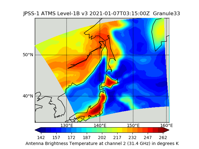
JPSS-1 ATMS Level 1B Brightness Temperature V3 (SNDRJ1ATMSL1B) at GES DISC recent views
The Advanced Technology Microwave Sounder (ATMS) Level 1B data files contain brightness temperature measurements along with ancillary spacecraft, instrument, and geolocation... -
Shuttle Radar Topography Mission 1-arc second Global recent views
The Shuttle Radar Topography Mission (SRTM) was flown aboard the space shuttle Endeavour February 11-22, 2000. The National Aeronautics and Space Administration (NASA) and the... -
NCEP/CPC L3 Half Hourly 4km Global (60S - 60N) Merged IR V1 (GPM_MERGIR) at GES DISC recent views
These data originate from NOAA/NCEP. The NOAA Climate Prediction Center/NCEP/NWS is making the data available originally in binary format, in a weekly rotating archive. The NASA... -
IRIS/Nimbus-4 Level 1 Radiance Data V001 (IRISN4RAD) at GES DISC recent views
The Nimbus-4 Infrared Interferometer Spectrometer (IRIS) Level 1 Radiance Data contain thermal emissions of the Earth's atmosphere at wave numbers between 400 and 1600 cm-1,... -
USGS Digital Orthophoto Quadrangles recent views
A Digital Orthophoto Quadrangle (DOQ) is a computer-generated image of an aerial photograph in which the image displacement caused by terrain relief and camera tilt has been... -
MISR Geometric Parameters V003 recent views
MIB2GEOP_003 is the Multi-angle Imaging SpectroRadiometer (MISR) Geometric Parameters Version 3 product. It contains the Geometric Parameters which measure the sun and view... -
TROPICS07 L2A Unified Resolution Brightness Temperatures V0.2 recent views
The "Time-Resolved Observations of Precipitation structure and storm Intensity with a Constellation of Smallsats" (TROPICS) mission has a goal of providing nearly all-weather... -
Annual Summary of Artificial Light At Night from VIIRS/S-NPP at CONUS County and Census Tract V1 (ALAN_VIIRS_CONUS) at GES DISC recent views
This product provides detailed information about the satellite-based data on artificial light at night (ALAN). The Suomi National Polar-orbiting Partnership (S-NPP) Visible... -
Airborne Multi-angle Imaging SpectroRadiometer (AirMISR) Data from the BARC 2001 Campaign recent views
The AirMISR BARC 2001 data were acquired during a flight over the Beltsville Agricultural Research Center (BARC) on July 21, 2001. The Jet Propulsion Laboratory (JPL) in... -
CALIPSO Lidar Level 1B profile data, V4-10 recent views
CAL_LID_L1-Standard-V4-10 is the Cloud-Aerosol Lidar and Infrared Pathfinder Satellite Observation (CALIPSO) Lidar Level 1B profile data, Version 4-10 data product. This data... -
Airborne Multi-angle Imaging SpectroRadiometer (AirMISR) Data from the Lunar Lake 2001 Campaign recent views
The AIRMISR_LUNAR_LAKE_2001 data were acquired during a flight over Lunar Lake, Nevada on June 30, 2001. The Jet Propulsion Laboratory (JPL) in Pasadena, California provided the... -
MISR Level 1B2 Local Mode Terrain Radiance Data V002 recent views
MB2LMT_2 is the Multi-angle Imaging SpectroRadiometer (MISR) Level 1B2 Local Mode Terrain Radiance Data Version 2 product. It contains the terrain-projected Top-of-Atmosphere... -
CALIPSO Lidar Level 2 5 km Aerosol Layer Data, V4-20 recent views
CAL_LID_L2_05kmALay-Standard-V4-20 is the Cloud-Aerosol Lidar and Infrared Pathfinder Satellite Observation (CALIPSO) Lidar Level 2 5 km Aerosol Layer Data, Version 4-20 data... -
IceBridge GPS/IMU L1B Primary Position and Attitude Solution, Version 1 recent views
This data set contains elevation, roll, pitch, heading, north-south acceleration, east-west acceleration, and vertical acceleration measurements over Antarctica using the...

Official websites use .gov
A
.gov website belongs to an official government
organization in the United States.
Secure .gov websites use HTTPS
A
lock (
) or https:// means you’ve safely connected to
the .gov website. Share sensitive information only on official,
secure websites.