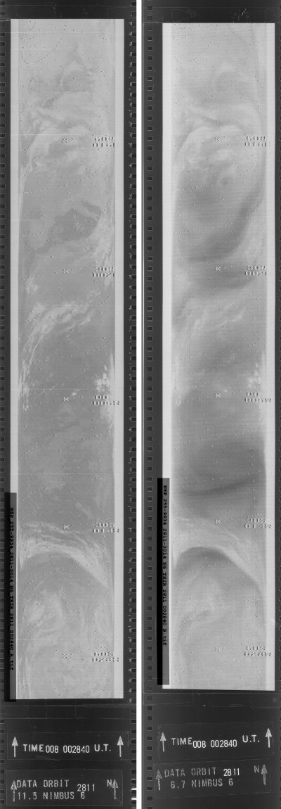
THIR/Nimbus-6 Images of Daytime and Nighttime Brightness Temperature on 70 mm Film V001 (THIRN6IM) at GES DISC
Access & Use Information
Downloads & Resources
-
Get a related visualizationJPEG
11.5 micron at left and 6.7 micron at right
-
This dataset's landing pageHTML
Access the dataset landing page from the GES DISC website.
-
Download this dataset through a directory mapHTML
Access the data via HTTPS.
-
View this dataset's read me documentPDF
README Document
-
View this dataset's user's guidePDF
Nimbus 6 User's Guide
-
View documentation related to this datasetGZ
Nimbus 6 Data Catalog
-
View documentation related to this datasetHTML
Additional Nimbus data and images can be found at NSIDC
-
Landing PageLanding Page
Dates
| Metadata Created Date | November 12, 2020 |
|---|---|
| Metadata Updated Date | December 6, 2023 |
Metadata Source
- Data.json Data.json Metadata
Harvested from NASA Data.json
Graphic Preview

Additional Metadata
| Resource Type | Dataset |
|---|---|
| Metadata Created Date | November 12, 2020 |
| Metadata Updated Date | December 6, 2023 |
| Publisher | NASA/GSFC/SED/ESD/GCDC/GESDISC |
| Maintainer | |
| Identifier | C1273652220-GES_DISC |
| Data First Published | 2013-10-27 |
| Language | en-US |
| Data Last Modified | 2013-10-27 |
| Category | CWIC, geospatial |
| Public Access Level | public |
| Bureau Code | 026:00 |
| Metadata Context | https://project-open-data.cio.gov/v1.1/schema/catalog.jsonld |
| Metadata Catalog ID | https://data.nasa.gov/data.json |
| Schema Version | https://project-open-data.cio.gov/v1.1/schema |
| Catalog Describedby | https://project-open-data.cio.gov/v1.1/schema/catalog.json |
| Citation | Goddard Space Flight Center (GSFC). 2013-10-24. THIRN6IM. Version 001. THIR/Nimbus-6 Images of Daytime and Nighttime Brightness Temperature on 70 mm Film V001. Greenbelt, MD, USA. Archived by National Aeronautics and Space Administration, U.S. Government, Goddard Earth Sciences Data and Information Services Center (GES DISC). https://disc.gsfc.nasa.gov/datacollection/THIRN6IM_001.html. Digital Science Data. |
| Creator | Goddard Space Flight Center (GSFC) |
| Data Presentation Form | Digital Science Data |
| Graphic Preview Description | 11.5 micron at left and 6.7 micron at right |
| Graphic Preview File | https://docserver.gesdisc.eosdis.nasa.gov/public/project/Images/THIRN6IM_001.jpg |
| Harvest Object Id | b47d0bf5-e2a1-481b-8c19-fac4627bfd7a |
| Harvest Source Id | 58f92550-7a01-4f00-b1b2-8dc953bd598f |
| Harvest Source Title | NASA Data.json |
| Homepage URL | https://cmr.earthdata.nasa.gov:443/search/concepts/C1273652220-GES_DISC.html |
| Metadata Type | geospatial |
| Old Spatial | -180.0 -90.0 180.0 90.0 |
| Program Code | 026:001 |
| Release Place | Greenbelt, MD, USA |
| Series Name | THIRN6IM |
| Source Datajson Identifier | True |
| Source Hash | 384ad752332b0736fdbaaf93579ffbede0a51684fbe3fa796eecc63b7d4fd4cc |
| Source Schema Version | 1.1 |
| Spatial | |
| Temporal | 1976-01-07T00:00:00Z/1976-04-05T23:59:59.999Z |
Didn't find what you're looking for? Suggest a dataset here.

