Sounder SIPS: Aqua AIRS Level-1B Calibration Subset: Summary, V2 (SNDRAQIML1BCALSUBSUM) at GES DISC
Access & Use Information
Downloads & Resources
-
Google Scholar search resultsHTML
Search results for publications that cite this dataset by its DOI.
-
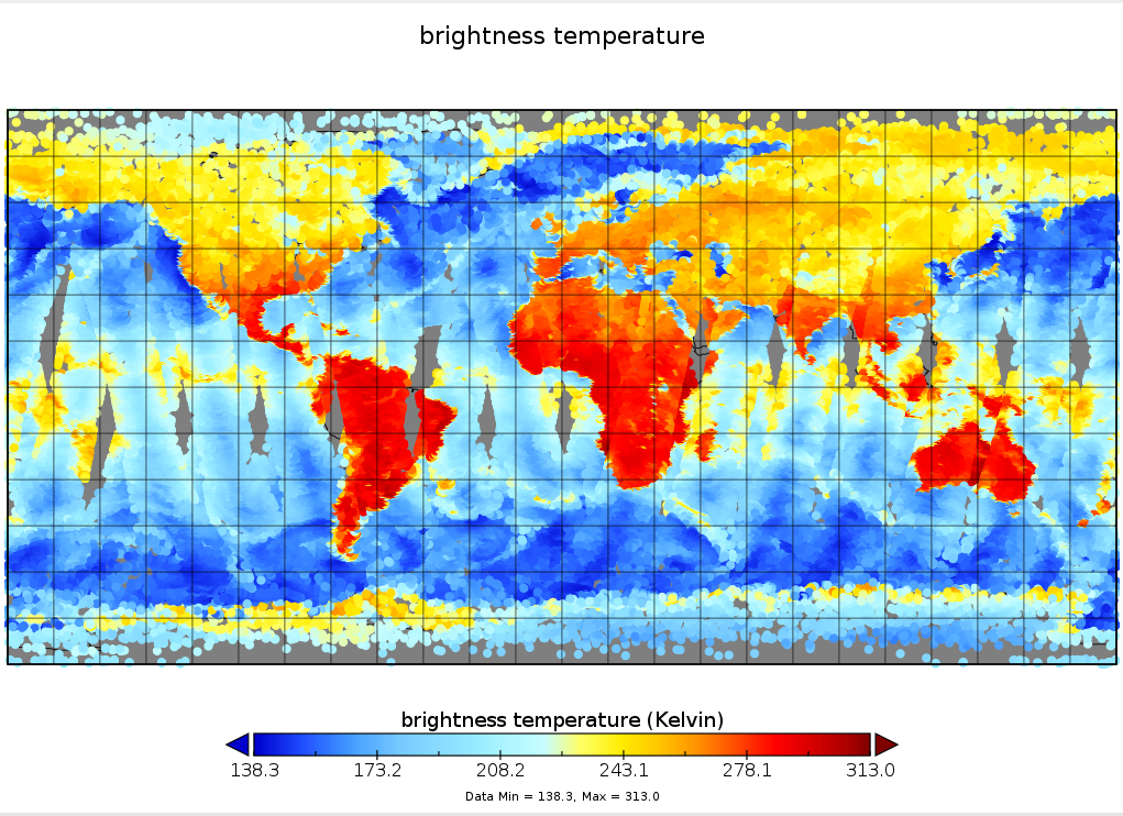
Get a related visualizationPNG
SNDRAQIML1BCALSUBSUM.2.amsua.BT.channel1.20070112.png
-
This dataset's landing pageHTML
Access the dataset landing page from the GES DISC website.
-
Download this dataset through a directory mapHTML
Access the data via HTTPS.
-
Use OPeNDAP to access the dataset's dataHTML
Access the data via the OPeNDAP protocol.
-
Download this dataset through Earthdata SearchHTML
Use the Earthdata Search to find and retrieve data sets across multiple data...
-
The dataset's project home pageHTML
AIRS home page at NASA/JPL. General information on the AIRS instrument,...
-
View information related to this datasetHTML
AIRS Documentation Page
-
View this dataset's read me documentPDF
README Document
-
View this dataset's algorithm theoretical...PDF
ATBD documentation
-
View documentation related to this datasetPDF
Summary of validation status of products
-
Landing PageLanding Page
References
| https://doi.org/10.3390/rs12172743 |
| https://doi.org/10.3390/rs12081338 |
Dates
| Metadata Created Date | May 30, 2023 |
|---|---|
| Metadata Updated Date | April 22, 2024 |
Metadata Source
- Data.json Data.json Metadata
Harvested from NASA Data.json
Graphic Preview

Additional Metadata
| Resource Type | Dataset |
|---|---|
| Metadata Created Date | May 30, 2023 |
| Metadata Updated Date | April 22, 2024 |
| Publisher | NASA/GSFC/SED/ESD/GCDC/GESDISC |
| Maintainer | |
| Identifier | C2210019692-GES_DISC |
| Data First Published | 2022-01-28 |
| Language | en-US |
| Data Last Modified | 2024-04-17 |
| Category | Aqua, geospatial |
| Public Access Level | public |
| Bureau Code | 026:00 |
| Metadata Context | https://project-open-data.cio.gov/v1.1/schema/catalog.jsonld |
| Metadata Catalog ID | https://data.nasa.gov/data.json |
| Schema Version | https://project-open-data.cio.gov/v1.1/schema |
| Catalog Describedby | https://project-open-data.cio.gov/v1.1/schema/catalog.json |
| Citation | AIRS project, Jet Propulsion Laboratory. 2022-12-12. SNDRAQIML1BCALSUBSUM. Version 2. Sounder SIPS: Aqua AIRS Level-1B Calibration Subset: Summary. Greenbelt, MD, USA. Archived by National Aeronautics and Space Administration, U.S. Government, Goddard Earth Sciences Data and Information Services Center (GES DISC). https://doi.org/10.5067/7Q4P1LBIZYZ7. https://disc.gsfc.nasa.gov/datacollection/SNDRAQIML1BCALSUBSUM_2.html. Digital Science Data. |
| Creator | AIRS project, Jet Propulsion Laboratory |
| Data Presentation Form | Digital Science Data |
| Graphic Preview File | https://docserver.gesdisc.eosdis.nasa.gov/public/project/Images/SNDRAQIML1BCALSUBSUM.2.amsua.BT.channel1.20070112.png |
| Harvest Object Id | 466fe2aa-9482-4cb3-9619-9ac2990195f2 |
| Harvest Source Id | 58f92550-7a01-4f00-b1b2-8dc953bd598f |
| Harvest Source Title | NASA Data.json |
| Homepage URL | https://doi.org/10.5067/7Q4P1LBIZYZ7 |
| Metadata Type | geospatial |
| Old Spatial | -180.0 -90.0 180.0 90.0 |
| Program Code | 026:001 |
| Related Documents | https://doi.org/10.3390/rs12172743, https://doi.org/10.3390/rs12081338 |
| Release Place | Greenbelt, MD, USA |
| Series Name | SNDRAQIML1BCALSUBSUM |
| Source Datajson Identifier | True |
| Source Hash | d34b8b2368446898aa821e5933493291e9d4c4417c197d691b7cc0677c0aa136 |
| Source Schema Version | 1.1 |
| Spatial | |
| Temporal | 2002-08-31T00:00:00Z/2024-04-22T00:00:00Z |
Didn't find what you're looking for? Suggest a dataset here.

