

Get a related visualization
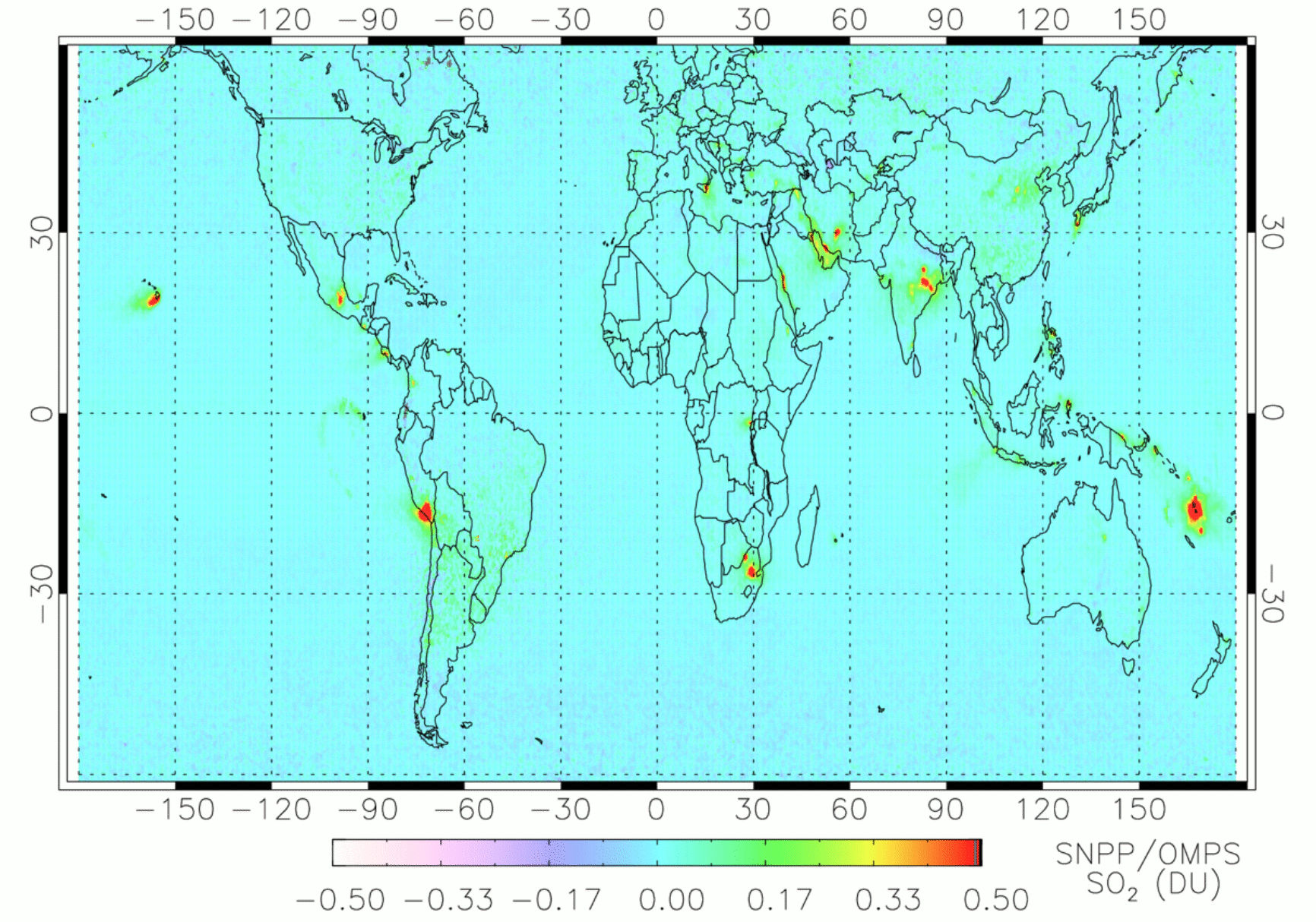
Annual mean SO2 vertical column densities (VCDs) in Dobson Units (DU, 1 DU = 2.69 ×10¹⁶ molecules/cm2) for 2018 from the OMPS_NPP_NMSO2_PCA_L2 V2.0 product. Pixels with large cloud fractions (> 0.3) or solar zenith angles (> 65º) or near the edge of the swath (rows 1-2 and 35-36 out of 36 OMPS rows) or low sensitivities to SO2 (air mass factor, AMF < 0.3) have been excluded. In addition, days with large volcanic plumes from explosive eruptions have also been excluded. Areas having major anthropogenic SO2 sources (e.g., India, eastern China, the Middle East, and South Africa) or degassing volcanoes (e.g., Kilauea and Etna) can be identified from the map.
Source: OMPS/NPP PCA SO2 Total Column 1-Orbit L2 Swath 50x50km V2 (OMPS_NPP_NMSO2_PCA_L2) at GES DISC
About this Resource
| Last updated | unknown |
|---|---|
| Created | unknown |
| Name | Get a related visualization |
| Format | PNG Image File |
| License | License not specified |
| Created | 4 years ago |
| Media type | image/png |
| has views | True |
| id | ed36b5ff-e40f-45c0-8c9d-816a5cf0443c |
| metadata modified | 4 years ago |
| package id | c43b2283-cbf1-4d8c-b103-52a392bca201 |
| position | 1 |
| state | active |