MASTER: Costa Rica Airborne Research and Technology Applications (CARTA), 2005
Access & Use Information
Downloads & Resources
-
Google Scholar search resultsHTML
Search results for publications that cite this dataset by its DOI.
-
Download this datasetHTML
This link allows direct data access via Earthdata login
-
View documentation related to this datasetHTML
ORNL DAAC Data Set Documentation
-
This dataset's landing pageHTML
Data set Landing Page DOI URL
-
View documentation related to this datasetPDF
MASTER: Costa Rica Airborne Research and Technology Applications (CARTA),...
-
Get a related visualizationJPEG
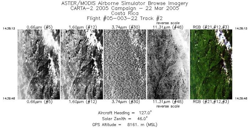
Single-band images and a RGB composite image from flight track 2 acquired on...
-
Landing PageLanding Page
Dates
| Metadata Created Date | July 27, 2023 |
|---|---|
| Metadata Updated Date | December 7, 2023 |
Metadata Source
- Data.json Data.json Metadata
Harvested from NASA Data.json
Graphic Preview

Additional Metadata
| Resource Type | Dataset |
|---|---|
| Metadata Created Date | July 27, 2023 |
| Metadata Updated Date | December 7, 2023 |
| Publisher | ORNL_DAAC |
| Maintainer | |
| Identifier | C2731733075-ORNL_CLOUD |
| Data First Published | 2023-07-06 |
| Language | en-US |
| Data Last Modified | 2023-07-13 |
| Category | MASTER, geospatial |
| Public Access Level | public |
| Bureau Code | 026:00 |
| Metadata Context | https://project-open-data.cio.gov/v1.1/schema/catalog.jsonld |
| Metadata Catalog ID | https://data.nasa.gov/data.json |
| Schema Version | https://project-open-data.cio.gov/v1.1/schema |
| Catalog Describedby | https://project-open-data.cio.gov/v1.1/schema/catalog.json |
| Citation | Hook, S.J., J.S. Myers, K.J. Thome, M. Fitzgerald, A.B. Kahle, Airborne Sensor Facility NASA Ames Research Center, and J.A. Diaz. 2022. MASTER: Costa Rica Airborne Research and Technology Applications (CARTA), 2005. ORNL DAAC, Oak Ridge, Tennessee, USA. https://doi.org/10.3334/ORNLDAAC/2034 |
| Graphic Preview Description | Single-band images and a RGB composite image from flight track 2 acquired on 22 March 2005 over Costa Rica. U.S. Source: MASTERL1B_0500322_02_20050322_1438_1439_V01.jpg |
| Graphic Preview File | https://daac.ornl.gov/MASTER/guides/MASTER_CARTA_2005_Fig1.jpg |
| Harvest Object Id | 89eb736a-4c22-484a-af18-05ebccfbffe3 |
| Harvest Source Id | 58f92550-7a01-4f00-b1b2-8dc953bd598f |
| Harvest Source Title | NASA Data.json |
| Homepage URL | https://doi.org/10.3334/ORNLDAAC/2034 |
| Metadata Type | geospatial |
| Old Spatial | -86.08 7.9 -82.54 11.28 |
| Program Code | 026:001 |
| Source Datajson Identifier | True |
| Source Hash | 44cb50e472bc4839e56df6e13df6d95adee6ce7d85f5de88c085f8e62828bddc |
| Source Schema Version | 1.1 |
| Spatial | |
| Temporal | 2005-03-01T14:32:46Z/2005-04-06T18:05:25Z |
Didn't find what you're looking for? Suggest a dataset here.

