Hawaii and Pacific Islands King Tides Project
Access & Use Information
Downloads & Resources
-
GeoServer
This URL provides access to this dataset via GeoServer, which offers multiple...
-
King Tides Map ViewerHTML
This URL provides a viewer and/or data access for this dataset.
-
King Tides Photo Entry FormHTML
This URL provides a viewer and/or data access for this dataset.
-
Web Resourceapplication/vnd.lotus-organizer
-
Web Resource
-
Web Resourceapplication/vnd.lotus-organizer
-
Web Resourceapplication/vnd.lotus-organizer
-
Web Resourceapplication/vnd.lotus-organizer
-
Web Resourceapplication/vnd.lotus-organizer
-
OGC-WFSWFS
Open Geospatial Consortium Web Feature Service (WFS). Supported WFS versions...
-
Web Resourceapplication/vnd.lotus-organizer
-
Web Resourceapplication/vnd.lotus-organizer
-
OGC-WMSWMS
Open Geospatial Consortium Web Map Service (WMS). Supported WMS versions...
Dates
| Metadata Date | November 14, 2024 |
|---|---|
| Metadata Created Date | November 12, 2020 |
| Metadata Updated Date | January 26, 2025 |
| Reference Date(s) | December 14, 2018 (creation), December 14, 2018 (issued), December 14, 2018 (revision) |
| Frequency Of Update |
Metadata Source
- ISO-19139 ISO-19139 Metadata
Harvested from ioos
Graphic Preview

Additional Metadata
| Resource Type | Dataset |
|---|---|
| Metadata Date | November 14, 2024 |
| Metadata Created Date | November 12, 2020 |
| Metadata Updated Date | January 26, 2025 |
| Reference Date(s) | December 14, 2018 (creation), December 14, 2018 (issued), December 14, 2018 (revision) |
| Responsible Party | Hawaii Sea Grant King Tides Project (Point of Contact) |
| Contact Email | |
| Guid | pac_uhsg_usa_kingtides_photos |
| Access Constraints | |
| Bbox East Long | 171.3731519 |
| Bbox North Lat | 28.218039 |
| Bbox South Lat | -14.32367 |
| Bbox West Long | -177.378088 |
| Coupled Resource | [{"title": [], "href": ["#DataIdentification"], "uuid": []}, {"title": [], "href": ["#DataIdentification"], "uuid": []}] |
| Frequency Of Update | |
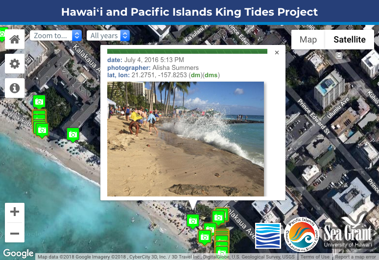
| Graphic Preview Description | Sample image. |
| Graphic Preview File | http://pacioos.org/metadata/browse/pac_uhsg_usa_kingtides_photos.png |
| Harvest Object Id | b2234106-7b77-4c5d-bffe-9d86b7c2deff |
| Harvest Source Id | 54e15a6e-6dde-4c9c-a8f0-345cc0dfccfb |
| Harvest Source Title | ioos |
| Licence | |
| Lineage | 2018-12-14T00:00:00Z OGC web services (WMS and WFS) enabled by PacIOOS via GeoServer. Original data from source provider may have been reformatted, reprojected, or adjusted in other ways to optimize these capabilities. |
| Metadata Language | eng |
| Metadata Type | geospatial |
| Old Spatial | {"type": "Polygon", "coordinates": [[[-177.378088, -14.32367], [171.3731519, -14.32367], [171.3731519, 28.218039], [-177.378088, 28.218039], [-177.378088, -14.32367]]]} |
| Progress | |
| Spatial Data Service Type | Open Geospatial Consortium Web Feature Service (WFS) |
| Spatial Reference System | |
| Spatial Harvester | True |
Didn't find what you're looking for? Suggest a dataset here.

