

GPM GROUND VALIDATION NEXRAD LEVEL II KMPX IFLOODS V1
Access & Use Information
Public: This dataset is intended for public access and use.
License: No license information was provided. If this work was prepared by an officer or employee of the United States government as part of that person's official duties it is considered a U.S. Government Work.
Downloads & Resources
-
Google Scholar search resultsHTML
Search results for publications that cite this dataset by its DOI.
-
Download this datasetHTML
Files may be downloaded directly to your workstation from this link
-
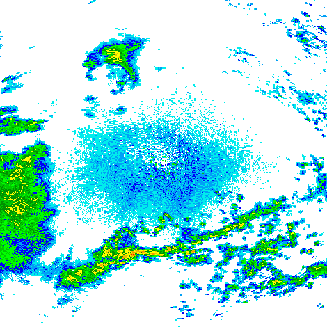
Get a related visualizationPNG
Sample Browse Image
-
View information related to this datasetHTML
IFloodS Field Campaign Collection DOI
-
View this dataset's publicationsHTML
Nexrad: next generation weather radar (WSR-88D)
-
View this dataset's publicationsHTML
A Review of NEXRAD Level II: Data, Distribution, and Applications
-
The dataset's project home pageHTML
IFloodS Field Campaign Project Homepage
-
Get a related visualizationHTML
Browse images illustrate the nature and coverage of the data
-
View documentation related to this datasetHTML
Instructions for citing GHRC data
-
Landing PageLanding Page
Dates
| Metadata Created Date | December 1, 2022 |
|---|---|
| Metadata Updated Date | August 22, 2025 |
Metadata Source
- Data.json Data.json Metadata
Harvested from NASA Data.json
Additional Metadata
| Resource Type | Dataset |
|---|---|
| Metadata Created Date | December 1, 2022 |
| Metadata Updated Date | August 22, 2025 |
| Publisher | NASA/MSFC/GHRC |
| Maintainer | |
| Identifier | C1982568561-GHRC_DAAC |
| Data First Published | 2015-03-03 |
| Language | en-US |
| Data Last Modified | 2025-07-17 |
| Category | IFloodS, geospatial |
| Public Access Level | public |
| Bureau Code | 026:00 |
| Metadata Context | https://project-open-data.cio.gov/v1.1/schema/catalog.jsonld |
| Schema Version | https://project-open-data.cio.gov/v1.1/schema |
| Catalog Describedby | https://project-open-data.cio.gov/v1.1/schema/catalog.json |
| Harvest Object Id | ecd8df8b-1332-4f08-b09d-ff1dd14f56d7 |
| Harvest Source Id | 58f92550-7a01-4f00-b1b2-8dc953bd598f |
| Harvest Source Title | NASA Data.json |
| Homepage URL | https://doi.org/10.5067/IFLOODS/NEXRAD/DATA204 |
| Metadata Type | geospatial |
| Old Spatial | -99.4 40.71 -87.74 48.99 |
| Program Code | 026:001 |
| Source Datajson Identifier | True |
| Source Hash | 5824308993ef67851c46d36ea200c6c737890b3fd00b9a128cc70c5aeb97ac7b |
| Source Schema Version | 1.1 |
| Spatial | |
| Temporal | 2013-03-29T20:51:00Z/2013-06-18T15:15:59Z |
Didn't find what you're looking for? Suggest a dataset here.