

Get a related visualization
URL: https://daac.ornl.gov/DELTAX/guides/DeltaX_ANUGA_Hydrodynamics_MRD_Fig1.png
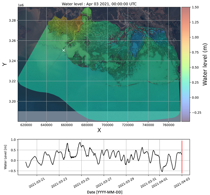
Figure 1: Snapshot of the water surface elevation in the model domain.
Source: Delta-X: ANUGA Hydrodynamic Outputs, Atchafalaya and Terrebonne, MRD, USA
About this Resource
| Last updated | unknown |
|---|---|
| Created | unknown |
| Name | Get a related visualization |
| Format | PNG Image File |
| License | License not specified |
| Created | 4 months ago |
| Media type | image/png |
| has views | True |
| id | 29c95dcc-69a8-41a9-a010-2bdf4fac542f |
| metadata modified | 4 months ago |
| package id | 1e180ba9-3936-49f8-ac94-31be1fb299b0 |
| position | 6 |
| state | active |