CRRF Weather Station: Palau: Koror: Ngeanges Island
Access & Use Information
Downloads & Resources
-
Data Subset FormHTML
ERDDAP's version of the OPeNDAP .html web page for this dataset. Specify a...
-
Make-A-Graph Form
ERDDAP's Make-A-Graph .html web page for this dataset. Create an image with a...
-
PacIOOS website
This URL provides a viewer and/or data access for this dataset.
-
Related URL
This URL provides additional information related to this dataset.
-
Web Resourceapplication/vnd.lotus-organizer
-
Web Resourceapplication/vnd.lotus-organizer
-
Web Resourceapplication/vnd.lotus-organizer
-
Web Resourceapplication/vnd.lotus-organizer
-
Web Resourceapplication/vnd.lotus-organizer
-
ERDDAP-tabledap
ERDDAP's tabledap service (a flavor of OPeNDAP) for tabular (sequence) data....
-
Web Resourceapplication/vnd.lotus-organizer
-
OPeNDAP
An OPeNDAP service for tabular (sequence) data. Add different extensions...
Dates
| Metadata Date | November 14, 2022 |
|---|---|
| Metadata Created Date | October 7, 2023 |
| Metadata Updated Date | October 7, 2023 |
| Reference Date(s) | March 1, 2007 (creation), August 13, 2015 (issued), November 14, 2022 (revision) |
| Frequency Of Update |
Metadata Source
- ISO-19139 ISO-19139 Metadata
Harvested from ioos
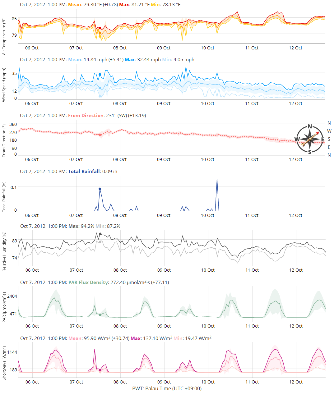
Graphic Preview

Additional Metadata
| Resource Type | Dataset |
|---|---|
| Metadata Date | November 14, 2022 |
| Metadata Created Date | October 7, 2023 |
| Metadata Updated Date | October 7, 2023 |
| Reference Date(s) | March 1, 2007 (creation), August 13, 2015 (issued), November 14, 2022 (revision) |
| Responsible Party | Coral Reef Research Foundation (CRRF) (Point of Contact) |
| Contact Email | |
| Guid | aws_crrf |
| Access Constraints | |
| Bbox East Long | 132.371 |
| Bbox North Lat | 7.20915 |
| Bbox South Lat | 7.20915 |
| Bbox West Long | 132.371 |
| Coupled Resource | [{"title": [], "href": ["#DataIdentification"], "uuid": []}, {"title": [], "href": ["#DataIdentification"], "uuid": []}] |
| Frequency Of Update | |
| Graphic Preview Description | Sample image. |
| Graphic Preview File | http://pacioos.org/metadata/browse/aws_crrf.png |
| Harvest Object Id | fdd0289f-37e6-4888-afcc-5d37d3477a79 |
| Harvest Source Id | 54e15a6e-6dde-4c9c-a8f0-345cc0dfccfb |
| Harvest Source Title | ioos |
| Licence | |
| Lineage | 2015-03-01T00:00:00Z CRRF (L. Colin) supplied 2007-2015 data to PacIOOS as Excel and PacIOOS converted to NetCDF. 2015-08-13T00:00:00Z NetCDF format converted to CF-1.6 discrete geometry (DSG). 2020-01-03T00:00:00Z NetCDF format modified to match NCEI_NetCDF_TimeSeries_Incomplete_Template_v2.0. 2021-03-08T00:00:00Z NetCDF variables station_name, platform1, instrument1, and crs converted from int to string and now contain respective data values. 2022-11-14T12:16:00Z Dataset identifier modified from "AWS-CRRF" to "aws_crrf" to satisfy future ERDDAP requirements. |
| Metadata Language | eng |
| Metadata Type | geospatial |
| Old Spatial | {"type": "Point", "coordinates": [132.371, 7.20915]} |
| Progress | |
| Spatial Data Service Type | ERDDAP tabledap |
| Spatial Reference System | |
| Spatial Harvester | True |
| Temporal Extent Begin | 2007-03-01T06:00:00Z |
| Temporal Extent End | 2015-02-28T14:00:00Z |
Didn't find what you're looking for? Suggest a dataset here.

