

CAMEX-3 MULTISPECTRAL ATMOSPHERIC MAPPING SENSOR (MAMS) V1
Access & Use Information
Public: This dataset is intended for public access and use.
License: No license information was provided. If this work was prepared by an officer or employee of the United States government as part of that person's official duties it is considered a U.S. Government Work.
Downloads & Resources
-
Google Scholar search resultsHTML
Search results for publications that cite this dataset by its DOI.
-
Download this datasetHTML
Files may be downloaded directly to your workstation from this link
-
Get a related visualizationGIF
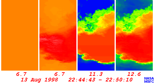
Sample browse image
-
View documentation related to this datasetHTML
The guide document contains detailed information about the dataset
-
The dataset's project home pageHTML
The home page for the project or program which sponsored the dataset
-
Get a related visualizationHTML
N/A
-
View documentation related to this datasetHTML
Instructions for citing GHRC data
-
Landing PageLanding Page
Dates
| Metadata Created Date | December 1, 2022 |
|---|---|
| Metadata Updated Date | December 7, 2023 |
Metadata Source
- Data.json Data.json Metadata
Harvested from NASA Data.json
Graphic Preview
Additional Metadata
| Resource Type | Dataset |
|---|---|
| Metadata Created Date | December 1, 2022 |
| Metadata Updated Date | December 7, 2023 |
| Publisher | NASA/MSFC/GHRC |
| Maintainer | |
| Identifier | C1979112118-GHRC_DAAC |
| Data First Published | 2000-10-30 |
| Language | en-US |
| Data Last Modified | 2022-04-28 |
| Category | CAMEX-3, geospatial |
| Public Access Level | public |
| Bureau Code | 026:00 |
| Metadata Context | https://project-open-data.cio.gov/v1.1/schema/catalog.jsonld |
| Metadata Catalog ID | https://data.nasa.gov/data.json |
| Schema Version | https://project-open-data.cio.gov/v1.1/schema |
| Catalog Describedby | https://project-open-data.cio.gov/v1.1/schema/catalog.json |
| Citation | Jedlovec, Gary J and Anthony R Guillory.2000. CAMEX-3 MULTISPECTRAL ATMOSPHERIC MAPPING SENSOR (MAMS) indicate subset used. Dataset available online from the NASA Global Hydrometeorology Resource Center DAAC, Huntsville, Alabama, U.S.A. DOI: http://dx.doi.org/10.5067/CAMEX-3/PHOTOMETER/DATA101 |
| Graphic Preview Description | N/A |
| Graphic Preview File | https://ghrc.nsstc.nasa.gov/pub/fieldCampaigns/camex3/er2mams/browse/ |
| Harvest Object Id | eb5eb482-4a48-418c-bf7a-4d53eb5718c1 |
| Harvest Source Id | 58f92550-7a01-4f00-b1b2-8dc953bd598f |
| Harvest Source Title | NASA Data.json |
| Homepage URL | https://doi.org/10.5067/CAMEX-3/PHOTOMETER/DATA101 |
| Metadata Type | geospatial |
| Old Spatial | -89.8519 13.8709 -63.1191 34.6333 |
| Program Code | 026:001 |
| Source Datajson Identifier | True |
| Source Hash | 67bc4cbae8e32dc14db1a228ad52713c6c780dd12d1f3e64344eabcb5fe29441 |
| Source Schema Version | 1.1 |
| Spatial | |
| Temporal | 1998-08-13T19:31:09Z/1998-09-27T20:23:30Z |
Didn't find what you're looking for? Suggest a dataset here.