

Get a related visualization
URL: https://daac.ornl.gov/ABOVE/guides/Wildfire_Effects_Spruce_Field_Fig1.png
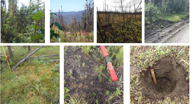
Photos from July 2017 field surveys. Clockwise from upper left photo: Unburned forest site; burned forest landscape of the Spicer Creek Fire; High Burn Severity (HBS) forest site; eroded roadside on the margin of the Spicer Creek Fire; soil pit to 30 cm depth; charred surface organic layer of HBS site with soil probe handle; surface organic layer of unburned forest site with 1-m long soil probe (Potter & Hugny, 2018).
Source: ABoVE: Characterization of Burned and Unburned Spruce Forest Sites, Tanana, AK, 2017
About this Resource
| Last updated | unknown |
|---|---|
| Created | unknown |
| Name | Get a related visualization |
| Format | PNG Image File |
| License | License not specified |
| Created | 2 years ago |
| Media type | image/png |
| has views | True |
| id | 38c7322a-8ded-4616-ba48-cb1663831435 |
| metadata modified | 2 years ago |
| package id | 5cb57389-1ebd-4486-a391-84c71dad9395 |
| position | 6 |
| state | active |