

13 datasets found
-
Federal
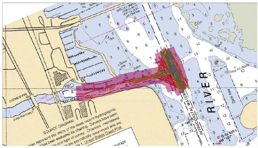
F00634: NOS Hydrographic Survey , 2013-06-04
National Oceanic and Atmospheric Administration, Department of Commerce —
The National Oceanic and Atmospheric Administration (NOAA) has the statutory mandate to collect hydrographic data in support of nautical chart compilation for safe... -
State
Reconnaissance geologic map of the Solomon D-6 Quadrangle, Seward Peninsula, Alaska
State of Alaska —
Reconnaissance geologic map of the Solomon D-6 Quadrangle, Seward Peninsula, Alaska, Open-File Report 72-325, provides 1:63,360 geologic mapping of parts of the... -
State
Ground gravity geophysical survey of the Holitna basin area, Alaska, data compilation
State of Alaska —
Gravity data were acquired at 1,175 stations during the period April 13 to May 3, 1982 by EDCON, Inc. using a helicopter-borne inertial surveying system and LaCoste... -
State
Surficial-geologic map of the Seward D-6 Quadrangle, Alaska
State of Alaska —
Surficial-geologic map of the Seward D-6 Quadrangle, Alaska, Report of Investigation 84-15, shows the distribution of unconsolidated deposits and undifferentiated... -
State
LA-ICP-MS uranium lead geochronologic data of zircon from igneous and meta-igneous rocks in the Mount Harper project area, Eagle, Tanacross, Mount Hayes, and Big Delta quadrangles, Alaska
State of Alaska —
LA-ICP-MS uranium lead geochronologic data of zircon from igneous and meta-igneous rocks in the Mount Harper project area, Eagle, Tanacross, Mount Hayes, and Big... -
Federal
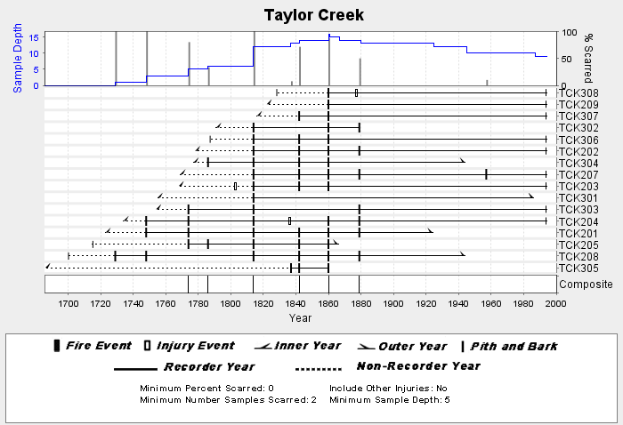
NOAA/WDS Paleoclimatology - Grissino-Mayer fire data from Taylor Creek - IMPD USTCD001
National Oceanic and Atmospheric Administration, Department of Commerce —
This archived Paleoclimatology Study is available from the NOAA National Centers for Environmental Information (NCEI), under the World Data Service (WDS) for... -
State
Field station locations and magnetic susceptibility data collected in 2021 for the Taylor Mountain project, Tanacross and Eagle quadrangles, Alaska
State of Alaska —
DGGS Raw Data File 2022-2, Field station locations and magnetic susceptibility data collected in 2021 for the Taylor Mountain project, Tanacross and Eagle... -
State
Lidar-derived elevation data for Turnagain Pass, southcentral Alaska, September 2, 2018
State of Alaska —
The State of Alaska Division of Geological & Geophysical Surveys (DGGS) used lidar to produce a digital terrain model (DTM) and digital surface model (DSM) of... -
State
Surficial-geologic map of the Eagle A-2 Quadrangle, Fortymile mining district, Alaska
State of Alaska —
Preliminary Interpretive Report 2001-3C, Surficial-Geologic Map of the Eagle A-2 Quadrangle, Fortymile mining district, Alaska, provides 1:63,360-scale geologic... -
State
Geologic investigation of the Western Tanacross and Taylor Mountain areas, Tanacross and Eagle quadrangles, Alaska
State of Alaska —
Geologic investigation of the Western Tanacross and Taylor Mountain areas, Tanacross and Eagle quadrangles, Alaska, Preliminary Interpretive Report 2024-6, presents a... -
State
U-Pb zircon geochronology of bedrock samples collected in the Eagle and Tanacross quadrangles, eastern Alaska
State of Alaska —
U-Pb zircon geochronology of bedrock samples collected in the Eagle and Tanacross quadrangles, eastern Alaska, Preliminary Interpretive Report 2023-2, presents... -
State
Stikine electromagnetic and magnetic airborne geophysical survey data compilation
State of Alaska —
The Stikine geophysical survey is located in southeast Alaska near the city of Wrangell, about 175 kilometers south of Juneau, Alaska. Frequency domain... -
State
Field station locations and magnetic susceptibility data collected in 2022 for the Mount Harper project, Eagle, Big Delta, and Mount Hayes quadrangles, Alaska
State of Alaska —
Field station locations and magnetic susceptibility data collected in 2022 for the Mount Harper project, Eagle, Big Delta, and Mount Hayes quadrangles, Alaska, Raw...
13 datasets found