

8 datasets found
-
Federal
Compilation of Geospatial Data (GIS) for the Mineral Industries and Related Infrastructure of Africa
Department of the Interior —
This geodatabase reflects the U.S. Geological Survey’s (USGS) ongoing commitment to its mission of understanding the nature and distribution of global mineral... -
Federal
Yale stocks and flows database (YSTAFDB) describing anthropogenic materials cycles, recycling, and criticality for 102 materials on spatial scales ranging from suburbs to global and timescales from the early 1800s to circa 2013
Department of the Interior —
This data release presents the Yale stocks and flows database (YSTAFDB). Its data describe the use of 102 materials from the early 1800s to circa 2013 through... -
Federal
Sea level measured by tide gauges from global oceans as part of the Joint Archive for Sea Level (JASL) since 1846
National Oceanic and Atmospheric Administration, Department of Commerce —
This collection contains the complete holdings of the Joint Archive for Sea Level (JASL) for hourly and daily data that have been quality controlled, assessed, and... -
Federal
USGS National and Global Oil and Gas Assessment Project—East Africa and Seychelles Provinces: Assessment Unit Boundaries, Assessment Input data, and Fact Sheet Data Tables
Department of the Interior —
This data release contains the boundaries of assessment units, assessment input data, and resulting fact sheet data tables for the assessment of undiscovered oil and... -
Federal
Province, Total Petroleum System and Assessment Unit Boundaries from the 2009-2011 World Petroleum Resources Project
Department of the Interior —
The boundaries illustrated by these Assessment Units are the result of geologic studies conducted by the World Petroleum Resources Project, 2009-2011 (Project). The... -
Federal
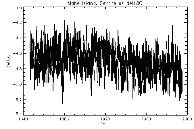
NOAA/WDS Paleoclimatology - Mahe - del18O Data
National Oceanic and Atmospheric Administration, Department of Commerce —
This archived Paleoclimatology Study is available from the NOAA National Centers for Environmental Information (NCEI), under the World Data Service (WDS) for... -
Federal
NOAA/WDS Paleoclimatology - Seychelles Coral Bleaching 20 Year Stable Isotope Data
National Oceanic and Atmospheric Administration, Department of Commerce —
This archived Paleoclimatology Study is available from the NOAA National Centers for Environmental Information (NCEI), under the World Data Service (WDS) for... -
Federal
NOAA/WDS Paleoclimatology - Seychelles Fossil Coral Data from the Last Interglacial
National Oceanic and Atmospheric Administration, Department of Commerce —
This archived Paleoclimatology Study is available from the NOAA National Centers for Environmental Information (NCEI), under the World Data Service (WDS) for...
8 datasets found