
-
Federal
The NOAA NCEI Global Marine Microplastics Data Collection (1972-present)
National Oceanic and Atmospheric Administration, Department of Commerce —
Microplastics (i.e., plastics measuring less than 5mm) pollution is a growing problem affecting coastal communities, marine ecosystems, aquatic life, and human... -
Federal
National Benthic Infaunal Database (NBID)
National Oceanic and Atmospheric Administration, Department of Commerce —
The NBID is a quantitative database on abundances of individual benthic species by sample and study region, along with other synoptically measured environmental... -
Federal
National Centers for Coastal Ocean Science (NCCOS) long-term monitoring: Regional Ecological Assessments and National Benthic Inventory (NCEI Accession 0202842)
National Oceanic and Atmospheric Administration, Department of Commerce —
The NCCOS Regional Ecological Assessments (REA) and NOAA National Benthic Inventory (NBI) include observations of water quality, sediment quality, fish and shellfish... -
Federal
NOAA Environmental Sensitivity Index (ESI) maps and geographic information systems data from 1900 to 2009
National Oceanic and Atmospheric Administration, Department of Commerce —
This collection comprises the Environmental Sensitivity Index (ESI) data for various regions in U.S. coastal waters. ESI data characterize estuarine environments and... -
Federal
Shallow benthic habitats of San Francisco Bay, California CMECS biotic component
National Oceanic and Atmospheric Administration, Department of Commerce —
This dataset has been developed for the National Oceanic and Atmospheric Administration's (NOAA) Office for Coastal Management (OCM) as a collaborative and... -
Federal
D00199: NOS Hydrographic Survey , 2015-06-16
National Oceanic and Atmospheric Administration, Department of Commerce —
The National Oceanic and Atmospheric Administration (NOAA) has the statutory mandate to collect hydrographic data in support of nautical chart compilation for safe... -
Federal
San Francisco Bay Water Quality Improvement Fund Major River and Tributary Lines, San Francisco Bay CA, 2019, U.S. EPA Region 9
U.S. Environmental Protection Agency —
This feature class contains 20 line features representing the major rivers and tributaries in the San Francisco Bay Area affected or potentially affected by projects... -
Federal
Central California 1 Arc-second MHW Coastal Digital Elevation Model
National Oceanic and Atmospheric Administration, Department of Commerce —
NOAA's National Geophysical Data Center (NGDC) is building high-resolution digital elevation models (DEMs) for select U.S. coastal regions. These integrated... -
Federal
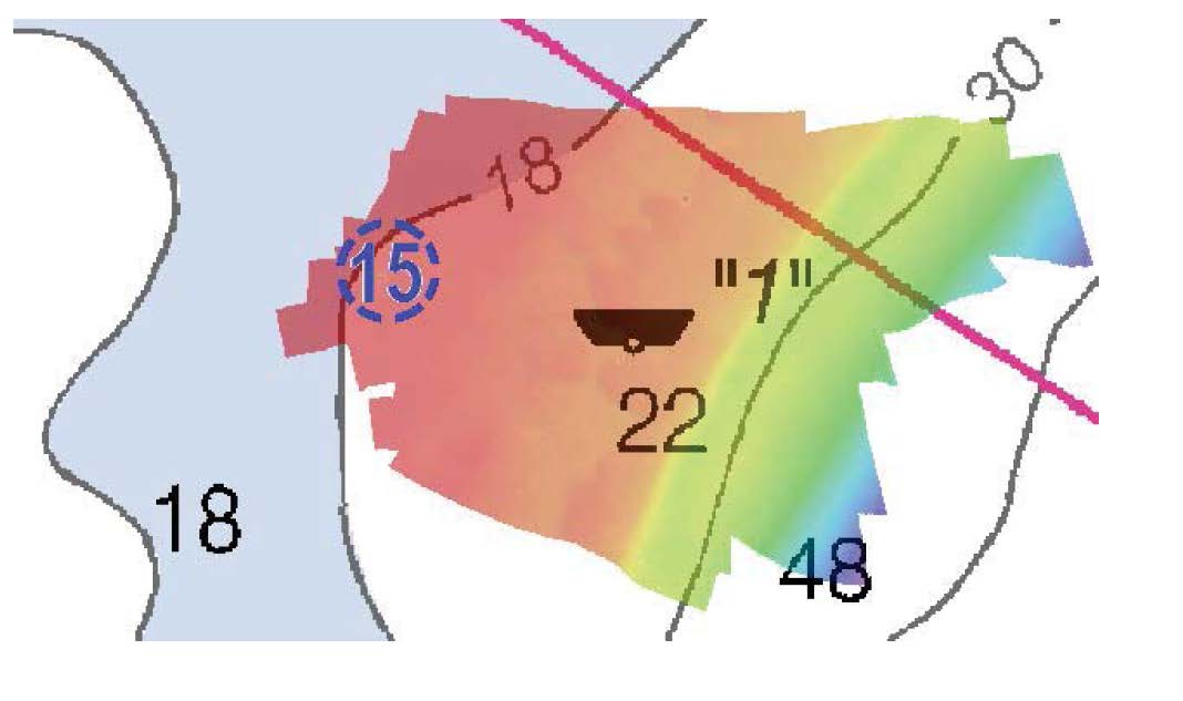
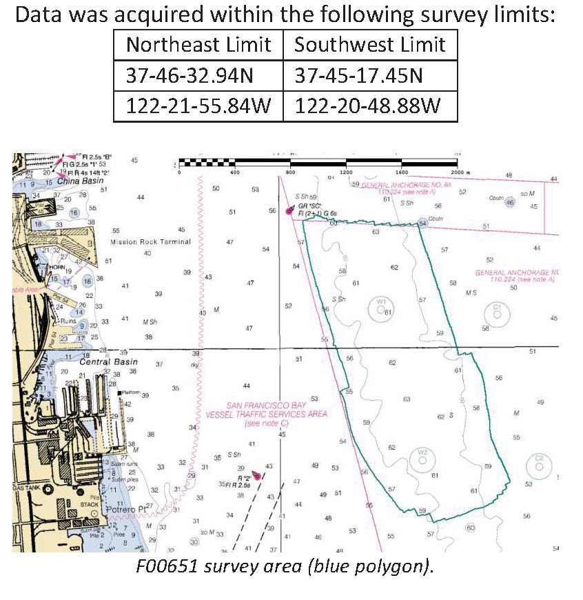
F00651: NOS Hydrographic Survey , 2014-10-09
National Oceanic and Atmospheric Administration, Department of Commerce —
The National Oceanic and Atmospheric Administration (NOAA) has the statutory mandate to collect hydrographic data in support of nautical chart compilation for safe... -
Federal
Shallow benthic habitats of San Francisco Bay, California CMECS substrate component
National Oceanic and Atmospheric Administration, Department of Commerce —
This dataset has been developed for the National Oceanic and Atmospheric Administration's (NOAA) Office for Coastal Management (OCM) as a collaborative and... -
Federal
Shallow benthic habitats of San Francisco Bay, California CMECS geoform component
National Oceanic and Atmospheric Administration, Department of Commerce —
This dataset has been developed for the National Oceanic and Atmospheric Administration's (NOAA) Office for Coastal Management (OCM) as a collaborative and... -
Federal
H10895: NOS Hydrographic Survey , San Joaquin River, California, 1999-08-03
National Oceanic and Atmospheric Administration, Department of Commerce —
The National Oceanic and Atmospheric Administration (NOAA) has the statutory mandate to collect hydrographic data in support of nautical chart compilation for safe... -
Federal
San Francisco Bay, California 1/3 arc-second NAVD 88 Coastal Digital Elevation Model
National Oceanic and Atmospheric Administration, Department of Commerce —
NOAA's National Geophysical Data Center (NGDC) is building high-resolution digital elevation models (DEMs) for select U.S. coastal regions. These integrated... -
Federal
D00191: NOS Hydrographic Survey , 2014-05-03
National Oceanic and Atmospheric Administration, Department of Commerce —
The National Oceanic and Atmospheric Administration (NOAA) has the statutory mandate to collect hydrographic data in support of nautical chart compilation for safe... -
Federal
F00477: NOS Hydrographic Survey , 2001-10-26
National Oceanic and Atmospheric Administration, Department of Commerce —
The National Oceanic and Atmospheric Administration (NOAA) has the statutory mandate to collect hydrographic data in support of nautical chart compilation for safe... -
Federal
D00182: NOS Hydrographic Survey , 2013-10-23
National Oceanic and Atmospheric Administration, Department of Commerce —
The National Oceanic and Atmospheric Administration (NOAA) has the statutory mandate to collect hydrographic data in support of nautical chart compilation for safe... -
Federal
F00657: NOS Hydrographic Survey , 2015-08-12
National Oceanic and Atmospheric Administration, Department of Commerce —
The National Oceanic and Atmospheric Administration (NOAA) has the statutory mandate to collect hydrographic data in support of nautical chart compilation for safe... -
Federal
National Status and Trends, Benthic Surveillance Project Sites, 1984-1992, National Centers for Coastal Ocean Science
National Oceanic and Atmospheric Administration, Department of Commerce —
This data set reports information regarding the nominal sampling locations for the National Status and Trends Benthic Surveillance Project sites. One record is... -
Federal
Shoreline Mapping Program of San Francisco Bay, Golden Gate to Point Chauncey, CA, CA1212D-CM-N NGDA
National Oceanic and Atmospheric Administration, Department of Commerce —
These data provide an accurate high-resolution shoreline compiled from imagery of San Francisco Bay, Golden Gate to Point Chauncey, CA . This vector shoreline data is... -
Federal
Archival and Discovery of December 23, 1854 Tsunami Event on Marigrams
National Oceanic and Atmospheric Administration, Department of Commerce —
NOAA National Centers for Environmental Information have more than 3,000 tsunami marigram (tide gauge) records in both image and paper format. The majority of these...

Official websites use .gov
A
.gov website belongs to an official government
organization in the United States.
Secure .gov websites use HTTPS
A
lock (
) or https:// means you’ve safely connected to
the .gov website. Share sensitive information only on official,
secure websites.
.jpg)