

4 datasets found
-
Federal
Estuarine Salinity Zones in US East Coast, Gulf of Mexico, and US West Coast from 1999-01-01 to 1999-12-31 (NCEI Accession 0127396)
National Oceanic and Atmospheric Administration, Department of Commerce —
These unprojected (geographic coordinates) 3-Zone Average Annual Salinity Digital Geographies are based on analysis of long-term salinity data for 147 estuaries of... -
Federal
H00523: NOS Hydrographic Survey
National Oceanic and Atmospheric Administration, Department of Commerce —
The National Oceanic and Atmospheric Administration (NOAA) has the statutory mandate to collect hydrographic data in support of nautical chart compilation for safe... -
Federal
Shoreline Mapping Program of RAPPAHANNOCK RIVER, PAYNES ISLAND TO FREDERICKSBURG, VA, VA0601B NGDA
National Oceanic and Atmospheric Administration, Department of Commerce —
These data provide an accurate high-resolution shoreline compiled from imagery of RAPPAHANNOCK RIVER, PAYNES ISLAND TO FREDERICKSBURG, VA . This vector shoreline data... -
Federal
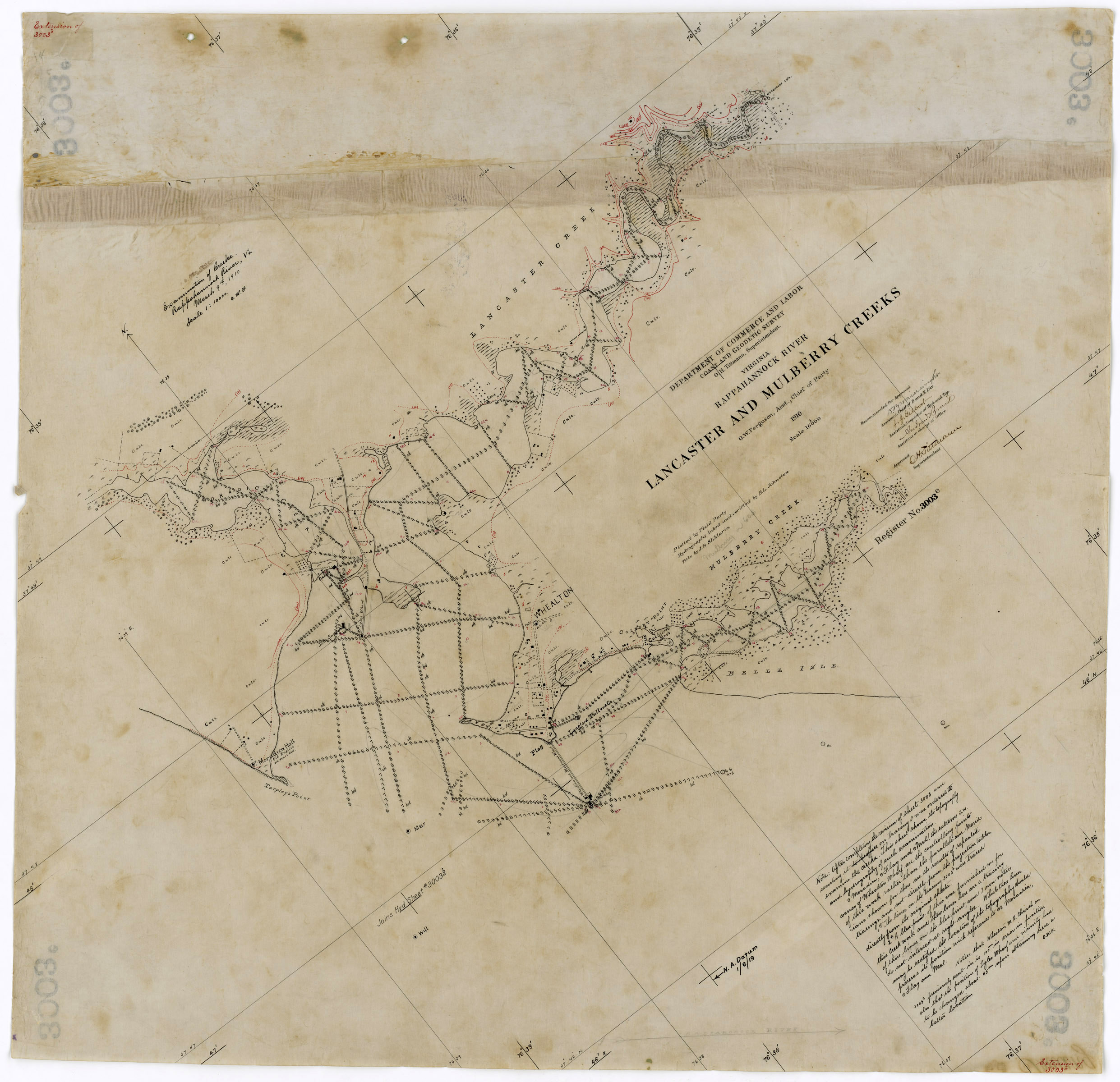
H03003D: NOS Hydrographic Survey , 1909-08-09
National Oceanic and Atmospheric Administration, Department of Commerce —
The National Oceanic and Atmospheric Administration (NOAA) has the statutory mandate to collect hydrographic data in support of nautical chart compilation for safe...
4 datasets found