
-
Federal
F00664: NOS Hydrographic Survey , 2015-07-08
National Oceanic and Atmospheric Administration, Department of Commerce —
The National Oceanic and Atmospheric Administration (NOAA) has the statutory mandate to collect hydrographic data in support of nautical chart compilation for safe... -
Federal
H13740: NOS Hydrographic Survey , 2023-08-17
National Oceanic and Atmospheric Administration, Department of Commerce —
The National Oceanic and Atmospheric Administration (NOAA) has the statutory mandate to collect hydrographic data in support of nautical chart compilation for safe... -
Federal
AFSC/RACE/GAP/Prescott: Norton Sound Shoreline
National Oceanic and Atmospheric Administration, Department of Commerce —
We assembled approximately 230,000 National Ocean Service (NOS) bathymetric soundings from 39 lead-line and single-beam echosounder hydrographic surveys conducted... -
Federal
AFSC/RACE/GAP/Prescott: Norton Sound Features
National Oceanic and Atmospheric Administration, Department of Commerce —
We assembled approximately 230,000 National Ocean Service (NOS) bathymetric soundings from 39 lead-line and single-beam echosounder hydrographic surveys conducted... -
Federal
H13373: NOS Hydrographic Survey , 2020-09-08
National Oceanic and Atmospheric Administration, Department of Commerce —
The National Oceanic and Atmospheric Administration (NOAA) has the statutory mandate to collect hydrographic data in support of nautical chart compilation for safe... -
Federal
H13693: NOS Hydrographic Survey , 2023-08-13
National Oceanic and Atmospheric Administration, Department of Commerce —
The National Oceanic and Atmospheric Administration (NOAA) has the statutory mandate to collect hydrographic data in support of nautical chart compilation for safe... -
Federal
H13700: NOS Hydrographic Survey , 2023-08-28
National Oceanic and Atmospheric Administration, Department of Commerce —
The National Oceanic and Atmospheric Administration (NOAA) has the statutory mandate to collect hydrographic data in support of nautical chart compilation for safe... -
Federal
H13695: NOS Hydrographic Survey , 2023-08-30
National Oceanic and Atmospheric Administration, Department of Commerce —
The National Oceanic and Atmospheric Administration (NOAA) has the statutory mandate to collect hydrographic data in support of nautical chart compilation for safe... -
Federal
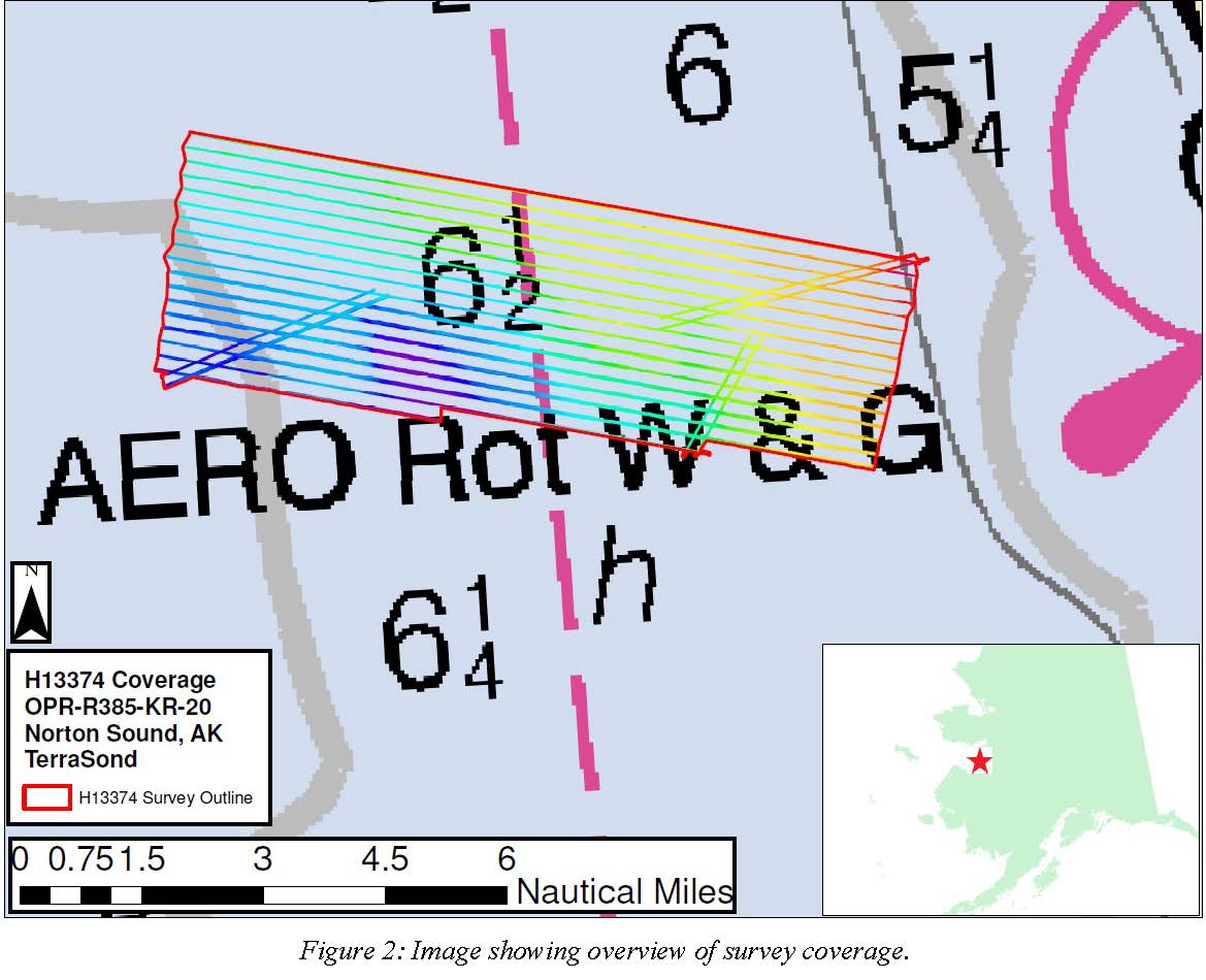
H13374: NOS Hydrographic Survey , 2020-09-10
National Oceanic and Atmospheric Administration, Department of Commerce —
The National Oceanic and Atmospheric Administration (NOAA) has the statutory mandate to collect hydrographic data in support of nautical chart compilation for safe... -
Federal
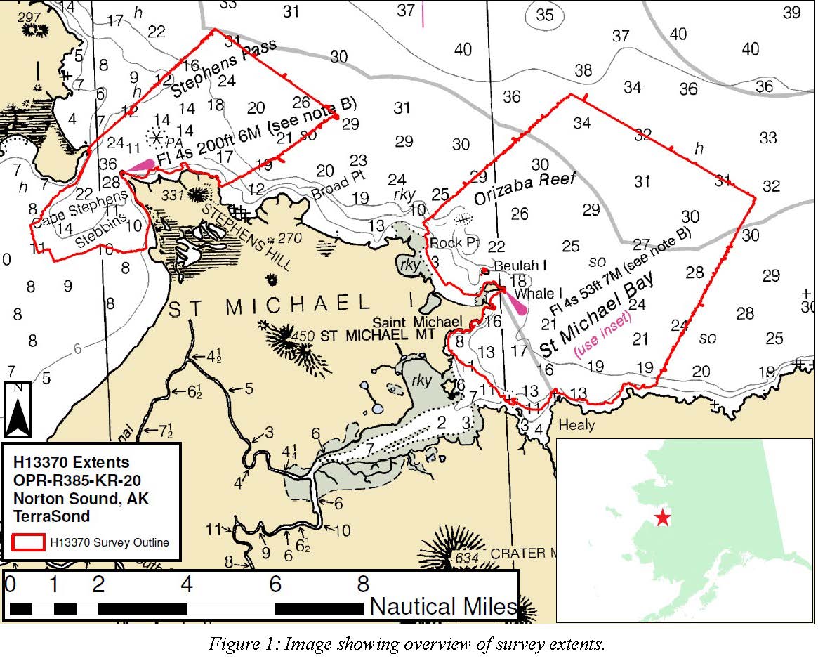
H13370: NOS Hydrographic Survey , 2020-09-16
National Oceanic and Atmospheric Administration, Department of Commerce —
The National Oceanic and Atmospheric Administration (NOAA) has the statutory mandate to collect hydrographic data in support of nautical chart compilation for safe... -
Federal
H13699: NOS Hydrographic Survey , 2023-08-11
National Oceanic and Atmospheric Administration, Department of Commerce —
The National Oceanic and Atmospheric Administration (NOAA) has the statutory mandate to collect hydrographic data in support of nautical chart compilation for safe... -
Federal
National Status and Trends, Benthic Surveillance Project Sites, 1984-1992, National Centers for Coastal Ocean Science
National Oceanic and Atmospheric Administration, Department of Commerce —
This data set reports information regarding the nominal sampling locations for the National Status and Trends Benthic Surveillance Project sites. One record is... -
Federal
H13694: NOS Hydrographic Survey , 2023-08-10
National Oceanic and Atmospheric Administration, Department of Commerce —
The National Oceanic and Atmospheric Administration (NOAA) has the statutory mandate to collect hydrographic data in support of nautical chart compilation for safe... -
State
Coastal hazard field investigations in response to the November 2011 Bering Sea storm, Norton Sound, Alaska
State of Alaska —
On November 8, 2011, an extra-tropical cyclone with a low pressure of 945 millibars developed over the Bering Sea and moved northeast across the western coast of... -
Federal
AFSC/RACE/GAP/Prescott: Norton Sound Sediments
National Oceanic and Atmospheric Administration, Department of Commerce —
We assembled approximately 230,000 National Ocean Service (NOS) bathymetric soundings from 39 lead-line and single-beam echosounder hydrographic surveys conducted... -
Federal
H13741: NOS Hydrographic Survey , 2023-08-30
National Oceanic and Atmospheric Administration, Department of Commerce —
The National Oceanic and Atmospheric Administration (NOAA) has the statutory mandate to collect hydrographic data in support of nautical chart compilation for safe... -
Federal
H13702: NOS Hydrographic Survey , 2023-08-12
National Oceanic and Atmospheric Administration, Department of Commerce —
The National Oceanic and Atmospheric Administration (NOAA) has the statutory mandate to collect hydrographic data in support of nautical chart compilation for safe... -
Federal
H13701: NOS Hydrographic Survey , 2023-09-01
National Oceanic and Atmospheric Administration, Department of Commerce —
The National Oceanic and Atmospheric Administration (NOAA) has the statutory mandate to collect hydrographic data in support of nautical chart compilation for safe... -
State
Reconnaissance report on surficial geology of the coastal area from Tolstoi Point to Cape Nome, Norton Sound, Alaska
State of Alaska —
Reconnaissance report on surficial geology of the coastal area from Tolstoi Point to Cape Nome, Norton Sound, Alaska, Alaska Open-File Report 125, presents a... -
Federal
H13371: NOS Hydrographic Survey , 2020-09-17
National Oceanic and Atmospheric Administration, Department of Commerce —
The National Oceanic and Atmospheric Administration (NOAA) has the statutory mandate to collect hydrographic data in support of nautical chart compilation for safe...

Official websites use .gov
A
.gov website belongs to an official government
organization in the United States.
Secure .gov websites use HTTPS
A
lock (
) or https:// means you’ve safely connected to
the .gov website. Share sensitive information only on official,
secure websites.