

6 datasets found
-
Federal
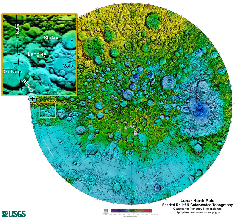
Gazetteer of Planetary Nomenclature: Moon: 1:10 million-scale Shaded Relief and Color-coded Topography: North Pole
National Aeronautics and Space Administration —
These lunar maps display the four different areas of the moon with color-coded topography in low and high resolution approved by the International Astronomical Union... -
Federal
Yukon-Tanana Upland airborne magnetic geophysical data merge, version 2023
Department of the Interior —
The Yukon-Tanana Upland airborne magnetic geophysical data merge provides a merged raster grid of magnetic data for the Yukon-Tanana Upland (YTU), Alaska. This... -
Federal
Tanana River and Big Delta Airborne Magnetic and Radiometric Survey
Department of the Interior —
The Tanana River and Big Delta airborne magnetic and radiometric geophysical survey covers parts of the Big Delta, Charley River, Circle, Eagle, Fairbanks, Kantishna... -
Federal
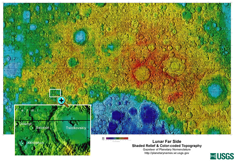
Gazetteer of Planetary Nomenclature: Moon: 1:10 million-scale Shaded Relief and Color-coded Topography: Far Side
National Aeronautics and Space Administration —
These lunar maps display the four different areas of the moon with color-coded topography in low and high resolution approved by the International Astronomical Union... -
Federal
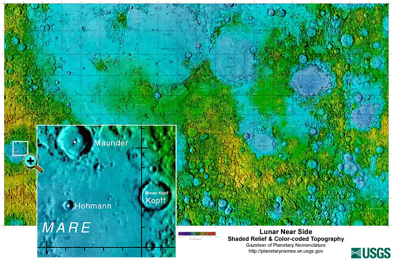
Gazetteer of Planetary Nomenclature: Moon: 1:10 million-scale Shaded Relief and Color-coded Topography: Near Side
National Aeronautics and Space Administration —
These lunar maps display the four different areas of the moon with color-coded topography in low and high resolution approved by the International Astronomical Union... -
Federal
Gazetteer of Planetary Nomenclature: Moon: 1:10 million-scale Shaded Relief and Color-coded Topography: South Pole
National Aeronautics and Space Administration —
These lunar maps display the four different areas of the moon with color-coded topography in low and high resolution approved by the International Astronomical Union...
6 datasets found