

10 datasets found
-
Federal
Estuarine Salinity Zones in US East Coast, Gulf of Mexico, and US West Coast from 1999-01-01 to 1999-12-31 (NCEI Accession 0127396)
National Oceanic and Atmospheric Administration, Department of Commerce —
These unprojected (geographic coordinates) 3-Zone Average Annual Salinity Digital Geographies are based on analysis of long-term salinity data for 147 estuaries of... -
Federal
Social Cultural Data - Social Impacts of Fishery Managementin the West Coast Groundfish Fishery
National Oceanic and Atmospheric Administration, Department of Commerce —
This project measures social and cultural impacts of fishery management on the fishing industry and fishing communities. One key focus of this project is the catch... -
Federal
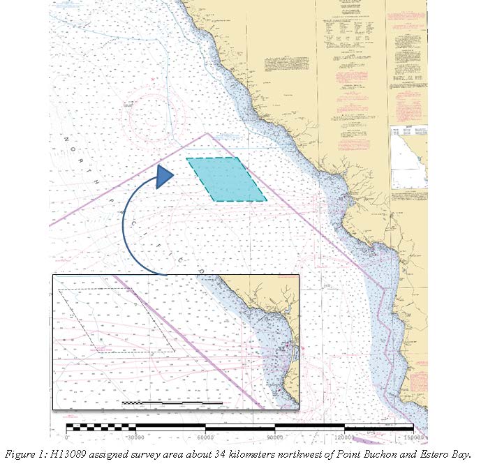
H13089: NOS Hydrographic Survey , 2017-10-05
National Oceanic and Atmospheric Administration, Department of Commerce —
The National Oceanic and Atmospheric Administration (NOAA) has the statutory mandate to collect hydrographic data in support of nautical chart compilation for safe... -
Federal
Port San Luis, California Tsunami Forecast Grids for MOST Model
National Oceanic and Atmospheric Administration, Department of Commerce —
The Port San Luis, California Forecast Model Grids provides bathymetric data strictly for tsunami inundation modeling with the Method of Splitting Tsunami (MOST)... -
Federal
Port San Luis, California Coastal Digital Elevation Model
National Oceanic and Atmospheric Administration, Department of Commerce —
NOAA's National Geophysical Data Center (NGDC) is building high-resolution digital elevation models (DEMs) for select U.S. coastal regions. These integrated... -
Federal
Port San Luis, California 1/3 arc-second MHW Coastal Digital Elevation Model
National Oceanic and Atmospheric Administration, Department of Commerce —
NOAA's National Geophysical Data Center (NGDC) is building high-resolution digital elevation models (DEMs) for select U.S. coastal regions. These integrated... -
Federal
H04044: NOS Hydrographic Survey
National Oceanic and Atmospheric Administration, Department of Commerce —
The National Oceanic and Atmospheric Administration (NOAA) has the statutory mandate to collect hydrographic data in support of nautical chart compilation for safe... -
Federal
Port San Luis, California 1/3 arc-second NAVD 88 Coastal Digital Elevation Model
National Oceanic and Atmospheric Administration, Department of Commerce —
NOAA's National Geophysical Data Center (NGDC) is building high-resolution digital elevation models (DEMs) for select U.S. coastal regions. These integrated... -
Federal
Shoreline Data Rescue Project of Morro Bay, California, CA35A05 NGDA
National Oceanic and Atmospheric Administration, Department of Commerce —
These data were automated to provide an accurate high-resolution historical shoreline of Morro Bay, California suitable as a geographic information system (GIS) data... -
Federal
H09737: NOS Hydrographic Survey , Morro Bay, California, 1978-02-18
National Oceanic and Atmospheric Administration, Department of Commerce —
The National Oceanic and Atmospheric Administration (NOAA) has the statutory mandate to collect hydrographic data in support of nautical chart compilation for safe...
10 datasets found