
-
Federal
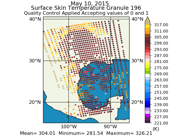
Aqua/AIRS L2 Support Retrieval (AIRS+AMSU) V7.0 at GES DISC
National Aeronautics and Space Administration —
The Atmospheric Infrared Sounder (AIRS) is a grating spectrometer (R = 1200) aboard the second Earth Observing System (EOS) polar-orbiting platform, EOS Aqua. In... -
Federal
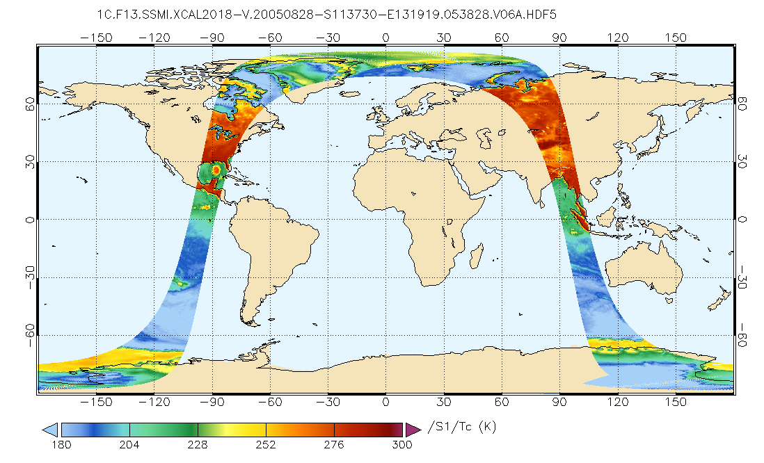
GPM SSMI on F13 Common Calibrated Brightness Temperatures L1C 1.5 hours 13 km V07 (GPM_1CF13SSMI) at GES DISC
National Aeronautics and Space Administration —
All 1C products have a common L1C data structure, simple and generic. Each L1C swath includes scan time, latitude and longitude, scan status, quality, incidence... -
Federal
HURRICANE AND SEVERE STORM SENTINEL (HS3) HURRICANE IMAGING RADIOMETER (HIRAD) V1
National Aeronautics and Space Administration —
The Hurricane and Severe Storm Sentinel (HS3) Hurricane Imaging Radiometer (HIRAD) was collected by the Hurricane Imaging Radiometer (HIRAD), which was a multi-band... -
Federal
BOREAS HYD-02 Estimated Snow Water Equivalent (SWE) from Microwave Measurements
National Aeronautics and Space Administration —
Contains HYD-02 snow water equivalent derived from microwave measurements from aircraft. -
Federal
High Altitude MMIC Sounding Radiometer (HAMSR) EPOCH V1
National Aeronautics and Space Administration —
The High Altitude MMIC Sounding Radiometer (HAMSR) EPOCH dataset includes measurements gathered by the HAMSR instrument during the East Pacific Origins and... -
Federal
GPM GROUND VALIDATION ADVANCED MICROWAVE RADIOMETER RAIN IDENTIFICATION (ADMIRARI) GCPEX V1
National Aeronautics and Space Administration —
The GPM Ground Validation Advanced Microwave Radiometer Rain Identification (ADMIRARI) GCPEx dataset measures brightness temperature at three frequencies (10.7, 21.0... -
Federal
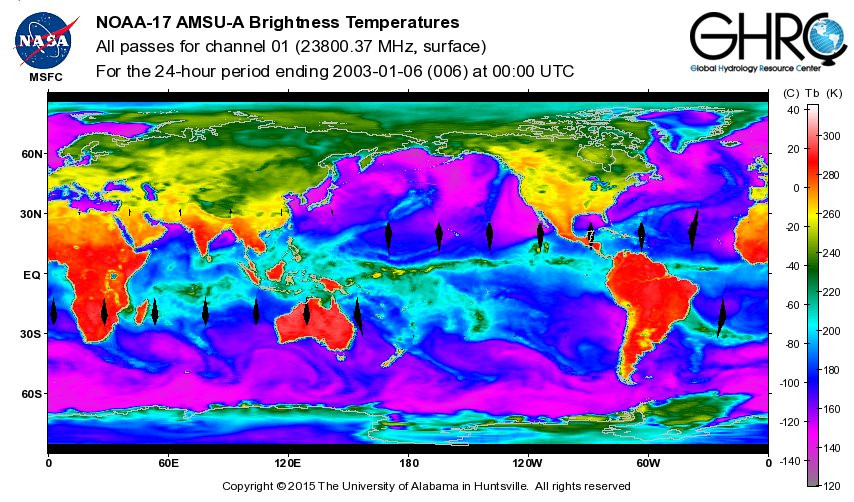
ADVANCED MICROWAVE SOUNDING UNIT-A (AMSU-A) SWATH FROM NOAA-17 V1
National Aeronautics and Space Administration —
AMSU-A, the Advanced Microwave Sounding Unit, is a 15-channel passive microwave radiometer used to profile atmospheric temperature and moisture from the earth's... -
Federal
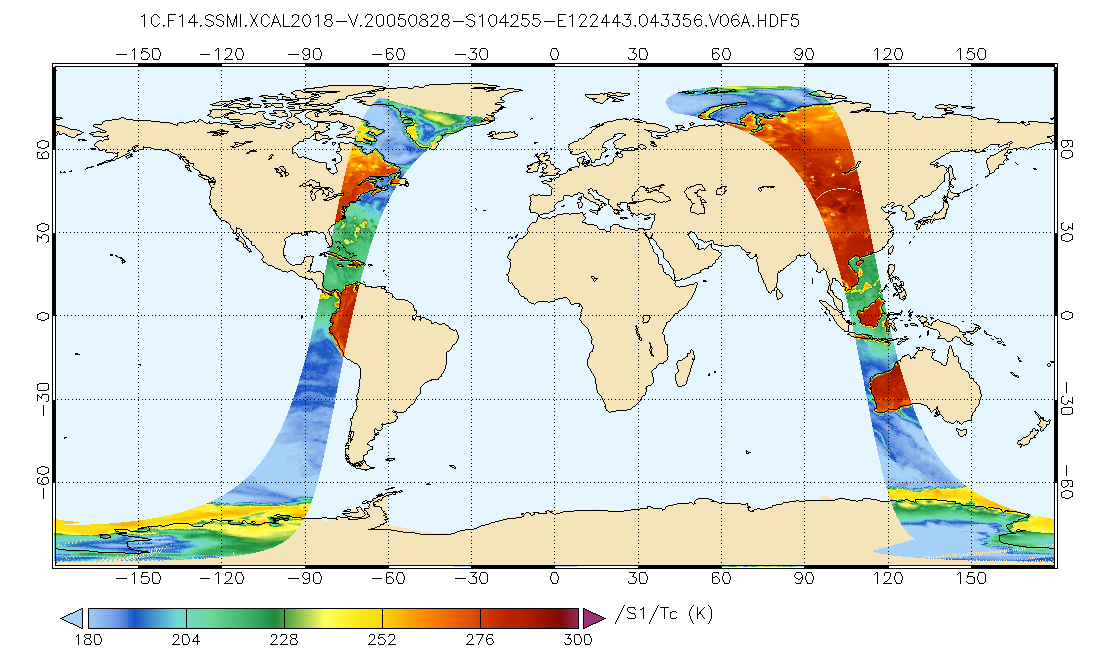
GPM SSMI on F14 Common Calibrated Brightness Temperatures L1C 1.5 hours 13 km V07 (GPM_1CF14SSMI) at GES DISC
National Aeronautics and Space Administration —
All 1C products have a common L1C data structure, simple and generic. Each L1C swath includes scan time, latitude and longitude, scan status, quality, incidence... -
Federal
MLS/Aura Level 2 Diagnostics, Geophysical Parameter Grid V005 (ML2DGG) at GES DISC
National Aeronautics and Space Administration —
ML2DGG is the EOS Aura Microwave Limb Sounder (MLS) product containing geophysical diagnostic quantities pertaining directly to the standard geophysical data... -
Federal
Tropical Ozone Transport Experiment – Vortex Ozone Transport Experiment (TOTE-VOTE) In Situ DC-8 Meteorology and Navigation Data
National Aeronautics and Space Administration —
TOTE-VOTE_MetNav_AircraftInSitu_DC8_Data_1 features the in situ meteorology and navigation data collected onboard the DC-8 aircraft during the Tropical Ozone... -
Federal
First ISCCP Regional Experiment (FIRE) Atlantic Stratocumulus Transition Experiment (ASTEX) SOFIA Le Suroit Microwave Data
National Aeronautics and Space Administration —
The First ISCCP Regional Experiments have been designed to improve data products and cloud/radiation parameterizations used in general circulation models (GCMs).... -
Federal
GPM GROUND VALIDATION SATELLITE SIMULATED ORBITS C3VP V1
National Aeronautics and Space Administration —
The GPM Ground Validation Satellite Simulated Orbits C3VP dataset is available in the Orbital database, which takes account for the atmospheric profiles, the... -
Federal
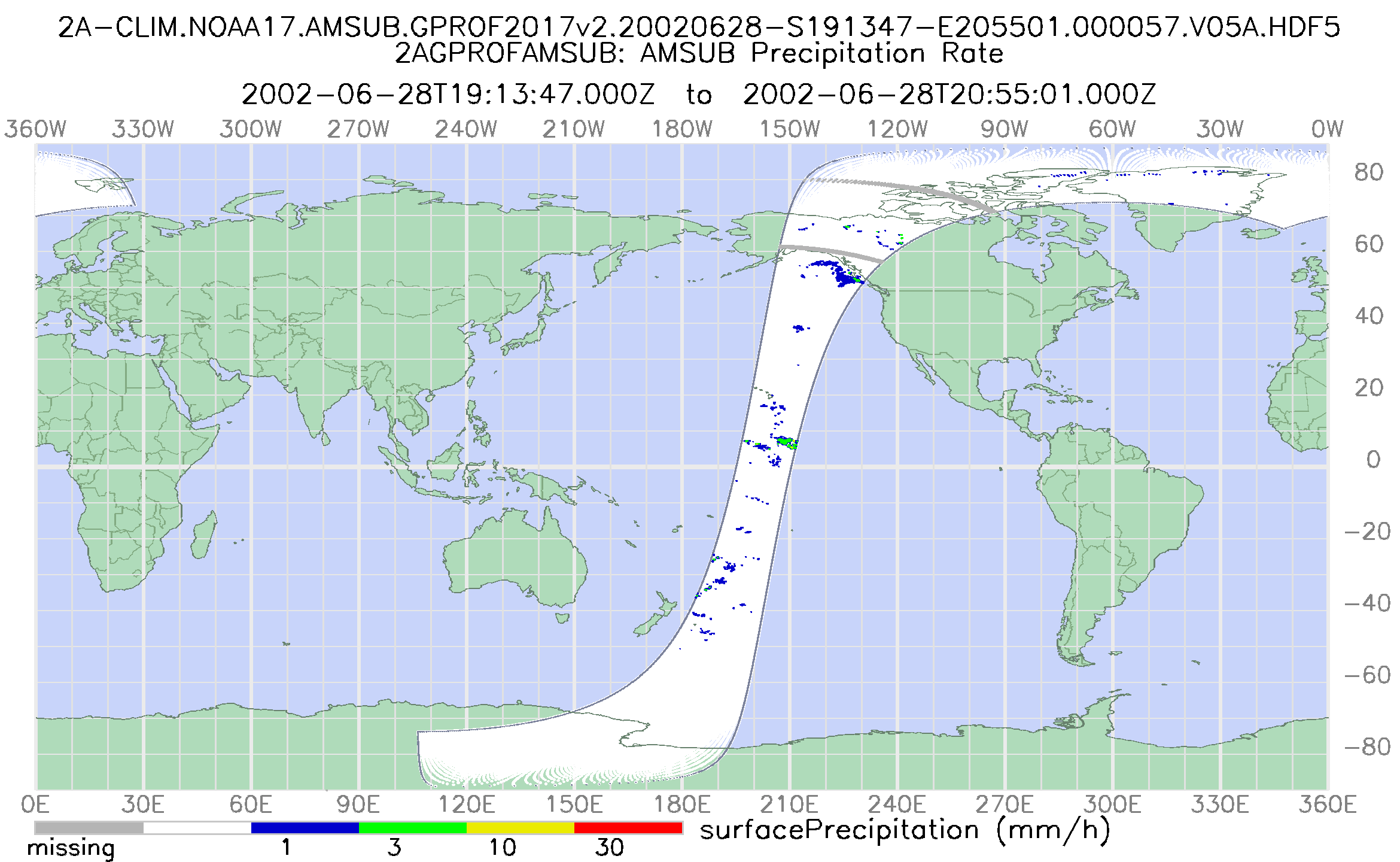
GPM AMSU-B on NOAA17 (GPROF) Climate-based Radiometer Precipitation Profiling L2 1.5 hours 16 km V07 (GPM_2AGPROFNOAA17AMSUB) at GES DISC
National Aeronautics and Space Administration —
Version 07 is the current version of the data set. Older versions will no longer be available and have been superseded by Version 07. The 'CLIM' products differ from... -
Federal
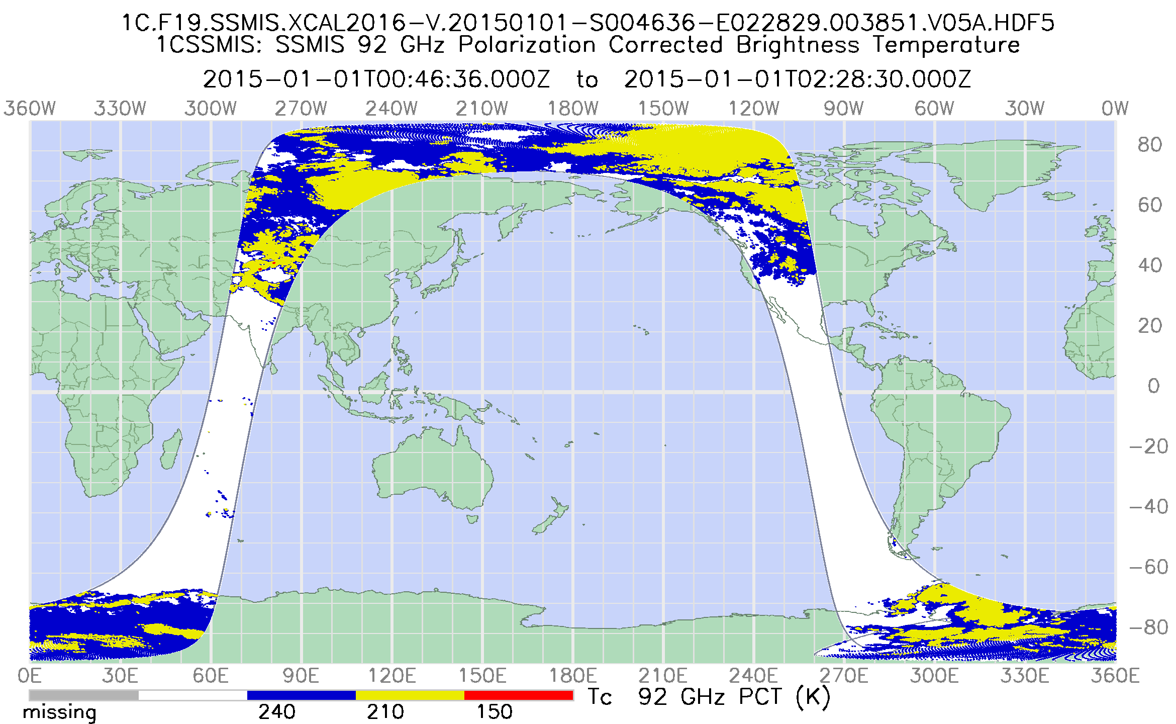
GPM SSMIS on F19 Common Calibrated Brightness Temperatures L1C 1.5 hours 12 km V07 (GPM_1CF19SSMIS) at GES DISC
National Aeronautics and Space Administration —
Version 07 is the current version of the data set. Older versions will no longer be available and have been superseded by Version 07. All 1C products have a common... -
Federal
GRIP HURRICANE IMAGING RADIOMETER (HIRAD) V0
National Aeronautics and Space Administration —
The GRIP Hurricane Imaging Radiometer (HIRAD) dataset was collected by the HIRAD instrument, which is a hurricane imaging, single-polarization passive C-band... -
Federal
GPM GROUND VALIDATION SATELLITE SIMULATED ORBITS LPVEX V1
National Aeronautics and Space Administration —
The GPM Ground Validation Satellite Simulated Orbits LPVEx dataset is available in the Orbital database, which takes account for the atmospheric profiles, the... -
Federal
GPM SSMI on F10 Common Calibrated Brightness Temperatures L1C 1.5 hours 13 km V07 (GPM_1CF10SSMI) at GES DISC
National Aeronautics and Space Administration —
All 1C products have a common L1C data structure, simple and generic. Each L1C swath includes scan time, latitude and longitude, scan status, quality, incidence... -
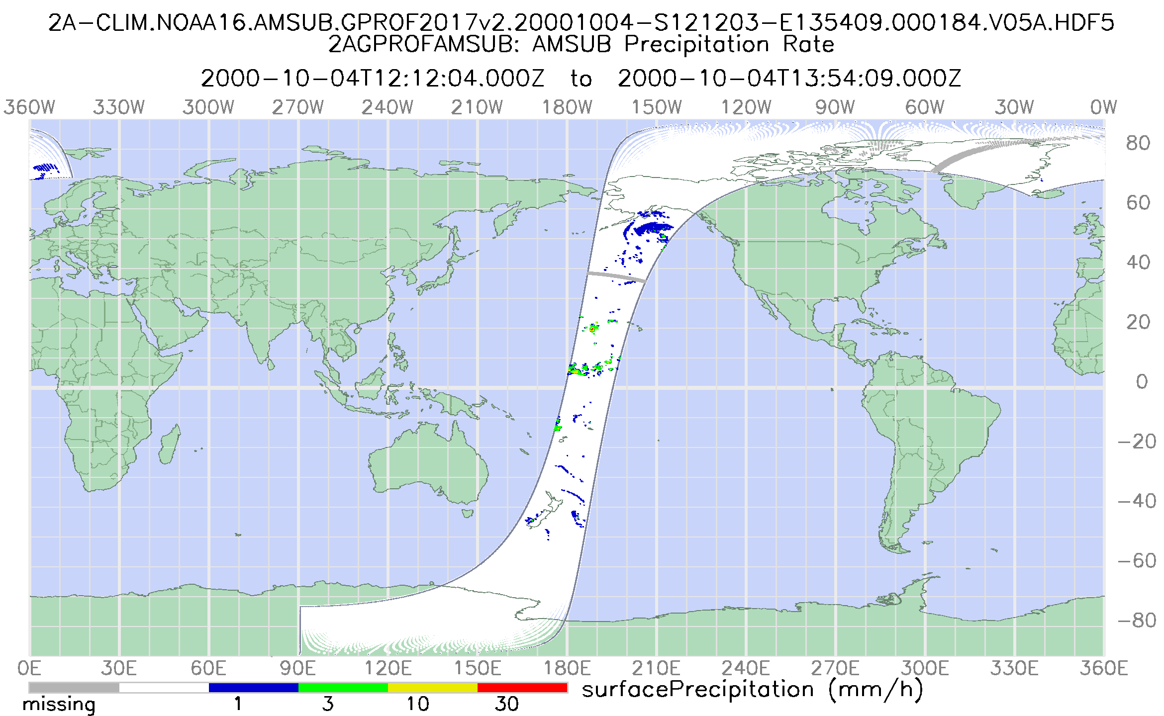
Federal
GPM AMSU-B on NOAA16 (GPROF) Climate-based Radiometer Precipitation Profiling L2 1.5 hours 16 km V07 (GPM_2AGPROFNOAA16AMSUB) at GES DISC
National Aeronautics and Space Administration —
Version 07 is the current version of the data set. Older versions will no longer be available and have been superseded by Version 07. The 'CLIM' products differ from... -
Federal
CLPX-Ground: Ground-based L and Ku band polarimetric scatterometry, Version 1
National Aeronautics and Space Administration —
This data set includes ground-based radar observations carried out at the Fraser Experimental Forest Headquarters, Colorado, USA. -
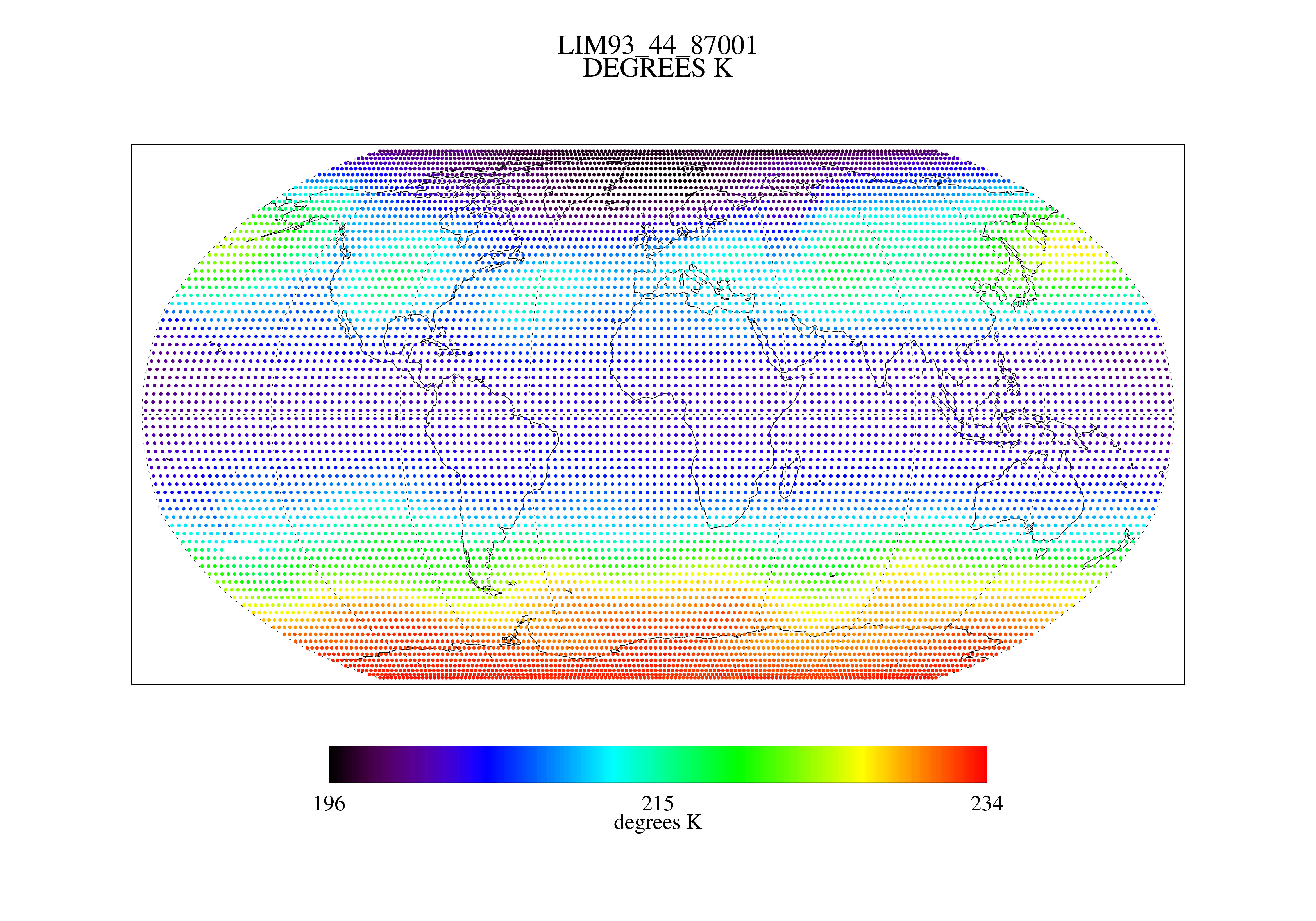
Federal
MSU Ch 4 Daily Lower Stratosphere Temps with Limb93 Correction L3 1 day 2.5 degree x 2.5 degree V001 (MSULST) at GES DISC
National Aeronautics and Space Administration —
The Microwave Sounding Unit (MSU) Lower Stratosphere Deep Layer Mean Temperature product (MSULST) provides gridded lower stratospheric temperatures for each day...

Official websites use .gov
A
.gov website belongs to an official government
organization in the United States.
Secure .gov websites use HTTPS
A
lock (
) or https:// means you’ve safely connected to
the .gov website. Share sensitive information only on official,
secure websites.