
-
Federal
Shoreline Data Rescue Project of Jacksonville, Florida, FL127F01 NGDA
National Oceanic and Atmospheric Administration, Department of Commerce —
These data were automated to provide an accurate high-resolution historical shoreline of Jacksonville, Florida suitable as a geographic information system (GIS) data... -
Federal
F00695: NOS Hydrographic Survey , 2017-08-31
National Oceanic and Atmospheric Administration, Department of Commerce —
The National Oceanic and Atmospheric Administration (NOAA) has the statutory mandate to collect hydrographic data in support of nautical chart compilation for safe... -
Federal
NOAA TIFF Image - 3m Bathymetry Slope, Florida Deep Coral Areas - Lost Coast Explorer - (2010), UTM 17N NAD83
National Oceanic and Atmospheric Administration, Department of Commerce —
This dataset contains a unified GeoTiff with 3x3 meter cell size representing the slope (in degrees) of several deep coral priority areas off the Atlantic Coast of... -
Federal
H06296: NOS Hydrographic Survey , 1939-12-31
National Oceanic and Atmospheric Administration, Department of Commerce —
The National Oceanic and Atmospheric Administration (NOAA) has the statutory mandate to collect hydrographic data in support of nautical chart compilation for safe... -
Federal
H12408: NOS Hydrographic Survey , 2013-09-26
National Oceanic and Atmospheric Administration, Department of Commerce —
The National Oceanic and Atmospheric Administration (NOAA) has the statutory mandate to collect hydrographic data in support of nautical chart compilation for safe... -
Federal
NOAA TIFF Image - 3m Bathymetric Rugosity, Florida Deep Coral Areas - Lost Coast Explorer - (2011), UTM 17N NAD83
National Oceanic and Atmospheric Administration, Department of Commerce —
This dataset contains a unified GeoTiff with 3x3 meter cell size representing the rugosity of several deep coral priority areas off the Atlantic Coast of Florida,... -
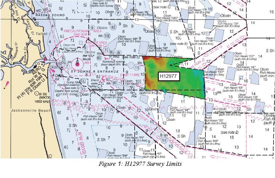
Federal
H12977: NOS Hydrographic Survey , 2017-09-05
National Oceanic and Atmospheric Administration, Department of Commerce —
The National Oceanic and Atmospheric Administration (NOAA) has the statutory mandate to collect hydrographic data in support of nautical chart compilation for safe... -
Federal
H12407: NOS Hydrographic Survey , St. Johns River, Florida, 2012-10-02
National Oceanic and Atmospheric Administration, Department of Commerce —
The National Oceanic and Atmospheric Administration (NOAA) has the statutory mandate to collect hydrographic data in support of nautical chart compilation for safe... -
Federal
NOAA TIFF Image - 3m Backscatter Mosaic, Florida Deep Coral Areas - Lost Coast Explorer - (2010), UTM 17N NAD83
National Oceanic and Atmospheric Administration, Department of Commerce —
This dataset contains a unified GeoTiff with 3x3 meter cell size representing the backscatter (intensity) of several deep coral priority areas off the Atlantic Coast... -
Federal
Shoreline Mapping Program of Jacksonville, St. Johns River, FL, FL02A NGDA
National Oceanic and Atmospheric Administration, Department of Commerce —
These data provide an accurate high-resolution shoreline compiled from imagery of Jacksonville, St. Johns River, FL . This vector shoreline data is based on an office... -
Federal
NOAA TIFF Image - 3m Bathymetry, Florida Deep Coral Areas (Jacksonville) - Lost Coast Explorer - (2010), UTM 17N NAD83
National Oceanic and Atmospheric Administration, Department of Commerce —
This dataset contains a unified GeoTiff with 3x3 meter cell size representing bathymetry of several deep coral priority areas off the Atlantic Coast of Florida,... -
Federal
Shoreline Data Rescue Project of Jacksonville, FL, EC17A04 NGDA
National Oceanic and Atmospheric Administration, Department of Commerce —
These data were automated to provide an accurate high-resolution historical shoreline of Jacksonville, FL suitable as a geographic information system (GIS) data... -
Federal
H12984: NOS Hydrographic Survey , 2017-10-15
National Oceanic and Atmospheric Administration, Department of Commerce —
The National Oceanic and Atmospheric Administration (NOAA) has the statutory mandate to collect hydrographic data in support of nautical chart compilation for safe... -
Federal
H12978: NOS Hydrographic Survey , 2017-11-01
National Oceanic and Atmospheric Administration, Department of Commerce —
The National Oceanic and Atmospheric Administration (NOAA) has the statutory mandate to collect hydrographic data in support of nautical chart compilation for safe... -
Federal
NOAA TIFF Image - 3m Bathymetry Slope, Florida Deep Coral Areas - Lost Coast Explorer - (2010), UTM 17N NAD83
National Oceanic and Atmospheric Administration, Department of Commerce —
This dataset contains a unified GeoTiff with 3x3 meter cell size representing bathymetry of several deep coral priority areas off the Atlantic Coast of Florida,... -
Federal
NOAA TIFF Image - 3m Bathymetry Slope, Florida Deep Coral Areas (Jacksonville) - Lost Coast Explorer - (2010), UTM 17N NAD83
National Oceanic and Atmospheric Administration, Department of Commerce —
This dataset contains a unified GeoTiff with 3x3 meter cell size representing the slope (in degrees) of several deep coral priority areas off the Atlantic Coast of... -
Federal
NOAA TIFF Image - 3m Bathymetric Rugosity, Florida Deep Coral Areas (Jacksonville) - Lost Coast Explorer - (2011), UTM 17N NAD83
National Oceanic and Atmospheric Administration, Department of Commerce —
This dataset contains a unified GeoTiff with 3x3 meter cell size representing the rugosity of several deep coral priority areas off the Atlantic Coast of Florida,... -
Federal
Timucuan Ecological and Historic Preserve Salt Marsh Classification
Department of the Interior —
Loss of salt marsh habitat at Timucuan Ecological and Historic Preserve (TIMU) due to sea level rise has been identified by park staff as a concern. The purpose of... -
Federal
Baseline coastal oblique aerial photographs collected from Key Largo, Florida, to the Florida/Georgia border, September 5-6, 2014
Department of the Interior —
The U.S. Geological Survey (USGS) conducts baseline and storm response photography missions to document and understand the changes in vulnerability of the Nation's... -
Federal
H09882: NOS Hydrographic Survey , Vicinity of Jacksonville, North Carolina, 1980-05-21
National Oceanic and Atmospheric Administration, Department of Commerce —
The National Oceanic and Atmospheric Administration (NOAA) has the statutory mandate to collect hydrographic data in support of nautical chart compilation for safe...

Official websites use .gov
A
.gov website belongs to an official government
organization in the United States.
Secure .gov websites use HTTPS
A
lock (
) or https:// means you’ve safely connected to
the .gov website. Share sensitive information only on official,
secure websites.