
-
Federal
Spectral Reflectance and Ancillary Data, Tundra Transect, North Slope, AK, 2000-2022
National Aeronautics and Space Administration —
This dataset provides visible-near infrared spectral reflectance, descriptions of vegetation cover, surface temperature, the total fraction of absorbed... -
Federal
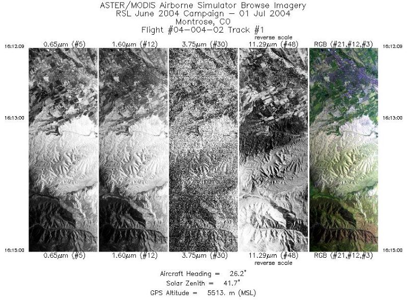
MASTER: Geological substrate mapping, Utah-Colorado, June, 2004
National Aeronautics and Space Administration —
This dataset includes Level 1B (L1B) data products from the MODIS/ASTER Airborne Simulator (MASTER) instrument. The spectral data were collected during two flights... -
Federal
MASTER: HyspIRI Airborne Campaign, California, Spring 2015
National Aeronautics and Space Administration —
This dataset includes Level 1B (L1B) and Level 2 (L2) data products from the MODIS/ASTER Airborne Simulator (MASTER) instrument. The spectral data were collected as... -
Federal
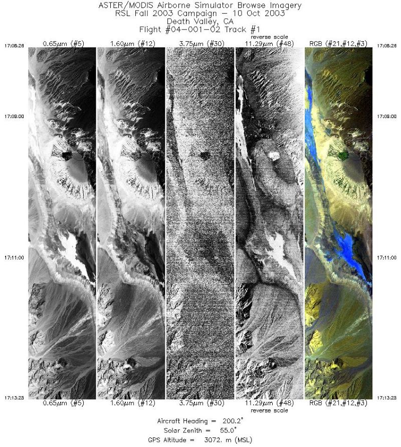
MASTER: Geological fault mapping, California-Nevada, October, 2003
National Aeronautics and Space Administration —
This dataset includes Level 1B (L1B) data products from the MODIS/ASTER Airborne Simulator (MASTER) instrument. The spectral data were collected during six flights... -
Federal
MASTER: FIREX-AQ Airborne Campaign, Western-Central USA, Summer 2019
National Aeronautics and Space Administration —
This dataset includes Level 1B (L1B) and Level 2 (L2) data products from the MODIS/ASTER Airborne Simulator (MASTER) instrument. The spectral data were collected as... -
Federal
AVIRIS-NG L1B Calibrated Radiance, Facility Instrument Collection, V1
National Aeronautics and Space Administration —
This dataset contains Level 1B (L1B) orthocorrected, scaled radiance image files as well as files of observational geometry and illumination parameters and supporting... -
Federal
BOREAS RSS-14 GOES-7 Level-1a Visible, Infrared, and Water Vapor Images
National Aeronautics and Space Administration —
The level-1a BOREAS GOES-7 image data was collected by Remote Sensing Science Team-14 (RSS-14) personnel at Florida State University and processed to level-1a... -
Federal
MASTER: Costa Rica Airborne Research and Technology Applications (CARTA), 2005
National Aeronautics and Space Administration —
This dataset includes Level 1B (L1B) data products from the MODIS/ASTER Airborne Simulator (MASTER) instrument. The spectral data were collected during 23 flights... -
Federal
BOREAS Daedalus TMS Level-0 Imagery: Digital Counts in BIL Format
National Aeronautics and Space Administration —
The level-0 Daedalus TMS imagery, along with the other remotely sensed images, was collected to provide spatially extensive information about radiant energy over the... -
Federal
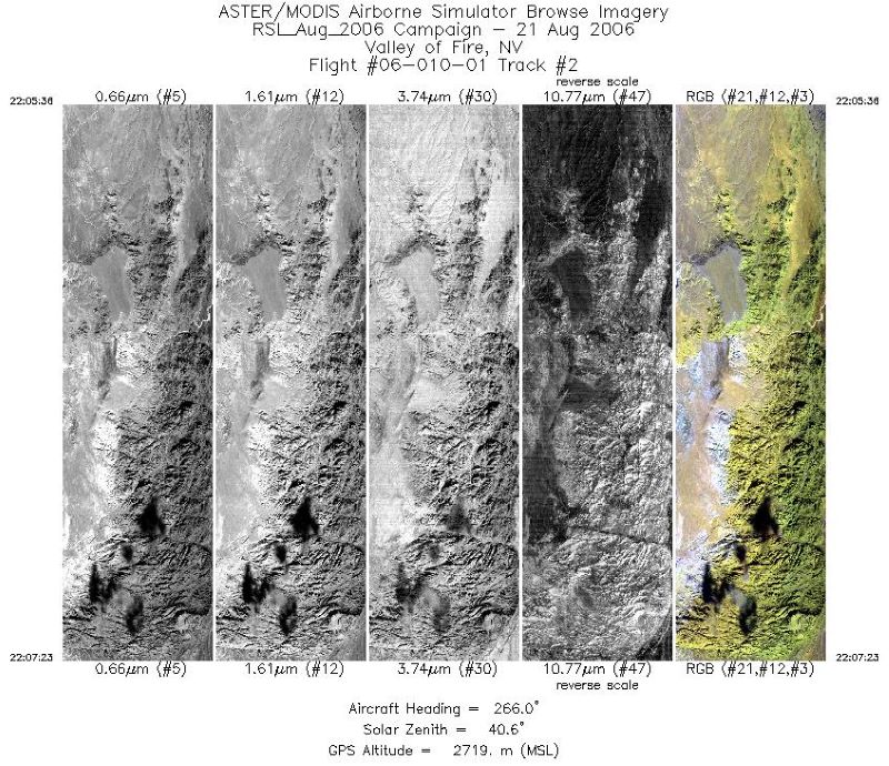
MASTER: Airborne Science, Southwest US, August 2006
National Aeronautics and Space Administration —
This dataset includes Level 1B (L1B) data products from the MODIS/ASTER Airborne Simulator (MASTER) instrument. The spectral data were collected during 18 flights... -
Federal
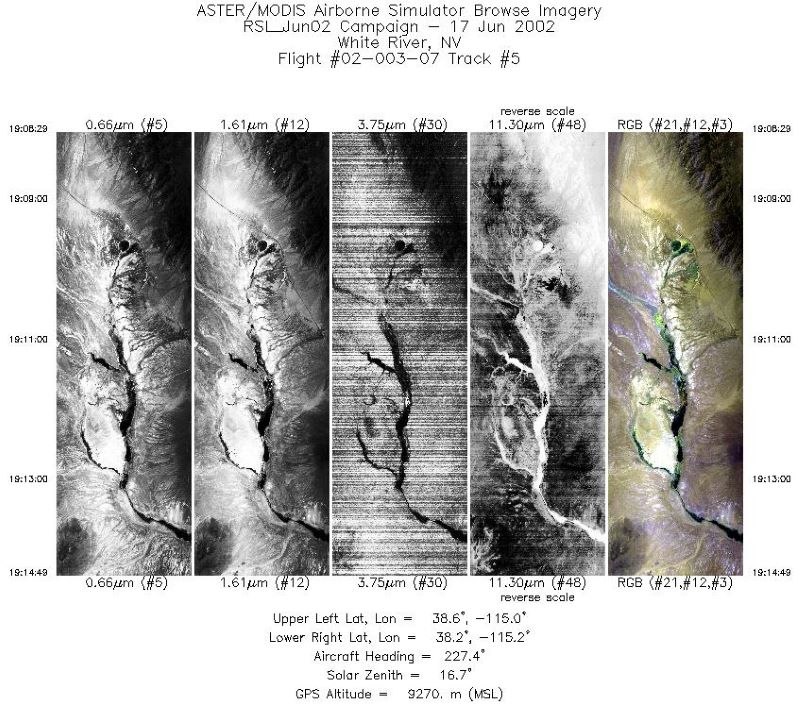
MASTER: Airborne Science, California-Nevada-Utah, June, 2002
National Aeronautics and Space Administration —
This dataset includes Level 1B (L1B) data products from the MODIS/ASTER Airborne Simulator (MASTER) instrument. The spectral data were collected during seven flights... -
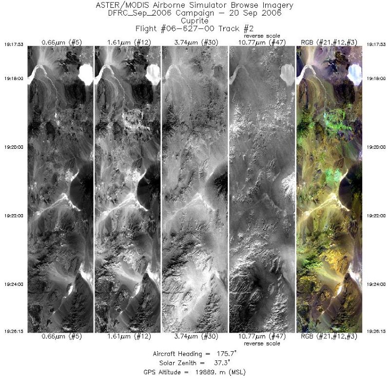
Federal
MASTER: Airborne Science, Western US, September, 2006
National Aeronautics and Space Administration —
This dataset includes Level 1B (L1B) and Level 2 (L2) data products from the MODIS/ASTER Airborne Simulator (MASTER) instrument. The spectral data were collected... -
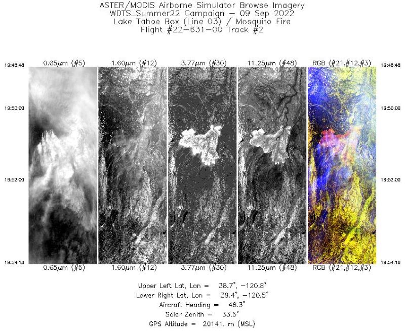
Federal
MASTER: Western Diversity Time Series Campaign, WDTS, September 2022
National Aeronautics and Space Administration —
This dataset includes Level 1B (L1B) and Level 2 (L2) data products from the MODIS/ASTER Airborne Simulator (MASTER) instrument. The spectral data were collected as... -
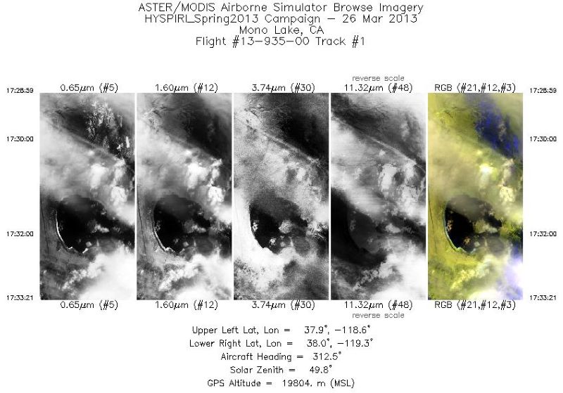
Federal
MASTER: HyspIRI Airborne Campaign, California, Early Spring 2013, V2
National Aeronautics and Space Administration —
This dataset includes Level 1B (L1B) and Level 2 (L2) data products from the MODIS/ASTER Airborne Simulator (MASTER) instrument. The spectral data were collected as... -
Federal
SHIFT: HyTES L1 Brightness Temperature, March 23 2022
National Aeronautics and Space Administration —
This dataset holds Level 1 (L1) brightness temperature data collected by the Hyperspectral Thermal Emission Spectrometer (HyTES) instrument. This imagery was acquired... -
Federal
MASTER: BP Oil Spill Mapping, Louisiana-Gulf of Mexico-Wisconsin, Fall, 2010
National Aeronautics and Space Administration —
This dataset includes Level 1B (L1B) and Level 2 (L2) data products from the MODIS/ASTER Airborne Simulator (MASTER) instrument. The raw data were collected during 9... -
Federal
MASTER: Student Airborne Research Program (SARP) Campaign, California, 2009
National Aeronautics and Space Administration —
This dataset includes Level 1B (L1B) data products from the MODIS/ASTER Airborne Simulator (MASTER) instrument collected and developed by the Student Airborne... -
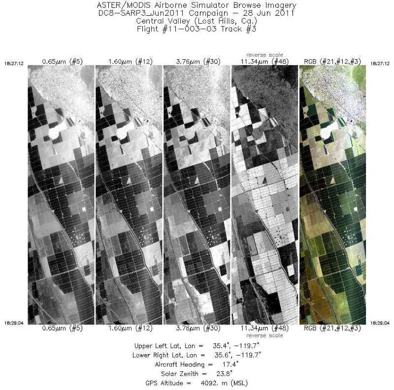
Federal
MASTER: Student Airborne Research Program (SARP) Campaign, California, 2011
National Aeronautics and Space Administration —
This dataset includes Level 1B (L1B) data products from the MODIS/ASTER Airborne Simulator (MASTER) instrument collected and developed by the Student Airborne...

Official websites use .gov
A
.gov website belongs to an official government
organization in the United States.
Secure .gov websites use HTTPS
A
lock (
) or https:// means you’ve safely connected to
the .gov website. Share sensitive information only on official,
secure websites.