

4 datasets found
-
State
Reconnaissance geologic maps and sample data, Teller A-1, A-2, A-3, B-1, B-2, B-3, C-1, and Bendeleben A-6, B-6, C-6, D-5, D-6 quadrangles, Seward Peninsula, Alaska
State of Alaska —
Reconnaissance geologic maps and sample data, Teller A-1, A-2, A-3, B-1, B-2, B-3, C-1, and Bendeleben A-6, B-6, C-6, D-5, D-6 quadrangles, Seward Peninsula, Alaska,... -
State
Bedrock geologic map of the Kigluaik Mountains, Seward Peninsula, Alaska
State of Alaska —
Bedrock geologic map of the Kigluaik Mountains, Seward Peninsula, Alaska, Public Data File 97-31, presents a 1:63,360-scale bedrock geologic map of parts of the... -
Federal
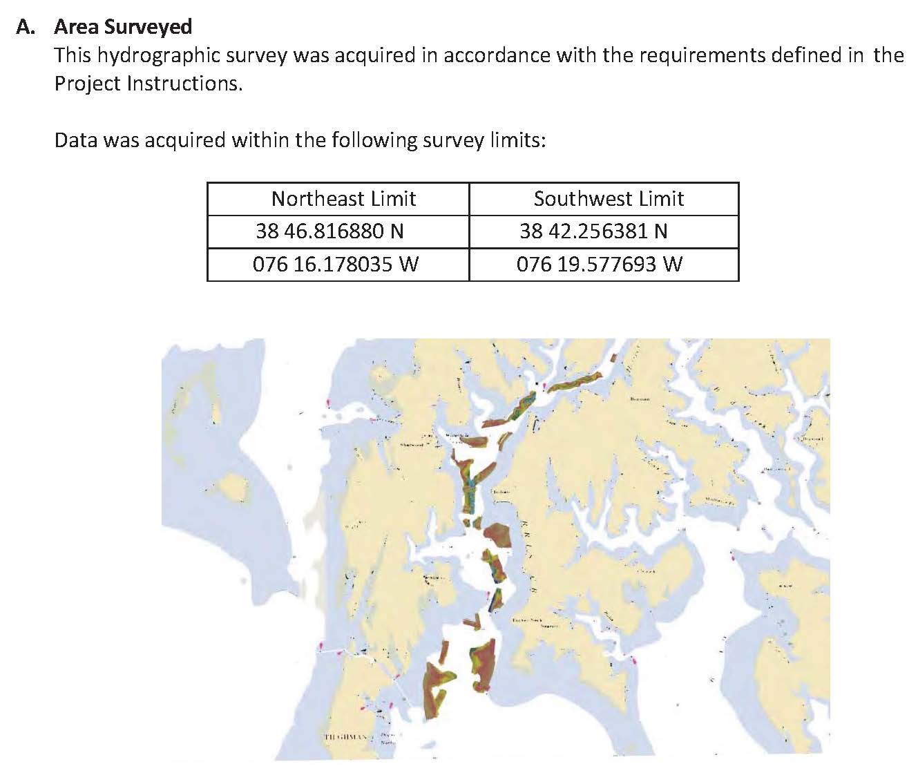
W00322: NOS Hydrographic Survey , 2015-12-14
National Oceanic and Atmospheric Administration, Department of Commerce —
The National Oceanic and Atmospheric Administration (NOAA) has the statutory mandate to collect hydrographic data in support of nautical chart compilation for safe... -
Federal
H02622: NOS Hydrographic Survey
National Oceanic and Atmospheric Administration, Department of Commerce —
The National Oceanic and Atmospheric Administration (NOAA) has the statutory mandate to collect hydrographic data in support of nautical chart compilation for safe...
4 datasets found