

10 datasets found
-
Federal
High Resolution Orthoimagery Collection – Historical NGDA
Department of the Interior —
'High resolution orthorectified images combine the image characteristics of an aerial photograph with the geometric qualities of a map. An orthoimage is a uniform-... -
Federal
Georeferenced Scans of National Oceanic and Atmospheric Administration (NOAA) T-Sheets Collected Along the New Jersey Coastline from 1839-1875
Department of the Interior —
Historical shoreline surveys were conducted by the National Ocean Service (NOS), dating back to the early 1800s. The maps resulting from these surveys, often called... -
Federal
Shapefile of Historical New Jersey Shoreline Data Derived from National Oceanic and Atmospheric Administration (NOAA) 1839-1875 T-Sheets
Department of the Interior —
Historical shoreline surveys were conducted by the National Ocean Service (NOS), dating back to the early 1800s. The maps resulting from these surveys, often called... -
Federal
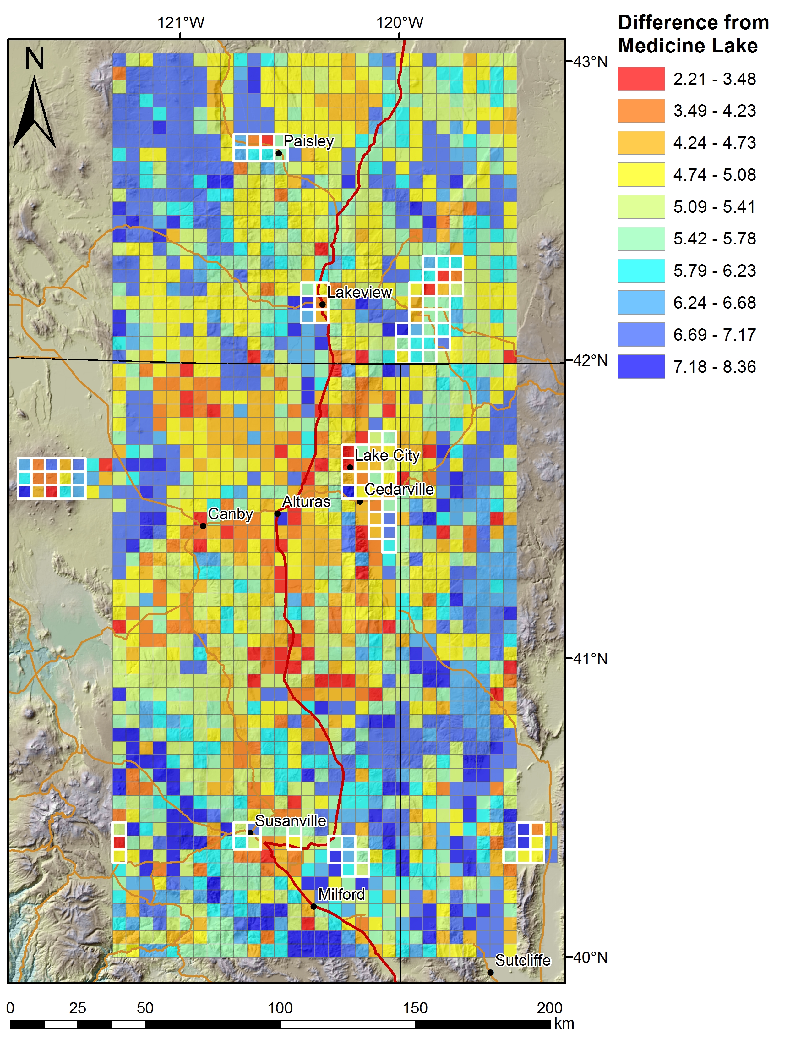
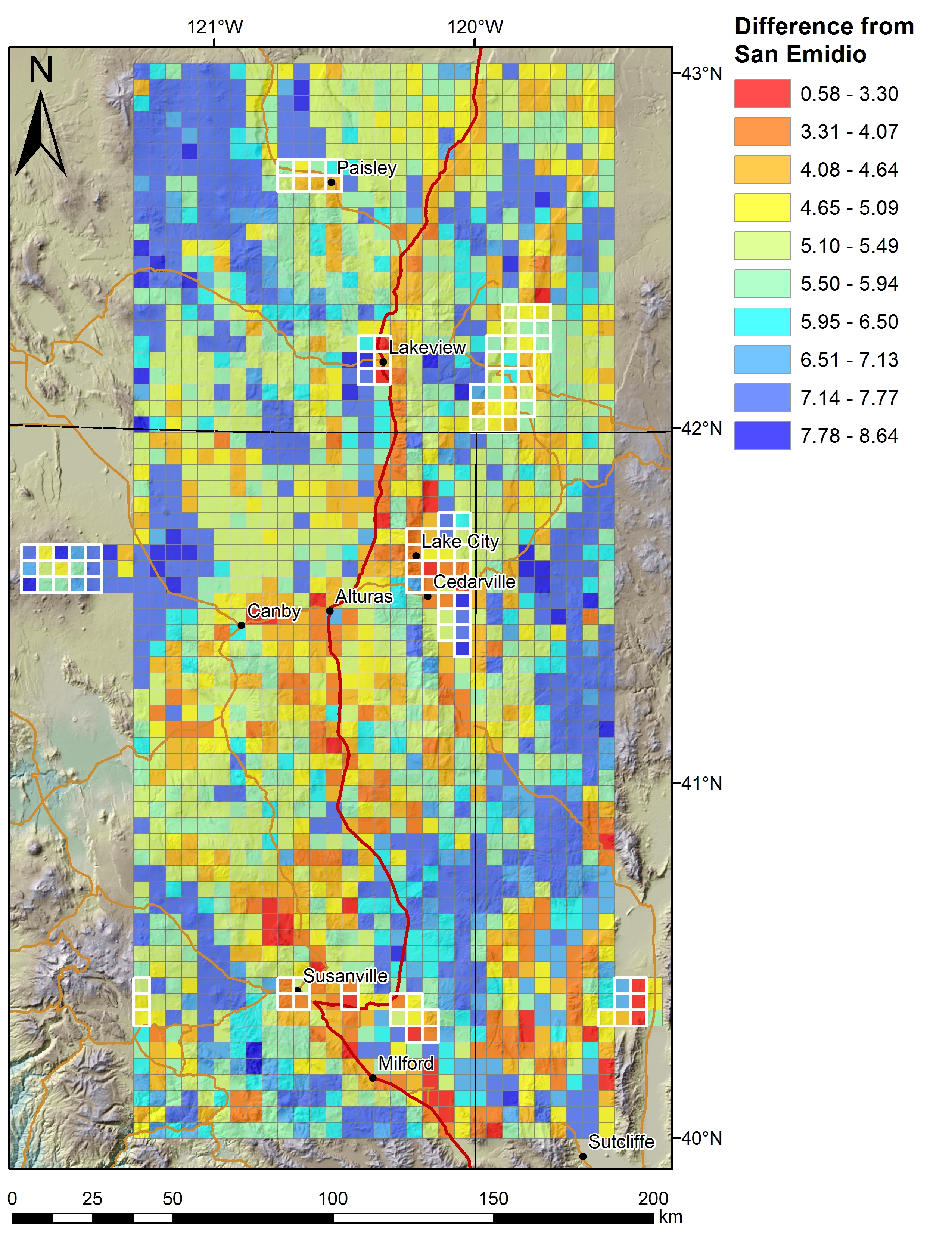
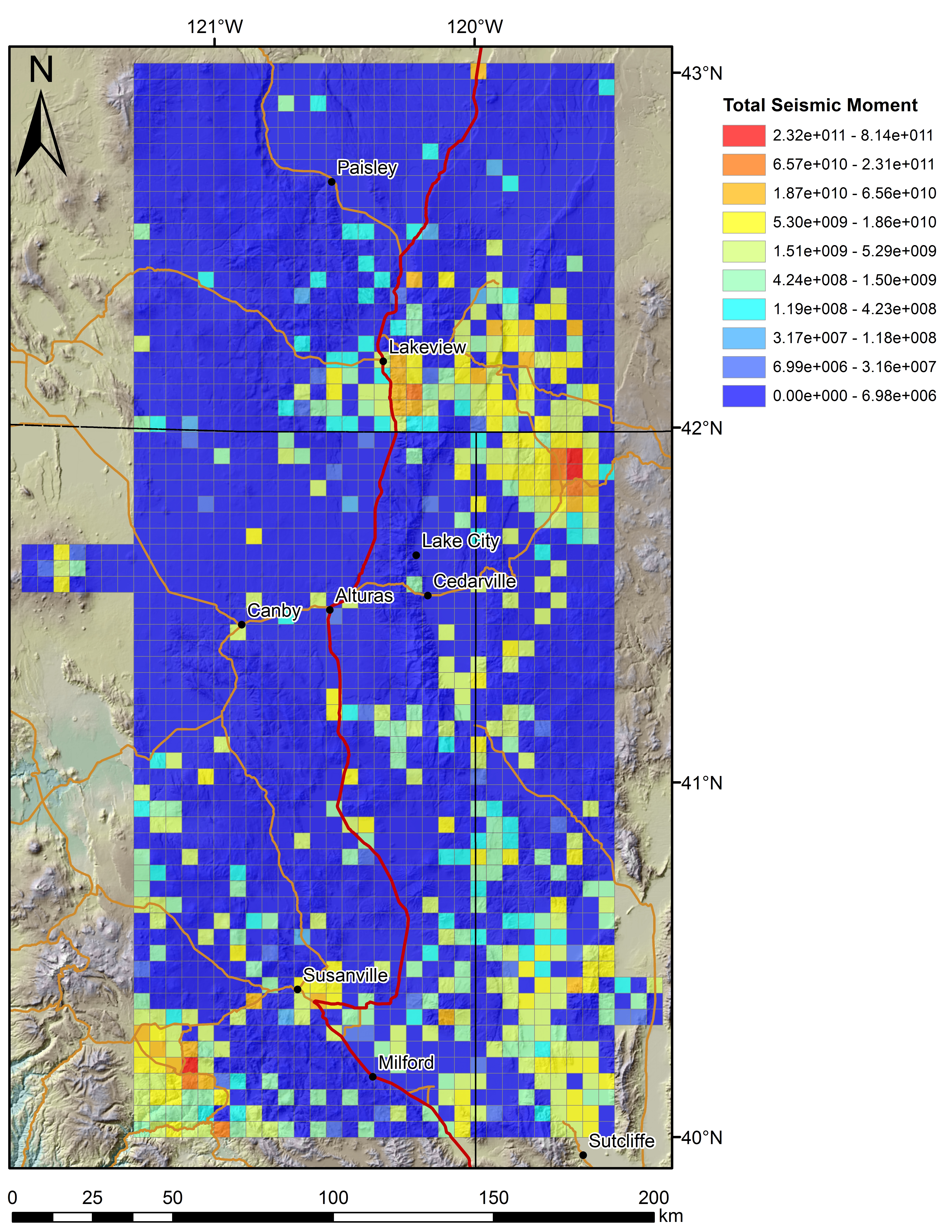
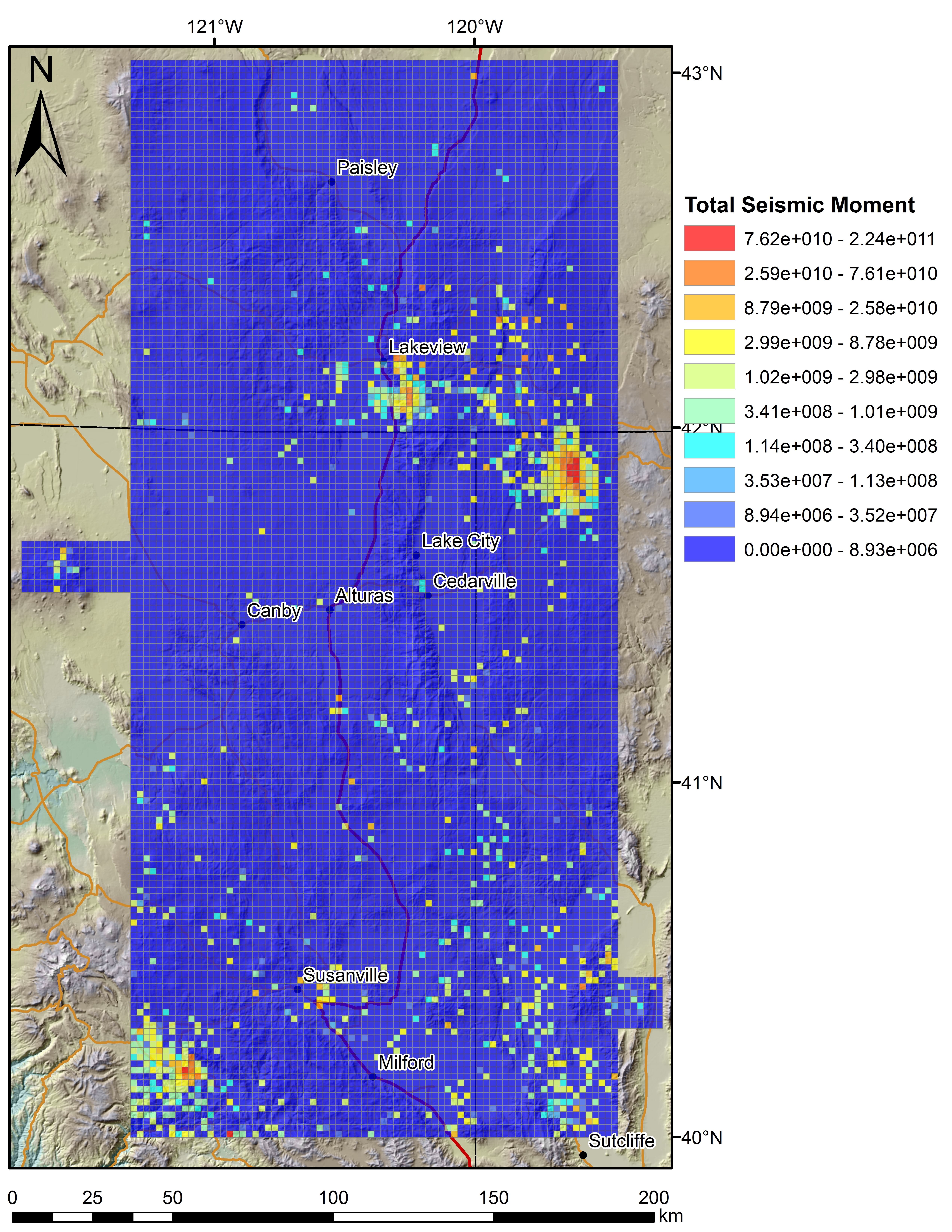
Play Fairway Analysis CA-NV-OR: Additional 2km Grid Figures
Department of Energy —
Various data sets displayed on a 2km grid for the Play Fairway Analysis CA-NV-OR area. Grids at 2km, updated from 5km. -
Federal
Shapefile of Historical Bathymetric Soundings for Mississippi and Alabama Derived from National Ocean Service (NOS) Hydrographic Sheets
Department of the Interior —
Hydrographic sheets (H-sheets) and nautical charts produced by the National Ocean Service (NOS) during the 1800s provide historic sounding (water depth) measurements... -
Federal
Georeferenced National Ocean Service (NOS) Hydrographic Sheets for Grand Bay, Mississippi, and Surrounding Areas
Department of the Interior —
Hydrographic sheets (H-sheets) and nautical charts produced by the National Ocean Service (NOS) during the 1800s provide historic sounding (water depth) measurements... -
Federal
Shapefile of Historical shorelines for Fire Island and Great South Bay, New York, derived from previously unpublished National Oceanic and Atmospheric Administration (NOAA) 1834-1875 topographic sheets
Department of the Interior —
Topographic sheets (t-sheets) produced by the National Ocean Service (NOS) during the 1800s provide the position of past shorelines. The shoreline data can be... -
Federal
Grid File of Historical Bathymetric Soundings for Mississippi and Alabama Derived from National Ocean Service (NOS) Hydrographic Sheets
Department of the Interior —
Hydrographic sheets (H-sheets) and nautical charts produced by the National Ocean Service (NOS) during the 1800s provide historic sounding (water depth) measurements... -
Federal
Play Fairway Analysis CA-NV-OR: Figures on 2km Grids
Department of Energy —
Various data sets displayed on a 2km grid for the Play Fairway Analysis CA-NV-OR area. -
Federal
Georeferenced scans of National Oceanic and Atmospheric Administration (NOAA) topographic sheets (T-Sheets) Collected Along the Fire Island and Great South Bay, New York, Coastline from 1834-1875
Department of the Interior —
Topographic sheets (t-sheets) produced by the National Ocean Service (NOS) during the 1800s provide the position of past shorelines. The shoreline data can be...
10 datasets found