

6 datasets found
-
Federal
Estuarine Salinity Zones in US East Coast, Gulf of Mexico, and US West Coast from 1999-01-01 to 1999-12-31 (NCEI Accession 0127396)
National Oceanic and Atmospheric Administration, Department of Commerce —
These unprojected (geographic coordinates) 3-Zone Average Annual Salinity Digital Geographies are based on analysis of long-term salinity data for 147 estuaries of... -
Federal
Shoreline Data Rescue Project of Barnegat Bay, NJ, NJ1935B NGDA
National Oceanic and Atmospheric Administration, Department of Commerce —
These data were automated to provide an accurate high-resolution historical shoreline of Barnegat Bay, NJ suitable as a geographic information system (GIS) data... -
Federal
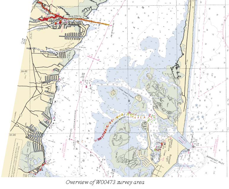
W00473: NOS Hydrographic Survey , 2018-01-17
National Oceanic and Atmospheric Administration, Department of Commerce —
The National Oceanic and Atmospheric Administration (NOAA) has the statutory mandate to collect hydrographic data in support of nautical chart compilation for safe... -
Federal
Shoreline Data Rescue Project of Barnegat Bay, New Jersey, NJ1932A NGDA
National Oceanic and Atmospheric Administration, Department of Commerce —
These data were automated to provide an accurate high-resolution historical shoreline of Barnegat Bay, New Jersey suitable as a geographic information system (GIS)... -
Federal
Barnegat Bay, NJ (M070) Bathymetric Digital Elevation Model (30 meter resolution) Derived From Source Hydrographic Survey Soundings Collected by NOAA
National Oceanic and Atmospheric Administration, Department of Commerce —
Bathymetry for Barnegat Bay was derived from six surveys containing 74,448 soundings. No surveys were deleted. The average separation between soundings was 49 meters.... -
Federal
Shoreline Data Rescue Project of Barnegat Bay, NJ, PH72A NGDA
National Oceanic and Atmospheric Administration, Department of Commerce —
These data were automated to provide an accurate high-resolution historical shoreline of Barnegat Bay, NJ suitable as a geographic information system (GIS) data...
6 datasets found