

58 datasets found
-
Federal
2017 Western Passage Tidal Energy Resource Characterization Measurements
Department of Energy —
These data are from tidal resource characterization measurements collected between April and July 2017 in Western Passage near Eastport, Maine, USA. The dataset... -
Federal
Tidal Energy Resource Characterization, Velocity and Turbulence Measurements, Processed Data, Cook Inlet, AK, 2021
Department of Energy —
This submission contains processed datasets from a long-term deployment of 3 moorings and a transect survey of the proposed tidal energy site off the East Forelands... -
Federal
Kvichak River RISEC Project Resource Reconnaissance and Physical Characterization, Igiugig, AK
Department of Energy —
During the summer and fall of 2011 TerraSond Ltd. (TerraSond) completed a bathymetric survey and hydrokinetic energy assessment of the Kvichak River at Igiugig,... -
Federal
Observation-Based Resource Assessment of Gulf Stream MHK
Department of Energy —
Multi-year measurements of current velocity, salinity, and temperature from fixed and vessel-mounted sensors quantify Gulf Stream (GS) MHK resource variability and... -
Federal
Velocity and Turbulence Measurements at Three Locations in the Salish Sea, WA, 2017
Department of Energy —
This submission contains raw and processed datasets of water velocity and turbulence measurements from 3-day deployments of Deepwater Buoyancy StableMoor buoys... -
Federal
Tidal Energy Resource Characterization, Bottom Lander Measurements, Cook Inlet, AK, 2021
Department of Energy —
These datasets are from tidal resource characterization measurements collected on the Terrasond High Energy Oceanographic Mooring (THEOM) from 1 July 2021 to 30... -
Federal
ADCP Acoustic Interference Survey Data, Sequim Bay Inlet, WA
Department of Energy —
Raw ADCP (Acoustic Doppler Current Profiler) datasets from acoustic interference surveys with a TRDI Workhorse 300, a Nortek Signature500 and two Signature1000... -
Federal
Processed ADCP Current Depth Profiles, Flow Classification, and Power Law Parameters at Tidal Energy Sites
Department of Energy —
This dataset contains processed acoustic Doppler current profiler (ADCP) measurements from twenty energetic tidal energy sites in the United States, Scotland, and New... -
Federal
Bathymetry raster of Old Erie Canal
Department of the Interior —
The Old Erie Canal has undergone sedimentation and aquatic growth that have restricted flow and diminished the aesthetic quality of the canal during the nearly 200... -
Federal
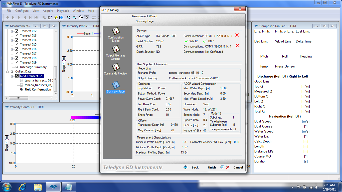
Tanana River Transects September 2010
Department of Energy —
As part of the initial site investigation for the Tanana River near Nenana, Alaska, a set of transects was completed on September 23rd, 2010. Similar to the one done... -
Federal
Velocity mapping in the tailwater of Kentucky Dam (Tennessee River) near Gilbertsville, Kentucky, September 12 and 17–18, 2020
Department of the Interior —
Water velocities were measured at discrete cross-sections along an approximately 1-mile reach of the Kentucky Dam tailwater on September 12 and 17-18, 2020, using a... -
Federal
Velocity and water-quality surveys in the Ohio River between Markland Locks and Dam and McAlpine Locks and Dam, Kentucky and Indiana, October 27–November 4, 2016, and June 26–29, 2017
Department of the Interior —
Velocity and water-quality surveys were completed along an approximately 71-mile reach of the Ohio River between Markland Locks and Dam (river mile 531.5) and... -
Federal
UNH TDP - ADCP Raw Data and Processing Scripts - Fall 2021
Department of Energy —
This submission contains raw Acoustic Doppler Current Profiler (ADCP) data and processing scripts associated with MHKDR submission 394 (UNH TDP - Concurrent... -
Federal
Hydrokinetic Canal Measurements: Inflow Velocity, Wake Flow Velocity, and Turbulence
Department of Energy —
The dataset consist of acoustic Doppler current profiler (ADCP) velocity measurements in the wake of a 3-meter diameter vertical-axis hydrokinetic turbine deployed in... -
Federal
ADCP Data in Support of Water and Suspended-Sediment Flux Measurements at the Golden Gate, 2016-2017
Department of the Interior —
Field observations of water and suspended-sediment fluxes at the Golden Gate were made over one ebb tide and one flood tide on three occasions: 1) 21-22 March 2016,... -
Federal
Field measurements of flow velocity acquired during a tracer experiment on the Missouri River near Lexington, MO, on May 11, 2024
Department of the Interior —
This data release includes in situ measurements of flow velocity acquired during a tracer experiment performed on the Missouri River near Lexington, Missouri, on May... -
Federal
Data for the development of a new method for dynamically estimating exposure time for turbulent flow measurements
Department of the Interior —
The mission of the U.S. Geological Survey (USGS) involves providing reliable, impartial, and timely information that is needed to understand the Nation’s water... -
Federal
Acoustic Doppler current profiler discharge measurement data used for QUant multiple-transect uncertainty analysis
Department of the Interior —
Acoustic Doppler current profiler (ADCP) discharge measurement data were collected and analyzed for use in developing an operational uncertainty analysis tool known...
58 datasets found