
-
Federal
NACP North American Forest Dynamics Project: Forest Disturbance and Regrowth Data 18 recent views
National Aeronautics and Space Administration —
This data set provides the results of time-series analyses of Landsat imagery for 55 selected forested sites across the conterminous U.S.A. The output is a pair of... -
Federal
Global Marine Microplastics Database 1972 to Present 18 recent views
National Oceanic and Atmospheric Administration, Department of Commerce —
The NOAA NCEI global Marine Microplastics product provides access to aggregated, comprehensive, standardized, quality controlled, global data on microplastics in... -
Federal
Historical Land-Cover Change and Land-Use Conversions Global Dataset 15 recent views
National Oceanic and Atmospheric Administration, Department of Commerce —
A set of three estimates of land-cover types and annual transformations of land use are provided on a global 0.5 x0.5 degree lat/lon grid at annual time steps. The... -
Federal
Willapa Bay, Washington Benthic Habitats 1995 Substrate
National Oceanic and Atmospheric Administration, Department of Commerce —
In June 1995, the Columbia River Estuary Study Taskforce (CREST) acquired 295 true color aerial photographs (1:12,000) of Willapa Bay, Washington, from the State of... -
Federal
Total Effluent from Onsite Sewage Disposal Systems (OSDS) - Hawaii
National Oceanic and Atmospheric Administration, Department of Commerce —
This layer represents the total effluent coming from onsite sewage disposal systems (OSDS) (e.g., cesspools and septic tanks). OSDS point data were obtained from the... -
Federal
Using Estuary Data to Teach about Coastal Impacts of Climate Change - NERRS/NSC(NERRS Science Collaborative)
National Oceanic and Atmospheric Administration, Department of Commerce —
The National Estuarine Research Reserve System has a proven track record of successfully transferring and translating reserve science to a broad suite of educators... -
Federal
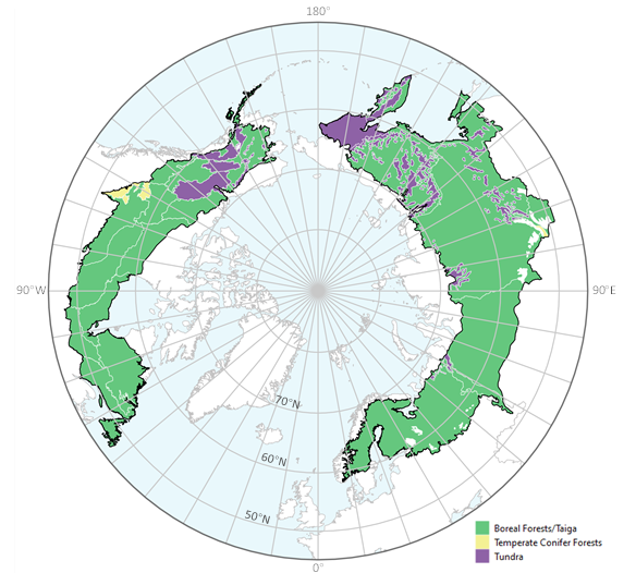
ABoVE: Tree Canopy Cover and Stand Age from Landsat, Boreal Forest Biome, 1984-2020
National Aeronautics and Space Administration —
This dataset contains Landsat-derived locally-calibrated estimates of tree canopy cover (TCC) and forest stand age across global boreal forests from 1984-2020 in... -
Federal
Kelp distribution off California
National Oceanic and Atmospheric Administration, Department of Commerce —
This data set delineates kelp beds (Nereocystis leutkeana and Macrocystis spp.) along the Pacific Coast of California. Multiple years of kelp mapping data for the... -
Federal
Channel Islands, Kelp Forest Monitoring, Sea Temperature, 1993-2007
National Oceanic and Atmospheric Administration, Department of Commerce —
This dataset from the Channel Islands National Park's Kelp Forest Monitoring Program has subtidal temperature data taken at permanent monitoring sites. Since 1993,... -
Federal
NERRS Boundaries Map Service Description
National Oceanic and Atmospheric Administration, Department of Commerce —
This layer represents the boundaries of all of the reserves in the National Estuarine Reserve System. -
Federal
Louisiana and Lower Mississippi River 2014 ESIP (Environmental Sensitivity Index - Polygons)
National Oceanic and Atmospheric Administration, Department of Commerce —
This data set contains vector polygons representing the shoreline and coastal habitats of Louisiana and the Lower Mississippi River classified according to the... -
Federal
2002 Average Monthly Sea Surface Temperature for California
National Oceanic and Atmospheric Administration, Department of Commerce —
The NOAA/ NASA AVHRR Oceans Pathfinder sea surface temperature data are derived from the 5-channel Advanced Very High Resolution Radiometers (AVHRR) on board the NOAA... -
Federal
GEDI L4A Footprint Level Aboveground Biomass Density, Version 2.1
National Aeronautics and Space Administration —
This dataset contains Global Ecosystem Dynamics Investigation (GEDI) Level 4A (L4A) Version 2 predictions of the aboveground biomass density (AGBD; in Mg/ha) and... -
Federal
Fish diversity in southern California using scuba surveys in kelp forests.
National Oceanic and Atmospheric Administration, Department of Commerce —
The Shannon Index of diversity was calculated from diver surveys on kelp beds in Southern California. Kelp diver visual census data was combined for two separate... -
Federal
Global Man-made Impervious Surface (GMIS) Dataset From Landsat
National Aeronautics and Space Administration —
The Global Man-made Impervious Surface (GMIS) Dataset From Landsat consists of global estimates of fractional impervious cover derived from the Global Land Survey... -
Federal
EM122 Water Column Sonar Data Collected During AR30-05
National Oceanic and Atmospheric Administration, Department of Commerce —
MF Noise -
Federal
EK60 Water Column Sonar Data Collected During EX1707
National Oceanic and Atmospheric Administration, Department of Commerce —
Singlebeam raw files (.bot, .idx, .raw) -
Federal
EK60 Water Column Sonar Data Collected During EX1503L2
National Oceanic and Atmospheric Administration, Department of Commerce —
Singlebeam raw files (.bot, .idx, .raw) -
Federal
EM710 Water Column Sonar Data Collected During NF1906
National Oceanic and Atmospheric Administration, Department of Commerce —
None -
Federal
EM712 Water Column Sonar Data Collected During SR1704
National Oceanic and Atmospheric Administration, Department of Commerce —
Cruise SR1704 on RV Sally Ride (EM712)

Official websites use .gov
A
.gov website belongs to an official government
organization in the United States.
Secure .gov websites use HTTPS
A
lock (
) or https:// means you’ve safely connected to
the .gov website. Share sensitive information only on official,
secure websites.