

11 datasets found
-
Federal
30-m Topographic Wetness Index
Department of the Interior —
The lidar Topographic Wetness Index (TWI) is the TWI data product produced and distributed by the National Park Service, Great Smoky Mountains National Park. Concave,... -
Federal
30-m Potential Solar Radiation (2014)
Department of the Interior —
The lidar Potential Solar Radiation (SRAD) is the SRAD data product produced and distributed by the National Park Service, Great Smoky Mountains National Park. Values... -
Federal
30-m Plan Curvature
Department of the Interior —
The lidar Plan Curvature is the Plan Curvature data product produced and distributed by the National Park Service, Great Smoky Mountains National Park. The primary... -
Federal
30-m Diurnal Anisotropic Heating Index
Department of the Interior —
The lidar Diurnal Anisotropic Heating Index (DAH) is the DA data product produced and distributed by the National Park Service, Great Smoky Mountains National Park. -
Federal
30-m Average Curvature
Department of the Interior —
The lidar Average Curvature is the Average Curvature data product produced and distributed by the National Park Service, Great Smoky Mountains National Park. The... -
Federal
Data from: Spatial and temporal features of snow water equivalent across a headwater catchment in the Sierra Nevada
Department of Agriculture —
Accompanying dataset for: “Spatial and Temporal Features of Snow Water Equivalent Across a Headwater Catchment in the Sierra Nevada”Abstract:Here, we present the... -
Federal
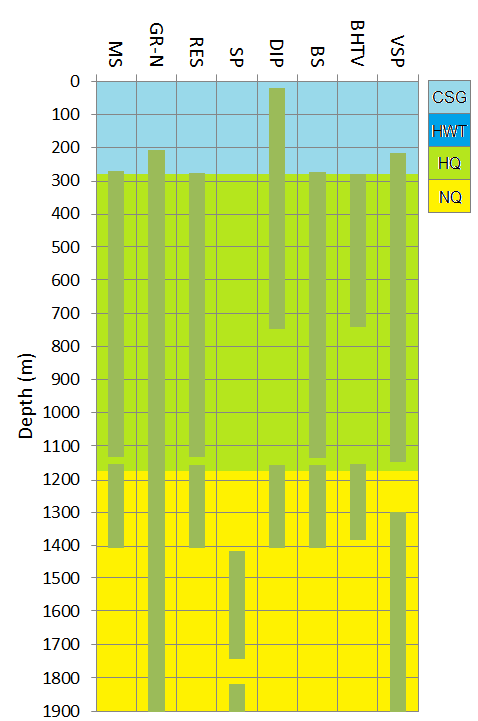
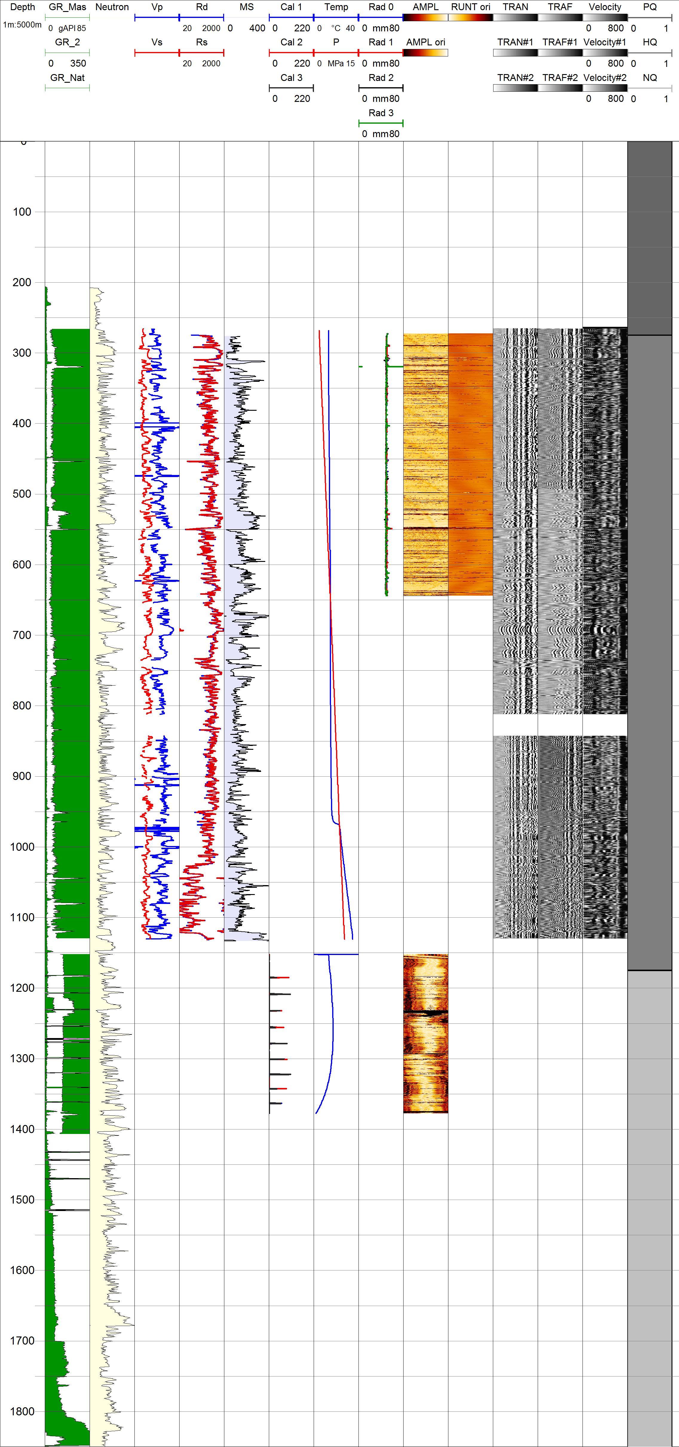
Project HOTSPOT: Kimama Well Borehole Geophysics Database
Department of Energy —
The Snake River Plain (SRP), Idaho, hosts potential geothermal resources due to elevated groundwater temperatures associated with the thermal anomaly Yellowstone-... -
Federal
30-m Profile Curvature
Department of the Interior —
The lidar Profile Curvature is the Profile Curvature data product produced and distributed by the National Park Service, Great Smoky Mountains National Park. The... -
Federal
30-m Morphometric Protection Index
Department of the Interior —
The lidar Morphometric Protection Index (MPI) is the MPI data product produced and distributed by the National Park Service, Great Smoky Mountains National Park.... -
Federal
UPDATED Fire Occurrence History Geodatabase at Great Smoky Mountains National Park, Tennessee and North Carolina
Department of the Interior —
This is an updated version of the previously posted geospatial dataset of fire occurrence history within the Great Smoky Mountains National Park. Fire perimeters and...
11 datasets found