
-
Federal
BLM Natl MLRS Mining Claims -Closed
Department of the Interior —
This dataset contains mining claim cases with the case disposition (status) of closed from US Bureau of Land Management's, BLM, Mineral and Land Record System(MLRS).... -
Federal
BLM Natl MLRS Mining Claims - Not Closed
Department of the Interior —
This dataset contains mining claim cases with the case disposition (status) of anything other than closed from US Bureau of Land Management's, BLM, Mineral and Land... -
Federal
TIGER/Line Shapefile, Current, State, Wisconsin, Place
U.S. Census Bureau, Department of Commerce —
This resource is a member of a series. The TIGER/Line shapefiles and related database files (.dbf) are an extract of selected geographic and cartographic information... -
Federal
TIGER/Line Shapefile, Current, State, Wisconsin, 119th Congressional District
U.S. Census Bureau, Department of Commerce —
This resource is a member of a series. The TIGER/Line shapefiles and related database files (.dbf) are an extract of selected geographic and cartographic information... -
Federal
TIGER/Line Shapefile, Current, State, Wisconsin, Census Tract
U.S. Census Bureau, Department of Commerce —
This resource is a member of a series. The TIGER/Line shapefiles and related database files (.dbf) are an extract of selected geographic and cartographic information... -
Federal
BLM Natl MLRS Geothermal Leases
Department of the Interior —
This dataset contains geothermal leases cases derived from Legal Land Descriptions (LLD) contained in the US Bureau of Land Management's, BLM, Mineral and Land Record... -
University
New Mexico Federal Lands
Earth Data Analysis Center, University of New Mexico —
This map layer consists of federally owned or administered lands of the United States, Puerto Rico, and the U.S. Virgin Islands. Only areas of 640 acres or more are... -
Federal
Magnetotelluric data from Minnesota, Wisconsin, and Upper Michigan, 2015-2019, station pen114
Department of the Interior —
This dataset consists of 176 wideband magnetotelluric (MT) stations collected from 2015-2019 across parts of Minnesota, Wisconsin and the Upper Peninsula of Michigan.... -
Federal
BLM Natl MLRS Oil and Gas Agreements
Department of the Interior —
This dataset contains oil and gas agreements cases derived from Legal Land Descriptions (LLD) contained in the US Bureau of Land Management's, BLM, Mineral and Land... -
Federal
H07162: NOS Hydrographic Survey , 1947-12-31
National Oceanic and Atmospheric Administration, Department of Commerce —
The National Oceanic and Atmospheric Administration (NOAA) has the statutory mandate to collect hydrographic data in support of nautical chart compilation for safe... -
Federal
B00215: NOS Hydrographic Survey , 1990-07-14
National Oceanic and Atmospheric Administration, Department of Commerce —
The National Oceanic and Atmospheric Administration (NOAA) has the statutory mandate to collect hydrographic data in support of nautical chart compilation for safe... -
Federal
TIGER/Line Shapefile, 2023, State, Wisconsin, Primary and Secondary Roads
U.S. Census Bureau, Department of Commerce —
The TIGER/Line shapefiles and related database files (.dbf) are an extract of selected geographic and cartographic information from the U.S. Census Bureau's Master... -
Federal
H07910: NOS Hydrographic Survey , 1950-12-31
National Oceanic and Atmospheric Administration, Department of Commerce —
The National Oceanic and Atmospheric Administration (NOAA) has the statutory mandate to collect hydrographic data in support of nautical chart compilation for safe... -
Federal
H04962: NOS Hydrographic Survey , 1930-12-31
National Oceanic and Atmospheric Administration, Department of Commerce —
The National Oceanic and Atmospheric Administration (NOAA) has the statutory mandate to collect hydrographic data in support of nautical chart compilation for safe... -
Federal
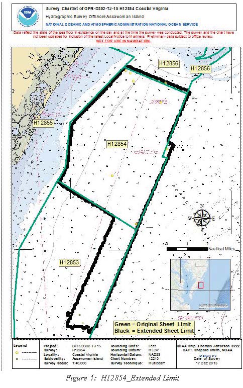
H12854: NOS Hydrographic Survey , 2015-12-17
National Oceanic and Atmospheric Administration, Department of Commerce —
The National Oceanic and Atmospheric Administration (NOAA) has the statutory mandate to collect hydrographic data in support of nautical chart compilation for safe... -
Federal
H12182: NOS Hydrographic Survey , Southern Chesapeake Bay, Virginia, 2010-03-24
National Oceanic and Atmospheric Administration, Department of Commerce —
The National Oceanic and Atmospheric Administration (NOAA) has the statutory mandate to collect hydrographic data in support of nautical chart compilation for safe... -
Federal
BLM ES Administrative Unit Office Points
Department of the Interior —
This feature-dataset depicts Bureau of Land Management (BLM) office locations. The land areas for higher level administrative units (district and administrative... -
Federal
H12201: NOS Hydrographic Survey , Approaches to Chesapeake Bay, 2010-10-24
National Oceanic and Atmospheric Administration, Department of Commerce —
The National Oceanic and Atmospheric Administration (NOAA) has the statutory mandate to collect hydrographic data in support of nautical chart compilation for safe... -
Federal
H01455C: NOS Hydrographic Survey , 1879-12-31
National Oceanic and Atmospheric Administration, Department of Commerce —
The National Oceanic and Atmospheric Administration (NOAA) has the statutory mandate to collect hydrographic data in support of nautical chart compilation for safe...

Official websites use .gov
A
.gov website belongs to an official government
organization in the United States.
Secure .gov websites use HTTPS
A
lock (
) or https:// means you’ve safely connected to
the .gov website. Share sensitive information only on official,
secure websites.
.jpg)