
-
Federal
NCEP/CPC L3 Half Hourly 4km Global (60S - 60N) Merged IR V1 (GPM_MERGIR) at GES DISC
National Aeronautics and Space Administration —
These data originate from NOAA/NCEP. The NOAA Climate Prediction Center/NCEP/NWS is making the data available originally in binary format, in a weekly rotating... -
Federal
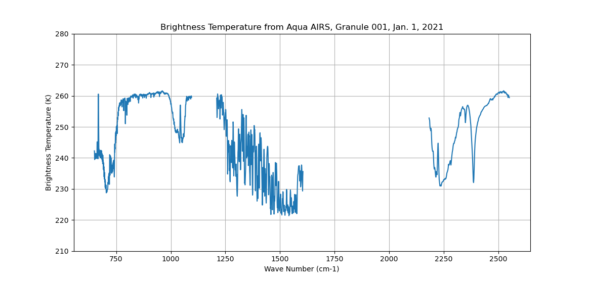
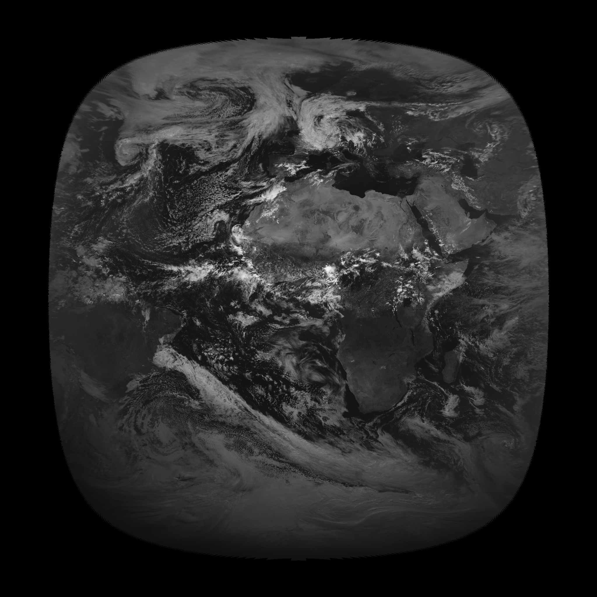
Sounder SIPS: Sun Synchronous 13:30 orbit Climate Hyperspectral InfraRed Product (CHIRP): Calibrated Radiances from EOS-Aqua, V2 (SNDR13CHRP1AQCal) at GES DISC
National Aeronautics and Space Administration —
The Climate Hyperspectral Infrared Radiance Product (CHIRP) is a Level 1 radiance product derived from Atmospheric Infrared Sounder (AIRS) on EOS-AQUA and the Cross-... -
Federal
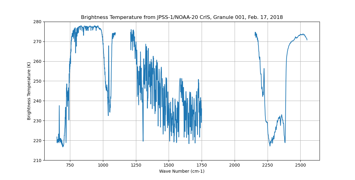
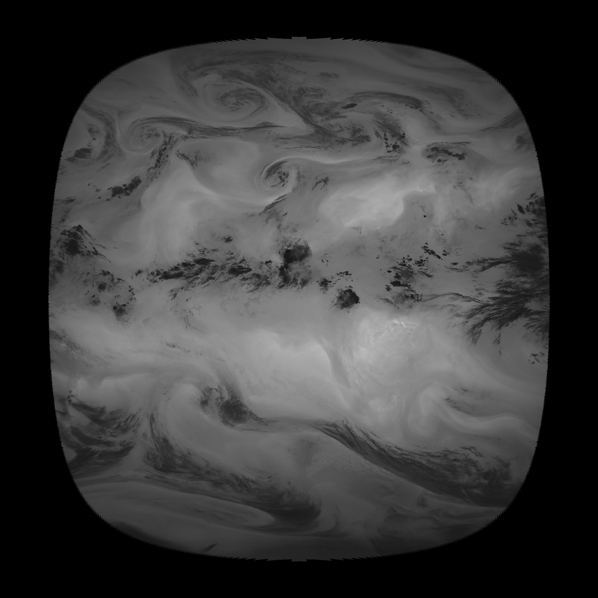
Sounder SIPS: Sun Synchronous 13:30 orbit Climate Hyperspectral InfraRed Product (CHIRP): Calibrated Radiances from JPSS-1/NOAA-20, V2 (SNDR13CHRP1J1Cal) at GES DISC
National Aeronautics and Space Administration —
The Climate Hyperspectral Infrared Radiance Product (CHIRP) is a Level 1 radiance product derived from Atmospheric Infrared Sounder (AIRS) on EOS-AQUA and the Cross-... -
Federal
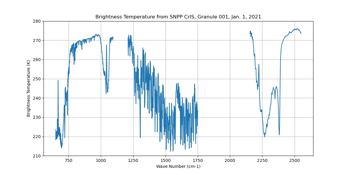
Sounder SIPS: Suomi NPP CrIS Level-1B NSR Calibration Subset: Random full spectra V2 (SNDRSNIL1BCALSUBRNDN) at GES DISC
National Aeronautics and Space Administration —
The CrIS/ATMS instruments used for this product are on board the Suomi National Polar-orbiting Partnership (SNPP) platform and use the Normal Spectral Resolution... -
Federal
BOREAS RSS-14 GOES-7 Level-1a Visible, Infrared, and Water Vapor Images
National Aeronautics and Space Administration —
The level-1a BOREAS GOES-7 image data was collected by Remote Sensing Science Team-14 (RSS-14) personnel at Florida State University and processed to level-1a... -
Federal
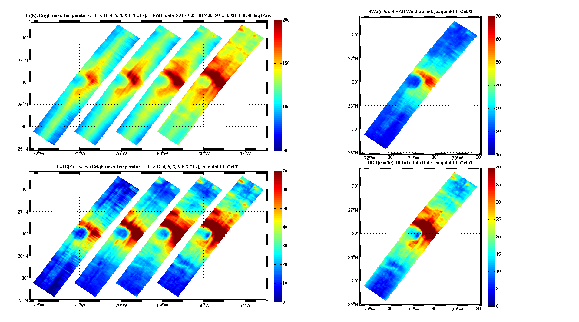
Tropical Cyclone Intensity (TCI) Hurricane Imaging Radiometer (HIRAD) V2.1
National Aeronautics and Space Administration —
The Tropical Cyclone Intensity (TCI) Hurricane Imaging Radiometer (HIRAD) dataset was created for the TCI field campaign from August 30, 2015 through October 23,... -
Federal
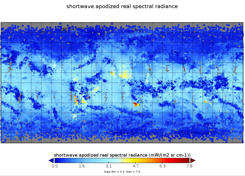
JPSS-1 CrIS Level 1B Principal Component Analysis / Rapid Event Detection V3.0 (SNDRJ1CrISL1BPCARED) at GES DISC
National Aeronautics and Space Administration —
This sample data collection contains L1B radiance values that are compressed and denoised via Principal Component Analysis (PCA). Additionally it contains a new Rapid... -
Federal
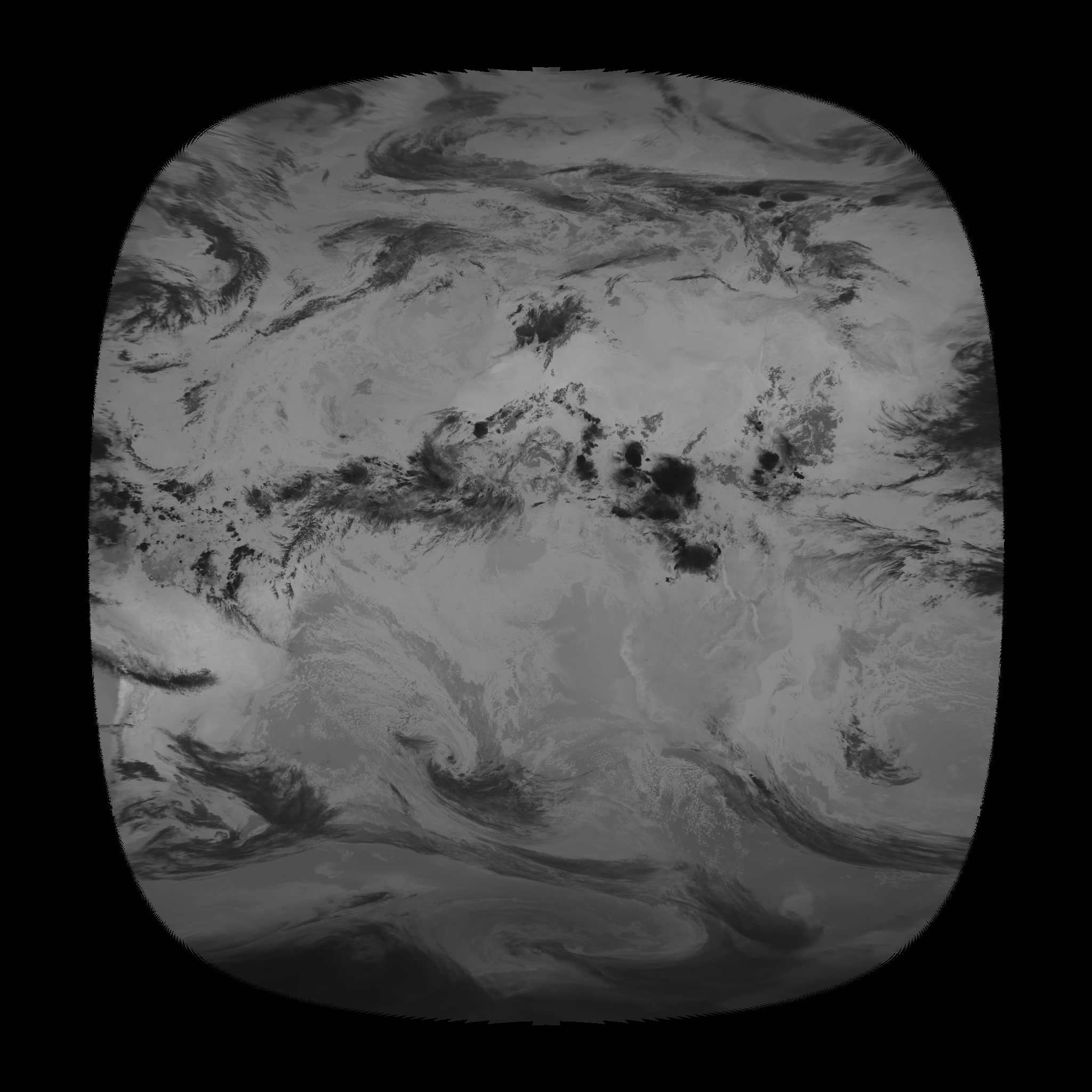
Sounder SIPS: Sun Synchronous 13:30 orbit Climate Hyperspectral InfraRed Product (CHIRP): Calibrated Radiances from EOS-Aqua, S-NPP, JPSS-1/NOAA-20, V2 (SNDR13CHRP1) at GES DISC
National Aeronautics and Space Administration —
The Climate Hyperspectral Infrared Radiance Product (CHIRP) is a Level 1 radiance product derived from Atmospheric Infrared Sounder (AIRS) on EOS-AQUA and the Cross-... -
Federal
SAFARI 2000 C-130 Aerosol and Meteorological Data, Dry Season 2000
National Aeronautics and Space Administration —
The Met Office C-130 research aircraft was based at Windhoek, Namibia, between September 5-16, 2000, where it conducted a series of flights over Namibia as part of... -
Federal
Ground-based Observations of XCO2, XCH4, and XCO, Fairbanks, AK, 2016-2019
National Aeronautics and Space Administration —
This dataset provides ground-based column-averaged dry mole fractions (DMFs) of CO2 (xco2), CO (xco), CH4 (xch4), and N2O (xn2o) to supplement satellite-based... -
Federal
SAMS/Nimbus-7 Level 1 Radiance Data from CD-ROM V001 (SAMSN7L1RAD_CDROM) at GES DISC
National Aeronautics and Space Administration —
SAMSN7L1RAD_CDROM is the gridded Nimbus-7 Stratospheric and Mesospheric Sounder (SAMS) Level 1 Radiance Data Product. The radiances were selected to derive gas... -
Federal
SAMS/Nimbus-7 Level 1 Radiance Data V001 (SAMSN7L1RAT) at GES DISC
National Aeronautics and Space Administration —
SAMSN7L1RAT is the gridded Nimbus-7 Stratospheric and Mesospheric Sounder (SAMS) Level 1 Radiance Data Product. The radiances were selected to derive gas... -
Federal
Sounder SIPS: Sun Synchronous 13:30 orbit Climate Hyperspectral InfraRed Product (CHIRP): Calibrated Radiances from S-NPP, V2 (SNDR13CHRP1SNCal) at GES DISC
National Aeronautics and Space Administration —
The Climate Hyperspectral Infrared Radiance Product (CHIRP) is a Level 1 radiance product derived from Atmospheric Infrared Sounder (AIRS) on EOS-AQUA and the Cross-... -
Federal
SAFARI 2000 MAPSS MOD05_L2 Water Vapor Summary Data for Southern Africa NGDA
National Aeronautics and Space Administration —
The MODIS (Moderate Resolution Imaging Spectroradiometer) Atmosphere Group develops remote sensing algorithms for deriving sets of atmospheric parameters from MODIS... -
Federal
GRIP METEOSAT SECOND GENERATION (MSG) IMAGE DATA V1
National Aeronautics and Space Administration —
The GRIP Meteosat Second Generation (MSG) Image Data was collected during the Genesis and Rapid Intensification Processes (GRIP) experiment from August 15, 2010 to... -
Federal
LRIR/Nimbus-6 Level 2 Inverted Profiles of Temperature and Ozone V001 (LRIRN6L2IPAT) at GES DISC
National Aeronautics and Space Administration —
LRIRN6L2IPAT is the Nimbus-6 Limb Radiance Inversion Radiometer (LRIR) Level 2 Inverted Profiles of Temperature and Ozone data product. The product contains daily... -
Federal
TOVS GLA MONTHLY GRIDS from NOAA-10 V01 (TOVSAMNG) at GES DISC
National Aeronautics and Space Administration —
This dataset (TOVSAMNG) contains the TIROS Operational Vertical Sounder (TOVS) level 3 geophysical parameters derived using data from NOAA-10 and the physical... -
Federal
Sounder SIPS: Aqua AIRS Level-1C Calibration Subset: Random Full Spectra V2 (SNDRAQIML1CCALSUBRND) at GES DISC
National Aeronautics and Space Administration —
The Atmospheric Infrared Sounder (AIRS) is a grating spectrometer (R = 1200) aboard the second Earth Observing System (EOS) polar-orbiting platform, EOS Aqua.... -
Federal
SAFARI 2000 Daily Rainfall Estimates, 0.1-Deg, Southern Africa, 1993-2001
National Aeronautics and Space Administration —
The Microwave InfraRed Algorithm (MIRA) is used to produce an imagery data set of daily mean rain rates at 0.1 degree spatial resolution over southern Africa for the... -
Federal
Sounder SIPS: Aqua AIRS Level-1B Calibration Subset: Summary, V2 (SNDRAQIML1BCALSUBSUM) at GES DISC
National Aeronautics and Space Administration —
The Atmospheric Infrared Sounder (AIRS) is a grating spectrometer (R = 1200) aboard the second Earth Observing System (EOS) polar-orbiting platform, EOS Aqua....

Official websites use .gov
A
.gov website belongs to an official government
organization in the United States.
Secure .gov websites use HTTPS
A
lock (
) or https:// means you’ve safely connected to
the .gov website. Share sensitive information only on official,
secure websites.