
-
Federal
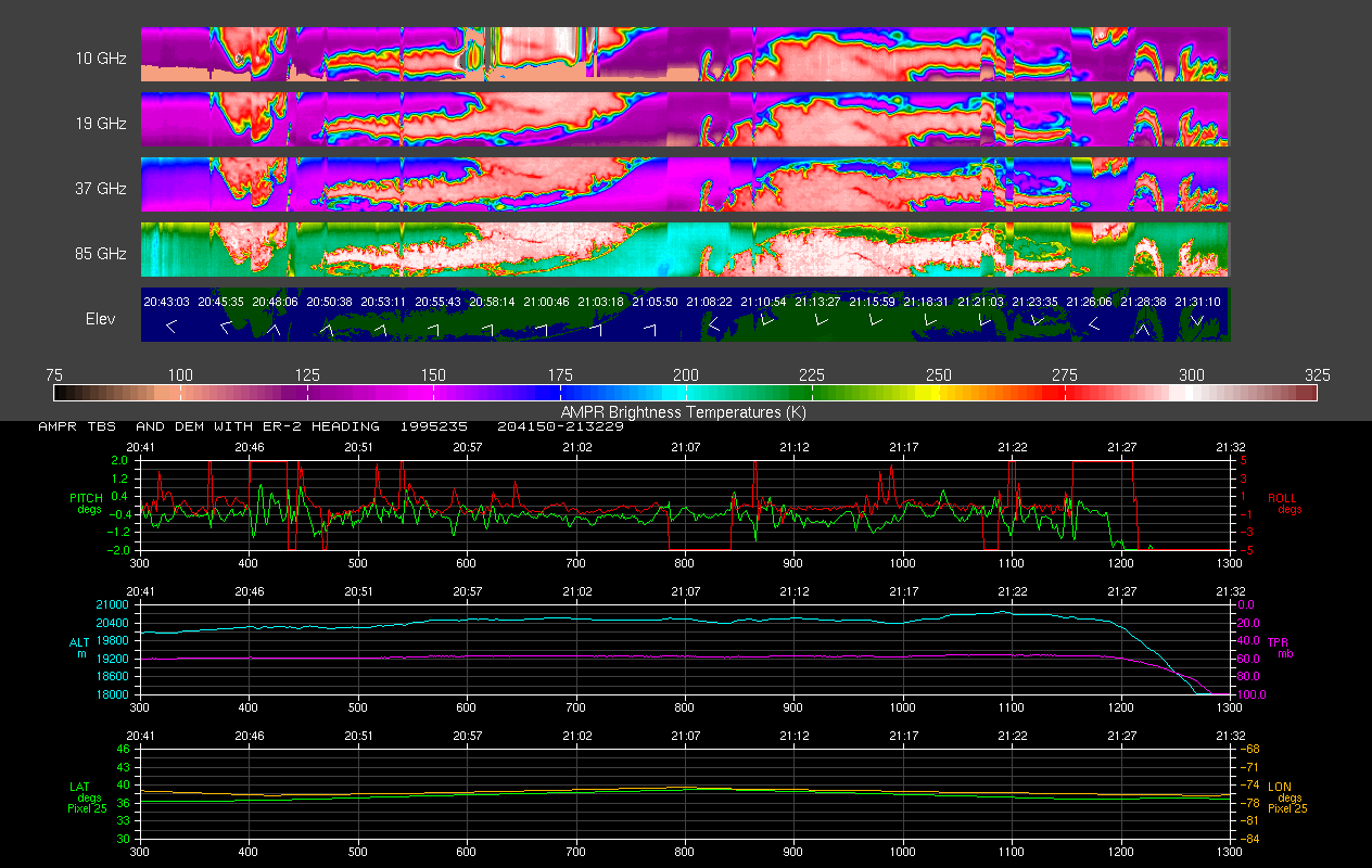
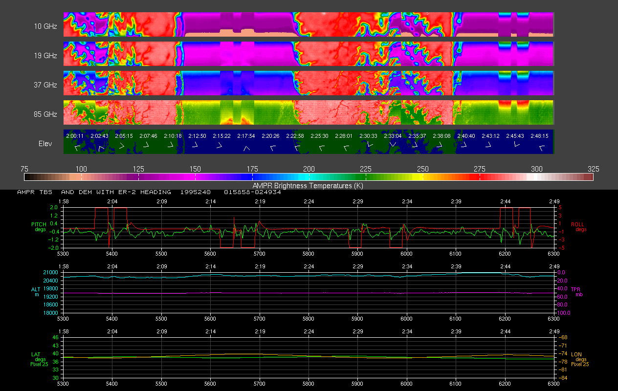
AMPR FIRE III ACE V1
National Aeronautics and Space Administration —
The Advanced Microwave Precipitation Radiometer (AMPR) was deployed during the First ISCCP Regional Experiment-III Arctic Cloud Experiment (FIRE-III/ACE). AMPR data... -
Federal
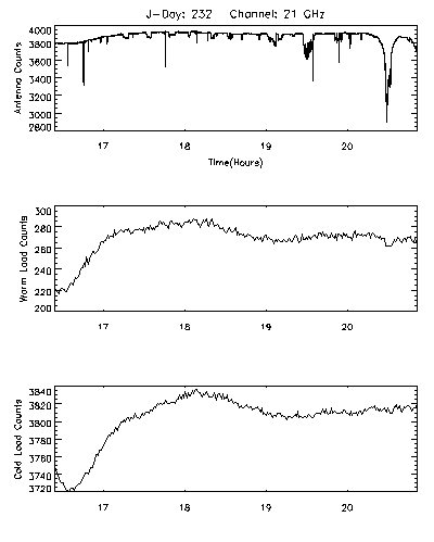
CAMEX-3 LiDAR Atmospheric Sensing Experiment (LASE) Imagery V1
National Aeronautics and Space Administration —
The CAMEX-3 LiDAR Atmospheric Sensing Experiment (LASE) Imagery dataset is a browse-only dataset that consists of plotted reflectivity data collected by the LiDAR... -
Federal
AMPR BRIGHTNESS TEMPERATURE CAMEX-2 V2
National Aeronautics and Space Administration —
The Advanced Microwave Precipitation Radiometer (AMPR) was deployed during the Convection and Moisture Experiment 2 (CAMEX-2). AMPR data were collected at a... -
Federal
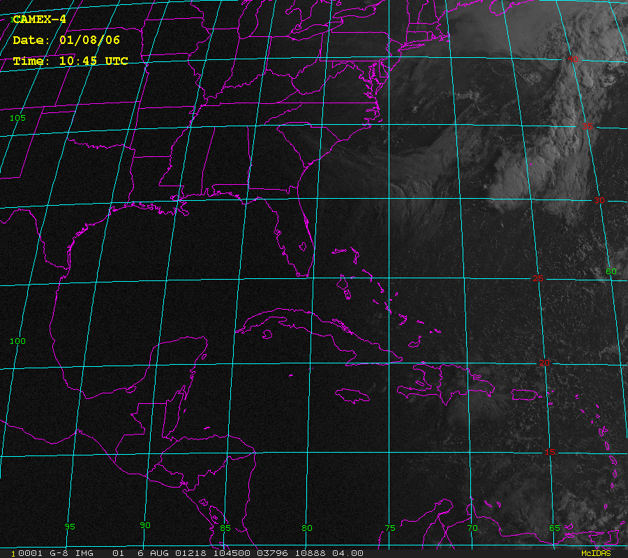
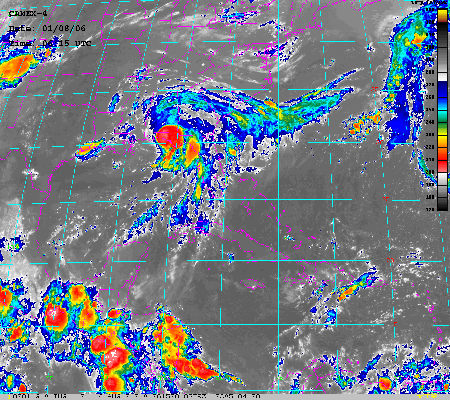
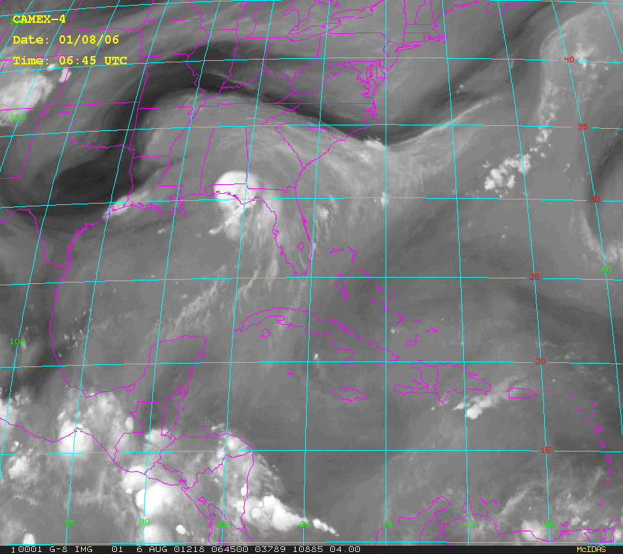
CAMEX-4 GOES-8 PRODUCTS V1
National Aeronautics and Space Administration —
The CAMEX-4 GOES-8 Products dataset was collected during the CAMEX-4 field campaign, which ocused on the study of tropical cyclone (hurricane) development, tracking,... -
Federal
GPM GROUND VALIDATION HIGH ALTITUDE IMAGING WIND AND RAIN AIRBORNE PROFILER (HIWRAP) MC3E V1
National Aeronautics and Space Administration —
The GPM Ground Validation High Altitude Imaging Wind and Rain Airborne Profiler (HIWRAP) MC3E dataset was collected by the High-Altitude Imaging Wind and Rain... -
Federal
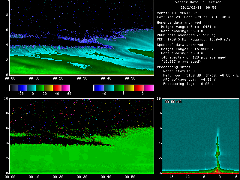
GPM GROUND VALIDATION MCGILL VERTICAL POINTING X-BAND (VERTIX) RADAR GCPEX V1
National Aeronautics and Space Administration —
The GPM Ground Validation McGill Vertical Pointing X-Band (VertiX) Radar GCPEx dataset consists of radar reflectivity and Doppler velocity data collected by the... -
Federal
AMPR BRIGHTNESS TEMPERATURE CAMEX-1 V2
National Aeronautics and Space Administration —
The Advanced Microwave Precipitation Radiometer (AMPR) was deployed during the Convection and Moisture Experiments (CAMEX-1) conducted at Wallops Island, VA. AMPR... -
Federal
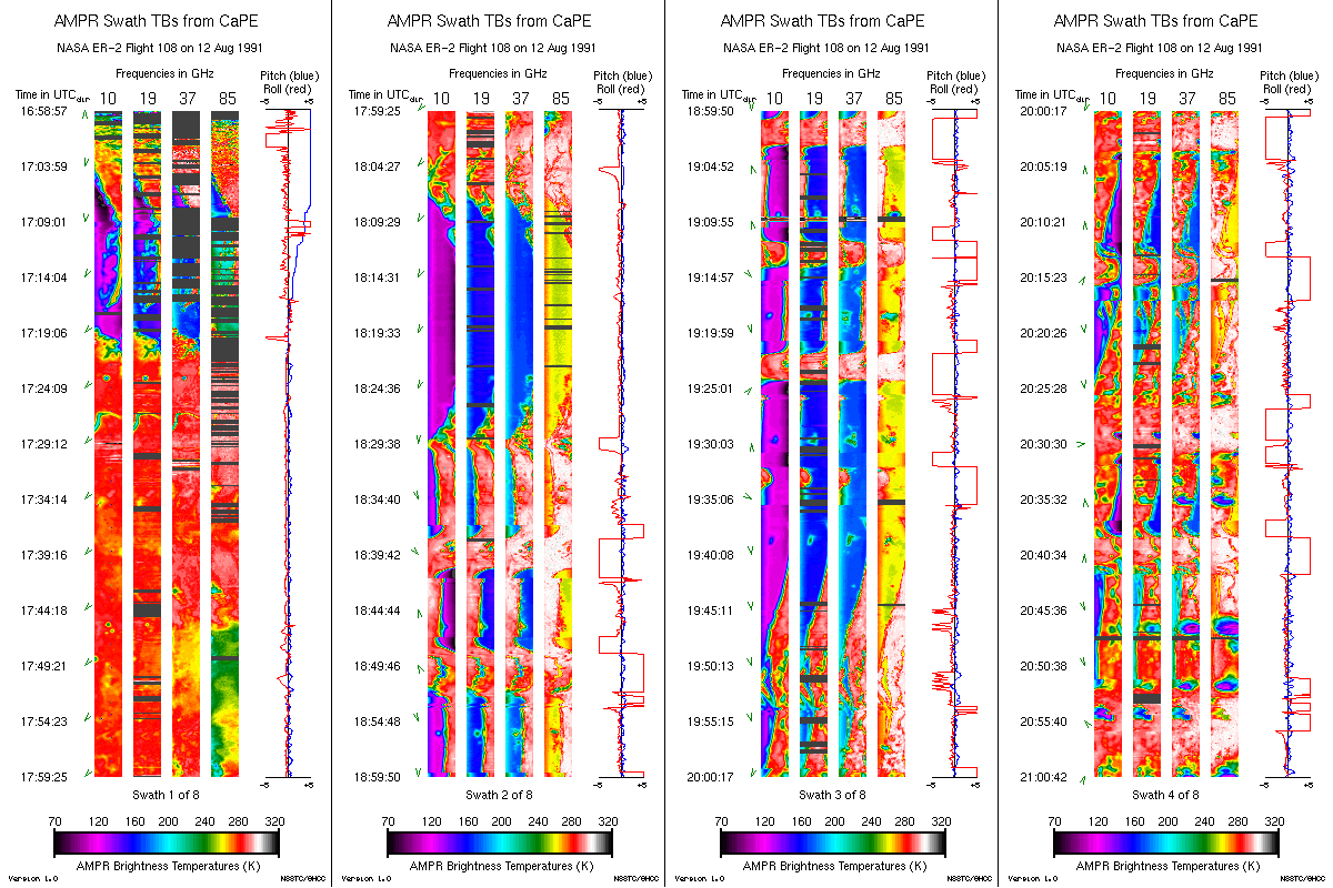
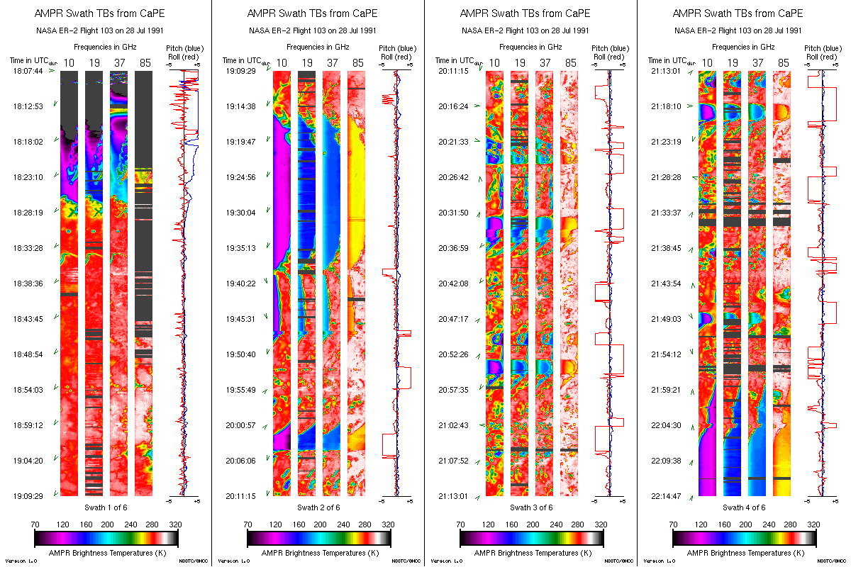
AMPR BRIGHTNESS TEMPERATURE CAPE EXPERIMENT V2
National Aeronautics and Space Administration —
The Advanced Microwave Precipitation Radiometer (AMPR) was deployed during the Convection and Precipitation/Electrification Experiment (CaPE). AMPR data werecollected... -
Federal
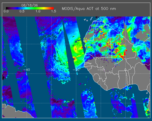
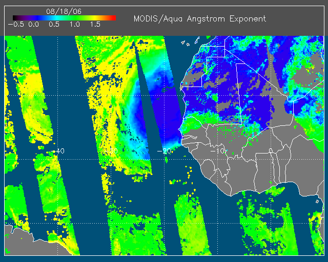
NAMMA MODIS/AQUA AND MODIS/TERRA DEEP BLUE PRODUCTS V1 NGDA
National Aeronautics and Space Administration —
The NAMMA MODIS/AQUA and MODIS/TERRA Deep Blue Products dataset is a collection of images depicting the aerosol optical depth derived from the MODIS deep blue... -
Federal
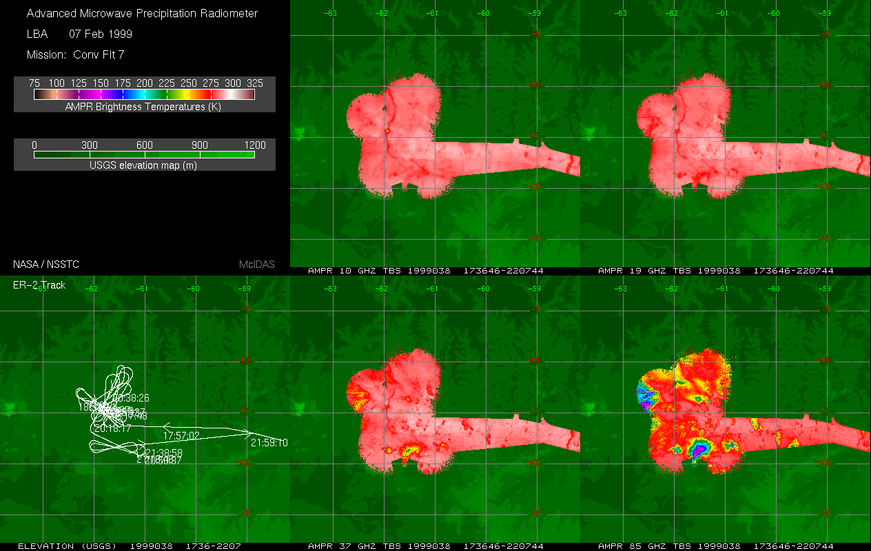
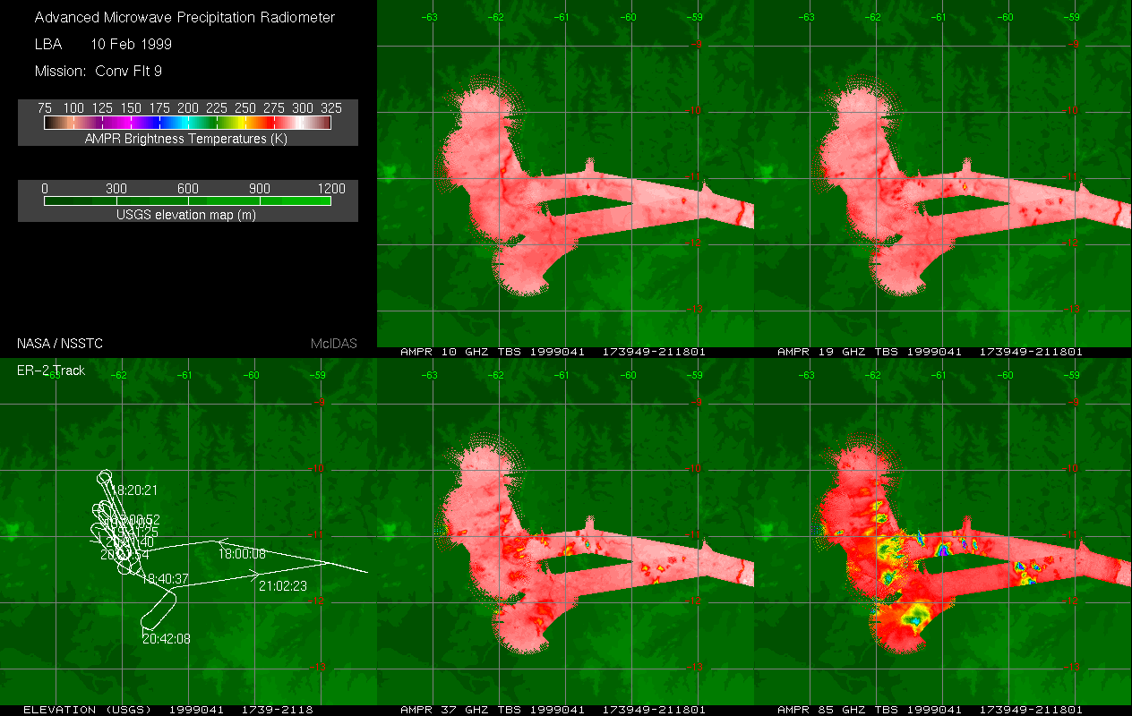
TRMM LBA (LARGE SCALE BIOSPHERE-ATMOSPHERE) EXPERIMENT (AMPR) V1
National Aeronautics and Space Administration —
The Advanced Microwave Precipitation Radiometer (AMPR) was deployed during the Tropical Rainfall Measuring Mission - Large Scale Biosphere-Atmosphere Experiment... -
Federal
CAMEX-4 CONICALLY-SCANNING TWO-LOOK AIRBORNE RADIOMETER (C-STAR) V1a
National Aeronautics and Space Administration —
The CAMEX-4 Conically-Scanning Two-Look Airborne Radiometer (C-STAR) dataset was collected by the Conically-Scanning Two-look Airborne Radiometer (C-STAR), which was... -
Federal
CAMEX-3 DC-8 Airborne Multichannel Microwave Radiometer (AMMR) V1
National Aeronautics and Space Administration —
The CAMEX-3 DC-8 Airborne Multichannel Microwave Radiometer (AMMR) dataset is a browse-only dataset that consists of plotted digital count measurements collected by... -
Federal
GPM Ground Validation CXSI Radar Imagery OLYMPEX V1
National Aeronautics and Space Administration —
The GPM Ground Validation CXSI Radar Imagery OLYMPEX dataset contains radar reflectivity and precipitation rate images obtained from Environment and Climate Change... -
Federal
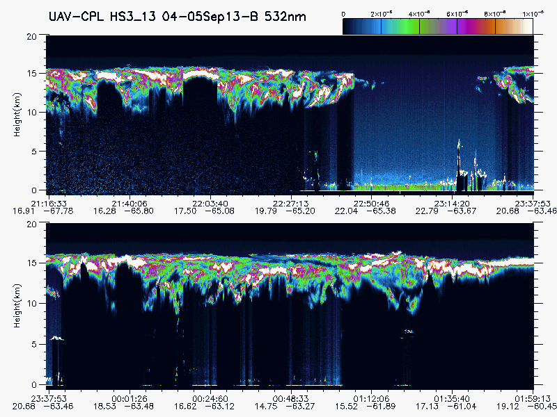
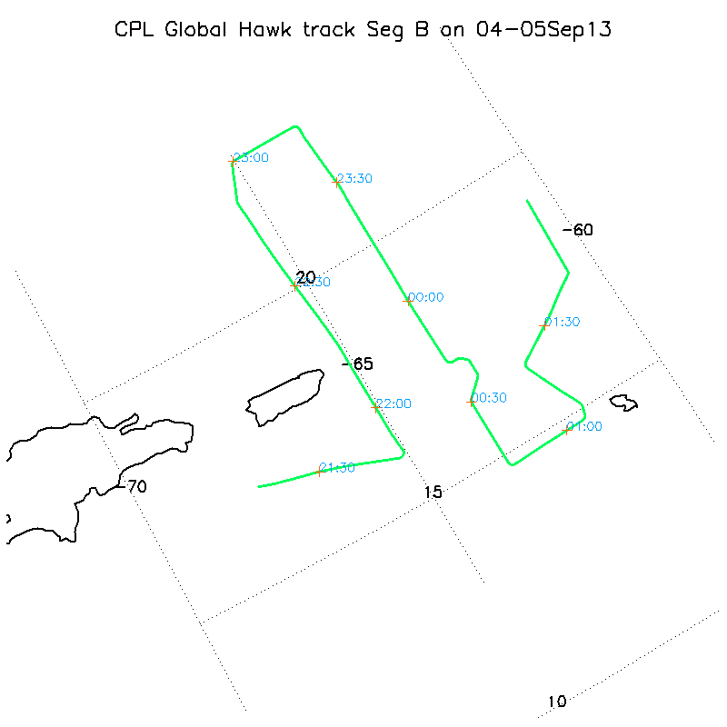
HURRICANE AND SEVERE STORM SENTINEL (HS3) GLOBAL HAWK CLOUD PHYSICS LIDAR (CPL) V1
National Aeronautics and Space Administration —
The Hurricane and Severe Storm Sentinel (HS3) Global Hawk Cloud Physics Lidar (CPL) dataset includes measurements gathered by the CPL instrument during the HS3... -
Federal
AIRS/Aqua L1B Near Real Time (NRT) Infrared (IR) quality assurance subset V005 (AIRIBQAP_NRT) at GES DISC
National Aeronautics and Space Administration —
The AIRS Level 1B Near Real Time (NRT) product (AIRIBQAP_NRT_005) differs from the routine product (AIRIBQAP_005) in 2 ways to meet the three hour latency... -
Federal
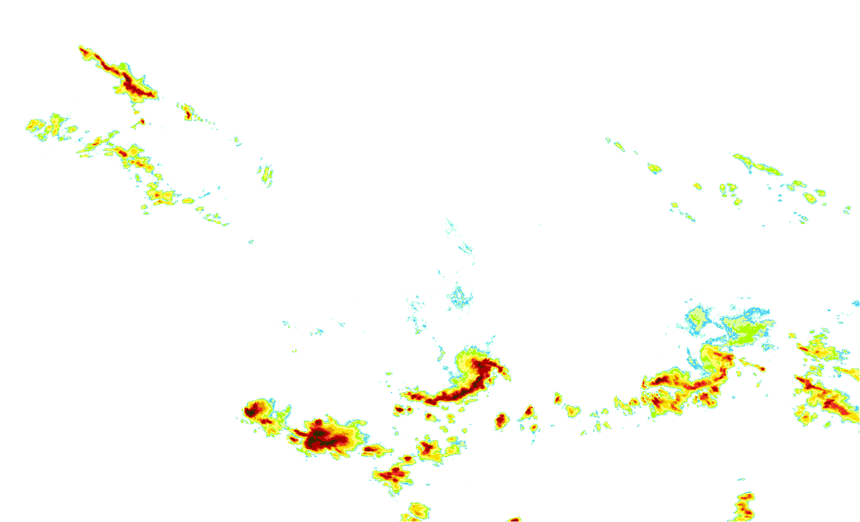
TCSP AMPR BRIGHTNESS TEMPERATURE (TB) V2
National Aeronautics and Space Administration —
The TCSP AMPR Brightness Temperature (TB) dataset consists of brightness temperature measurements from July 5, 2005 to July 27, 2005. The Advanced Microwave... -
Federal
AMPR JACKSONVILLE BRIGHTNESS TEMPERATURE (TB) V2
National Aeronautics and Space Administration —
The Advanced Microwave Precipitation Radiometer (AMPR) was deployed in Jacksonville, FL for the initial AMPR instrument validation. AMPR data were collected at four... -
Federal
GPM Ground Validation Iowa Flood Center (IFC) NEXRAD Composite IFloodS V1
National Aeronautics and Space Administration —
The GPM Ground Validation Iowa Flood Center (IFC) NEXRAD Composite IFloodS dataset contains rain rate estimates derived using NEXt Generation Weather RADar system... -
Federal
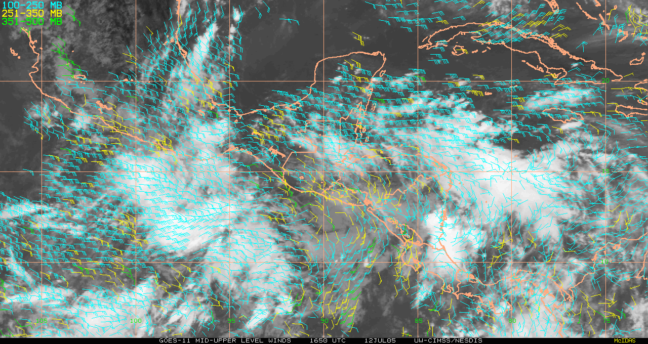
TCSP GOES 11 RAPID SCAN WINDS V1
National Aeronautics and Space Administration —
The TCSP GOES 11 Rapid Scan Winds dataset was generated from image triplets with 30 or 60 minute intervals, and occasionally 15 minute intervals. During Geostationary... -
Federal
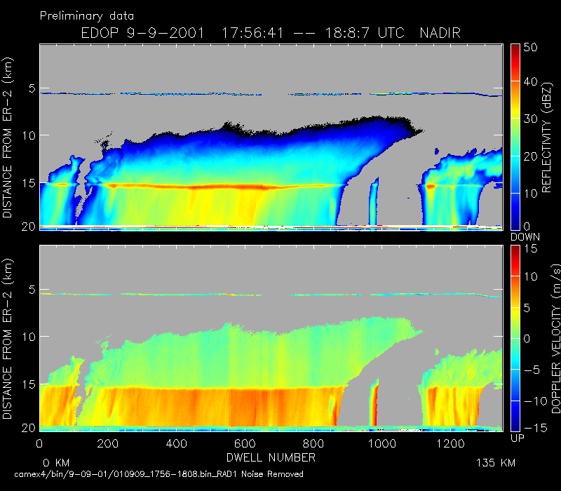
CAMEX-4 ER-2 DOPPLER RADAR V1
National Aeronautics and Space Administration —
The CAMEX-4 ER-2 Doppler Radar dataset was collected by the ER-2 Doppler radar (EDOP), which is an X-band (9.6 GHz) Doppler radar mounted in the nose of ER-2. The...

Official websites use .gov
A
.gov website belongs to an official government
organization in the United States.
Secure .gov websites use HTTPS
A
lock (
) or https:// means you’ve safely connected to
the .gov website. Share sensitive information only on official,
secure websites.