
-
Federal
Leaf Area Index Maps at 30-m Resolution, VALERI Site, Larose, Canada
National Aeronautics and Space Administration —
This data set provide local LAI maps for the Larose (Ontario) site in Canada. These derived maps may also be useful for validating other LAI maps over this same site... -
Federal
NOAA/WDS Paleoclimatology - Bigio fire data from Verkhiye Tal'tsy, Siberia - IMPD RUTAL001
National Oceanic and Atmospheric Administration, Department of Commerce —
This archived Paleoclimatology Study is available from the NOAA National Centers for Environmental Information (NCEI), under the World Data Service (WDS) for... -
Federal
NOAA/WDS Paleoclimatology - Brown fire data from Manitou Demo Plot - IMPD USMDP001
National Oceanic and Atmospheric Administration, Department of Commerce —
This archived Paleoclimatology Study is available from the NOAA National Centers for Environmental Information (NCEI), under the World Data Service (WDS) for... -
Federal
NOAA/WDS Paleoclimatology - Yocom fire data from El Diferencial, Sierra Madre Oriental, Nuevo León, Mexico - IMPD MXDI-001
National Oceanic and Atmospheric Administration, Department of Commerce —
This archived Paleoclimatology Study is available from the NOAA National Centers for Environmental Information (NCEI), under the World Data Service (WDS) for... -
Federal
Post-fire Recovery of Soil Organic Layer Carbon in Canadian Boreal Forests, 2015-2018
National Aeronautics and Space Administration —
This dataset provides site moisture, soil organic layer thickness, soil organic carbon, nonvascular plant functional group, stand dominance, ecozone, time-after-fire,... -
Federal
NOAA/WDS Paleoclimatology - Donnegan fire data from BSA Shortcut - IMPD USBSA001
National Oceanic and Atmospheric Administration, Department of Commerce —
This archived Paleoclimatology Study is available from the NOAA National Centers for Environmental Information (NCEI), under the World Data Service (WDS) for... -
Federal
NOAA/WDS Paleoclimatology - Olson fire data from Dugout Riparian, Blue Mountains, Oregon - IMPD USDUG001
National Oceanic and Atmospheric Administration, Department of Commerce —
This archived Paleoclimatology Study is available from the NOAA National Centers for Environmental Information (NCEI), under the World Data Service (WDS) for... -
Federal
NOAA/WDS Paleoclimatology - Margolis fire data from Seven Springs Plot 2, northern New Mexico - IMPD USSS-002
National Oceanic and Atmospheric Administration, Department of Commerce —
This archived Paleoclimatology Study is available from the NOAA National Centers for Environmental Information (NCEI), under the World Data Service (WDS) for... -
Federal
Global Forest Cover Change Forest Cover Change Multi-Year Global 30m V001
National Aeronautics and Space Administration —
The Land Processes Distributed Active Archive Center (LP DAAC) archives and distributes Global Forest Cover Change (GFCC) data products through the NASA Making Earth... -
Federal
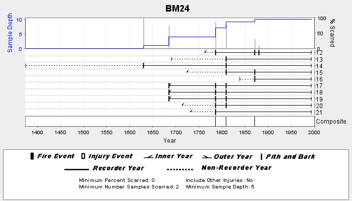
NOAA/WDS Paleoclimatology - Veblen fire data from BM24 - IMPD USBM-024
National Oceanic and Atmospheric Administration, Department of Commerce —
This archived Paleoclimatology Study is available from the NOAA National Centers for Environmental Information (NCEI), under the World Data Service (WDS) for... -
Federal
Classification of Global Forests for IPCC Aboveground Biomass Tier 1 Estimates, 2020
National Aeronautics and Space Administration —
This dataset provides classes of global forests delineated by status/condition in 2020 at approximately 30-m resolution. The data support generating Tier 1 estimates... -
Federal
NOAA/WDS Paleoclimatology - Mundo fire data from Lago Guacho, Patagonia - IMPD ARGUA001
National Oceanic and Atmospheric Administration, Department of Commerce —
This archived Paleoclimatology Study is available from the NOAA National Centers for Environmental Information (NCEI), under the World Data Service (WDS) for... -
Federal
Coastal Bend Texas Benthic Habitat Mapping Patchy Shapefile Map - San Antonio Bay and Espiritu Santo Bay
National Oceanic and Atmospheric Administration, Department of Commerce —
The NOAA Office for Coastal Management (OCM) requested the creation of benthic habitat data along the southern Texas coast to support the Texas Seagrass Monitoring... -
Federal
LBA-ECO LC-14 Specific Leaf Area and Phenology, km 67 Site, Para, Brazil: 2001-2006
National Aeronautics and Space Administration —
This data set provides measurements of specific leaf area and monthly phenological observations for selected tree and vine species at the km 67 Seca Floresta site,... -
Federal
BOREAS HYD-03 Canopy Density Data
National Aeronautics and Space Administration —
The BOREAS HYD-03 team collected several data sets related to the hydrology of forested areas. This data set contains measurements of canopy density (closure) from a... -
Federal
NOAA/WDS Paleoclimatology - VS-Lite Model of Tree-Ring Width
National Oceanic and Atmospheric Administration, Department of Commerce —
This archived Paleoclimatology Study is available from the NOAA National Centers for Environmental Information (NCEI), under the World Data Service (WDS) for... -
Federal
Wind speed estimates of the December 2021 Quad-State Tornado in Mayfield, KY based on treefall pattern analysis
National Institute of Standards and Technology —
A violent tornado outbreak occurred on December 10-11, 2021 in the Midwest US. One of the tornadoes, known as the Quad-State tornado, tracked across four states and... -
Federal
Block-GP: Scalable Gaussian Process Regression for Multimodal Data
National Aeronautics and Space Administration —
Regression problems on massive data sets are ubiquitous in many application domains including the Internet, earth and space sciences, and finances. In many cases,... -
Federal
Multi-objective optimization based privacy preserving distributed data mining in Peer-to-Peer networks
National Aeronautics and Space Administration —
This paper proposes a scalable, local privacy preserving algorithm for distributed Peer-to-Peer (P2P) data aggregation useful for many advanced data mining/analysis...

Official websites use .gov
A
.gov website belongs to an official government
organization in the United States.
Secure .gov websites use HTTPS
A
lock (
) or https:// means you’ve safely connected to
the .gov website. Share sensitive information only on official,
secure websites.