
-
Federal
First ISCCP Regional Experiment (FIRE) Cirrus Phase II NCAR Sabreliner Aircraft Microphysical Data
National Aeronautics and Space Administration —
The First ISCCP Regional Experiments have been designed to improve data products and cloud/radiation parameterizations used in general circulation models (GCMs).... -
Federal
First ISCCP Regional Experiment (FIRE) Atlantic Stratocumulus Transition Experiment (ASTEX) SOFIA Drifting Buoy Data
National Aeronautics and Space Administration —
The First ISCCP Regional Experiments have been designed to improve data products and cloud/radiation parameterizations used in general circulation models (GCMs).... -
Federal
MERRA-2 inst3_3d_asm_Np: 3d,3-Hourly,Instantaneous,Pressure-Level,Assimilation,Assimilated Meteorological Fields 0.625 x 0.5 degree V5.12.4 (M2I3NPASM) at GES DISC
National Aeronautics and Space Administration —
M2I3NPASM (or inst3_3d_asm_Np) is an instantaneous 3-dimensional 3-hourly data collection in Modern-Era Retrospective analysis for Research and Applications version 2... -
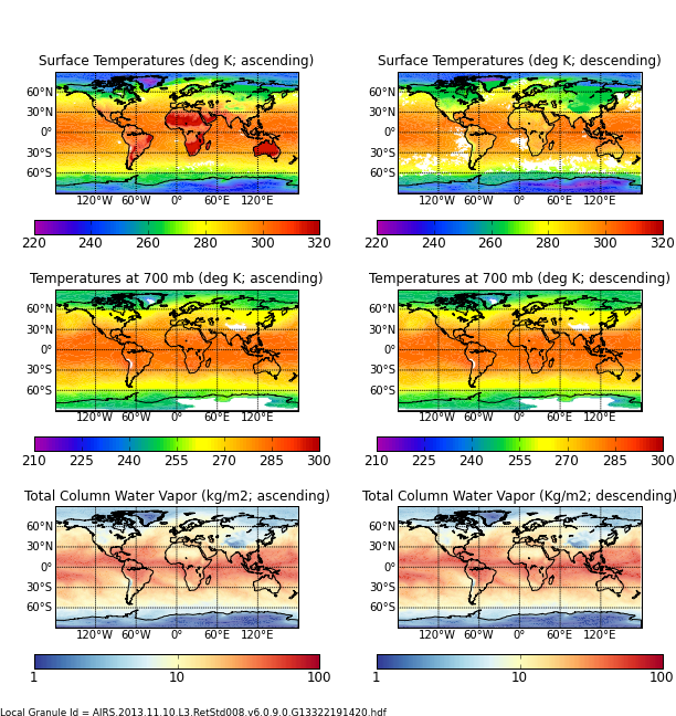
Federal
AIRS/Aqua L3 8-day Standard Physical Retrieval (AIRS-only) 1 degree X 1 degree V006 (AIRS3ST8) at GES DISC
National Aeronautics and Space Administration —
The Atmospheric Infrared Sounder (AIRS) is a grating spectrometer (R = 1200) aboard the second Earth Observing System (EOS) polar-orbiting platform, EOS Aqua. In... -
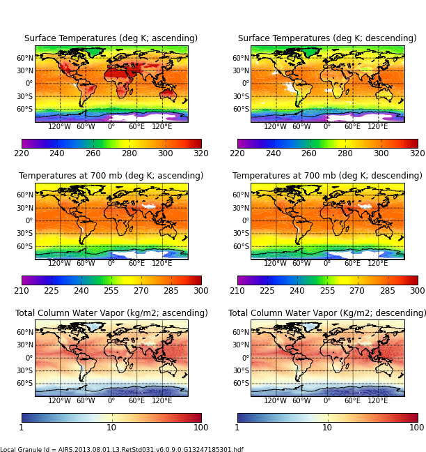
Federal
AIRS/Aqua L3 Monthly Standard Physical Retrieval (AIRS+AMSU) 1 degree x 1 degree V006 (AIRX3STM) at GES DISC
National Aeronautics and Space Administration —
The Atmospheric Infrared Sounder (AIRS) is a grating spectrometer (R = 1200) aboard the second Earth Observing System (EOS) polar-orbiting platform, EOS Aqua. In... -
Federal
GLDAS Catchment Land Surface Model L4 daily 0.25 x 0.25 degree V2.0 (GLDAS_CLSM025_D) at GES DISC
National Aeronautics and Space Administration —
NASA Global Land Data Assimilation System Version 2 (GLDAS-2) has three components: GLDAS-2.0, GLDAS-2.1, and GLDAS-2.2. GLDAS-2.0 is forced entirely with the... -
Federal
GLDAS CLM Land Surface Model L4 3 hourly 1.0 x 1.0 degree Subsetted V001 (GLDAS_CLM10SUBP_3H) at GES DISC
National Aeronautics and Space Administration —
With the upgraded Land Surface Models (LSMs) and updated forcing data sets, the GLDAS version 2.1 (GLDAS-2.1) production stream serves as a replacement for GLDAS-001.... -
Federal
Aqua/AIRS L2 Standard Physical Retrieval (AIRS+AMSU) V7.0 at GES DISC
National Aeronautics and Space Administration —
The Atmospheric Infrared Sounder (AIRS) is a grating spectrometer (R = 1200) aboard the second Earth Observing System (EOS) polar-orbiting platform, EOS Aqua. The... -
Federal
BOREAS/SRC AMS Suite A Surface Meteorological and Radiation Data: 1996
National Aeronautics and Space Administration —
Contains the data collected in 1996 by the AMS suite A instrument set operated by SRC and provided to BORIS. -
Federal
GPM GROUND VALIDATION GCPEX SNOW MICROPHYSICS CASE STUDY V1
National Aeronautics and Space Administration —
The GPM Ground Validation GCPEX Snow Microphysics Case Study characterizes the 3-D microphysical evolution and distribution of snow in context of the thermodynamic... -
Federal
SBU Mobile Soundings IMPACTS V1
National Aeronautics and Space Administration —
The SBU Mobile Sounding IMPACTS dataset consists of mobile sounding profiles collected during the Investigation of Microphysics and Precipitation for Atlantic Coast-... -
Federal
SOLVE II DC-8 Aircraft AATS14 Data
National Aeronautics and Space Administration —
SOLVE2_AircraftRemoteSensing_DC8_AATS14_Data is the remotely sensed trace gas data for the DC-8 aircraft collected during the SAGE III Ozone Loss and Validation... -
Federal
Sounder SIPS: JPSS-1 ATMS Level 2 RAMSES2 Standard: Atmosphere, precipitation and surface geophysical state V3 (SNDRJ1ML2RMS) at GES DISC
National Aeronautics and Space Administration —
This level 2 product is generated by the RAMSES (Retrieval Algorithm for Microwave Sounders in Earth Science II algorithm.The RAMSES II algorithm is a microwave only... -
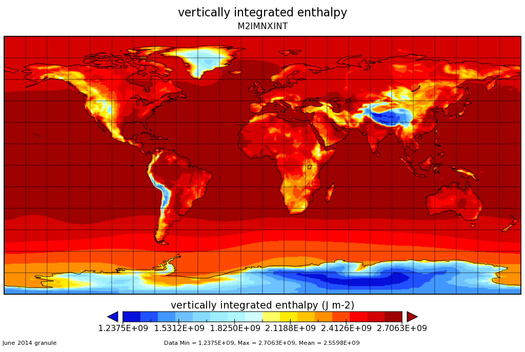
Federal
MERRA-2 instM_2d_int_Nx: 2d,Monthly mean,Instantaneous,Single-Level,Assimilation,Vertically Integrated Diagnostics 0.625 x 0.5 degree V5.12.4 (M2IMNXINT) at GES DISC
National Aeronautics and Space Administration —
M2IMNXINT (or instM_2d_int_Nx) is an instantaneous 2-dimensional monthly mean data collection in Modern-Era Retrospective analysis for Research and Applications... -
Federal
Aqua/AIRS L3 Daily Standard Physical Retrieval (AIRS+AMSU) 1 degree x 1 degree V7.0 at GES DISC
National Aeronautics and Space Administration —
The Atmospheric Infrared Sounder (AIRS) is a grating spectrometer (R = 1200) aboard the second Earth Observing System (EOS) polar-orbiting platform, EOS Aqua. In... -
Federal
MACPEX WB-57 Aircraft In-situ Meteorology and Navigational Data
National Aeronautics and Space Administration —
MACPEX_MetNav_AircraftInSitu_WB57_Data is the in-situ meteorology and navigational data collection during the Mid-latitude Airborne Cirrus Properties Experiment... -
Federal
HURRICANE AND SEVERE STORM SENTINEL (HS3) GLOBAL HAWK HIGH ALTITUDE MMIC SOUNDING RADIOMETER (HAMSR) V1
National Aeronautics and Space Administration —
The Hurricane and Severe Storm Sentinel (HS3) Global Hawk High Altitude MMIC Sounding Radiometer (HAMSR) dataset includes measurements gathered by the HAMSR... -
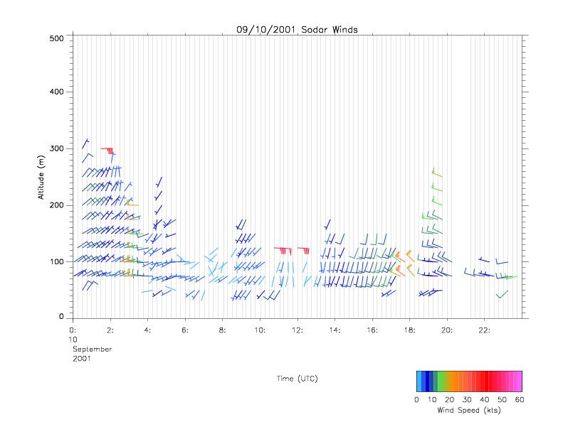
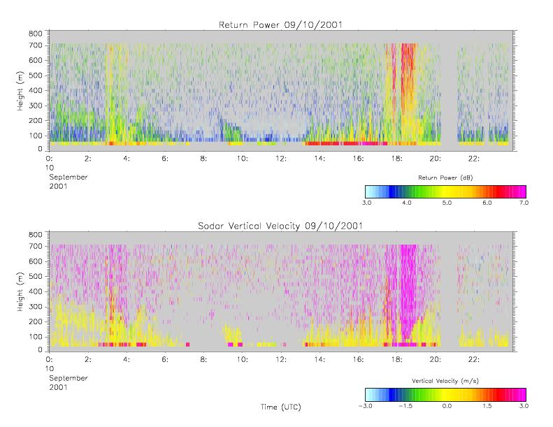
Federal
CAMEX-4 MIPS SODAR V1
National Aeronautics and Space Administration —
The University of Alabama in Huntsville (UAH) Mobile Integrated Profiling System (MIPS) is a mobile atmospheric profiling system. It includes a 915 MHz Doppler... -
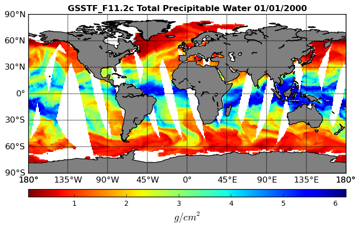
Federal
Goddard Satellite-Based Surface Turbulent Fluxes, 1x1 deg Daily Grid, Satellite F11 V2c (GSSTF_F11) at GES DISC
National Aeronautics and Space Administration —
These data are part of the Goddard Satellite-based Surface Turbulent Fluxes Version-2c (GSSTF 2c) Dataset recently produced through a MEaSURES funded project led by... -
Federal
First ISCCP Regional Experiment (FIRE) Cirrus 1 TIROS Operational Vertical Sounder (TOVS) Data
National Aeronautics and Space Administration —
Temperature soundings from the TOVS sensor on NOAA-9 and -10 satellites. Soundings were made for each pixel over the cirrus IFO network. Sounding information contains...

Official websites use .gov
A
.gov website belongs to an official government
organization in the United States.
Secure .gov websites use HTTPS
A
lock (
) or https:// means you’ve safely connected to
the .gov website. Share sensitive information only on official,
secure websites.