
-
Federal
CERES and GEO-Enhanced TOA, Within-Atmosphere and Surface Fluxes, Clouds and Aerosols 1-Hourly Terra-Aqua-NOAA20 Edition4B
National Aeronautics and Space Administration —
CER_SYN1deg-1Hour_Terra-Aqua-NOAA20_Edition4B is the Clouds and the Earth's Radiant Energy System (CERES) and geostationary (GEO) Top-of-Atmosphere (TOA) Within-... -
Federal
FLDAS Noah Land Surface Model L4 Global Monthly 0.1 x 0.1 degree (MERRA-2 and CHIRPS) V001 (FLDAS_NOAH01_C_GL_M) at GES DISC
National Aeronautics and Space Administration —
This dataset contains a series of land surface parameters simulated from the Noah 3.6.1 model in the Famine Early Warning Systems Network (FEWS NET) Land Data... -
Federal
CERES Daily Daytime Mean Regionally Averaged Terra and Aqua TOA Fluxes and Associated Cloud Properties Stratified by Optical Depth and Effective Pressure Edition4A
National Aeronautics and Space Administration —
CER_FluxByCldTyp-Day_Terra-Aqua-MODIS_Edition4A is the Clouds and the Earth's Radiant Energy System (CERES) Daily Daytime Mean Regionally Averaged Terra and Aqua Top-... -
Federal
ACCLIP WB-57 Aircraft In-Situ Aerosol Data
National Aeronautics and Space Administration —
ACCLIP_Aerosol_AircraftInSitu_WB57_Data is the in-situ aerosol data collected during the Asian Summer Monsoon Chemical & Climate Impact Project (ACCLIP). Data... -
Federal
IBEX High Energy Neutral Atom Imager (Hi) Data Release 04, Compton-Getting corrected, Survival Probability corrected, Omnidirectional, West Longitude Ecliptic Maps, Level H3 (H3), semiannually averaged Data
National Aeronautics and Space Administration —
1: The Interstellar Boundary Explorer (IBEX) has operated in space since 2008 updating our knowledge of the outer heliosphere and its interaction with the local... -
Federal
IBEX High Energy Neutral Atom Imager (Hi) Data Release 16, Compton-Getting corrected, not Survival Probability corrected, Omnidirectional, West Longitude Ecliptic Maps, Level H3 (H3), semiannually averaged Data
National Aeronautics and Space Administration —
1: The Interstellar Boundary Explorer (IBEX) has operated in space since 2008 updating our knowledge of the outer heliosphere and its interaction with the local... -
Federal
BARREL 4A X-ray Spectrometer (USPC) Bremsstrahlung X-ray Spectrum Ultra Fast Time Resolution, Level 2, 10 ms Data
National Aeronautics and Space Administration —
USPC: 30 channels of ultra fast time resolution, 10 ms, Bremsstrahlung X-ray spectra. The channel count data are in raw format. The energy levels for bins in each... -
Federal
Data associated with manuscript "Linearizing the vertical scale of an interferometric microscope and its effect on step-height measurement"
National Institute of Standards and Technology —
This repository contains all of the data used in the manuscript "Linearizing the vertical scale of an interferometric microscope and its effect on step-height... -
Federal
GPM Ground Validation Two-Dimensional Video Disdrometer (2DVD) WFF V2
National Aeronautics and Space Administration —
The GPM Ground Validation Two-Dimensional Video Disdrometer (2DVD) WFF data were collected during the Global Precipitation Mission (GPM) Ground Validation (GV)... -
Federal
FLASHFlux NOAA-20 Daily Gridded TOA and Surfaces/Clouds data Version 1A
National Aeronautics and Space Administration —
FLASH_TISA_NOAA20_Version1A is the Fast Longwave And SHortwave Fluxes (FLASHFlux) Daily Gridded Single Satellite Top-of-Atmosphere (TOA) and Surfaces/Clouds Version... -
Federal
Data associated with manuscript "Linearizing the vertical scale of an interferometric microscope and its effect on step-height measurement"
Department of Commerce —
This repository contains all of the data used in the manuscript "Linearizing the vertical scale of an interferometric microscope and its effect on step-height... -
Federal
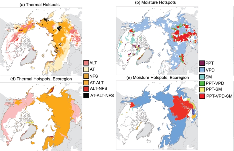
Trends of Thermal, Wetness, and Vegetative Change in the Circumpolar Arctic
National Aeronautics and Space Administration —
This dataset provides estimates of trends in temperature, moisture, and vegetation changes over the circumpolar Arctic. Time series trends were measured by the Theil-... -
Federal
CERES Time-Interpolated TOA Fluxes, Clouds and Aerosols Daily NOAA-20 Edition1B
National Aeronautics and Space Administration —
The Clouds and the Earth's Radiant Energy System (CERES) Single Scanner Footprint One Degree (SSF1deg) Day provides daily averages of regional constant meteorology... -
Federal
BOREAS CanSIS Regional Soils Data in Vector Format, V2
National Aeronautics and Space Administration —
This data set contains soils data from the Canada Soil Information System (CanSIS) in ESRI Shapefile format for the provinces of Saskatchewan and Manitoba. They are... -
Federal
IBEX High Energy Neutral Atom Imager (ENA-Hi) Data Release 10, Compton-Getting corrected, not Survival Probability corrected, Antiram direction, West Longitude Ecliptic Maps, Level H3 (H3), 7 year average Data
National Aeronautics and Space Administration —
The IBEX ENA-Hi and IBEX ENA-Lo data sets are from Release 10 of all-sky map data for the first seven years, 2009-2015, in the form of antiram direction Hydrogen, H,... -
Federal
IBEX High Energy Neutral Atom Imager (Hi) Data Release 07, not Compton-Getting corrected, not Survival Probability corrected, Omnidirectional, West Longitude Ecliptic Maps, Level H3 (H3), semiannually averaged Data
National Aeronautics and Space Administration —
1: The Interstellar Boundary Explorer (IBEX) has operated in space since 2008 updating our knowledge of the outer heliosphere and its interaction with the local... -
Federal
IBEX High Energy Neutral Atom Imager (Hi) Data Release 07, not Compton-Getting corrected, Survival Probability corrected, Ram direction, West Longitude Ecliptic Maps, Level H3 (H3), annually averaged Data
National Aeronautics and Space Administration —
1: The Interstellar Boundary Explorer (IBEX) has operated in space since 2008 updating our knowledge of the outer heliosphere and its interaction with the local... -
Federal
IBEX High Energy Neutral Atom Imager (ENA-Hi) Data Release 10, Compton-Getting corrected, not Survival Probability corrected, Antiram direction, West Longitude Ecliptic Maps, 1 year averaged data, Level H3
National Aeronautics and Space Administration —
This IBEX-Hi data set is from Release 10 of all-sky map data for the first seven years, 2009-2015, in the form of antiram direction Hydrogen, H, energetic neutral... -
Federal
IBEX High Energy Neutral Atom Imager (Hi) Data Release 07, Compton-Getting corrected, Survival Probability corrected, Antiram direction, West Longitude Ecliptic Maps, Level H3 (H3), annually averaged Data
National Aeronautics and Space Administration —
1: The Interstellar Boundary Explorer (IBEX) has operated in space since 2008 updating our knowledge of the outer heliosphere and its interaction with the local...

Official websites use .gov
A
.gov website belongs to an official government
organization in the United States.
Secure .gov websites use HTTPS
A
lock (
) or https:// means you’ve safely connected to
the .gov website. Share sensitive information only on official,
secure websites.