

11 datasets found for "Priority Conservation Areas"
-
Federal
Ag and Food Statistics: Charting the Essentials
Department of Agriculture —
A collection of over 75 charts and maps presenting key statistics on the farm sector, food spending and prices, food security, rural communities, the interaction of... -
Federal
OPERA Dynamic Surface Water Extent from Harmonized Landsat Sentinel-2 provisional product (Version 1)
National Aeronautics and Space Administration —
This dataset contains Level-3 Dynamic OPERA provisional surface water extent product version 1. The data are provisional surface water extent observations beginning... -
Federal
AFSC/REFM: Pacific cod Localized Depletion Study
National Oceanic and Atmospheric Administration, Department of Commerce —
Data from Localized Depletion study for Pacific cod 2001-2005. Study was conducted using cod pot gear to measure localized abundance of Pacific cod inside and outside... -
Federal
NACP: Forest Carbon Stocks, Fluxes and Productivity Estimates, Western USA, 1979-2099
National Aeronautics and Space Administration —
This dataset contains annual estimates of carbon stocks, fluxes, and productivity over forested land in 11 states of the western USA (Arizona, California, Colorado,... -
Federal
Soil Survey Reference (FIFE)
National Aeronautics and Space Administration —
The objectives of this study were to collect soil survey information from the FIFE study area, determine the soil types at the FIFE sites, and characterize the... -
Federal
Annual Burned Area from Landsat, Mawas, Central Kalimantan, Indonesia, 1997-2015
National Aeronautics and Space Administration —
This dataset provides maps of annual burned area for the part of Mawas conservation program in Central Kalimantan, Indonesia from 1997 through 2015. Landsat imagery... -
Federal
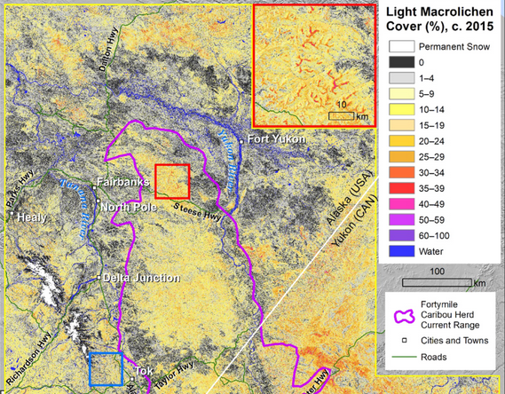
ABoVE: Lichen Forage Cover over Fortymile Caribou Range, Alaska and Yukon, 2000-2015
National Aeronautics and Space Administration —
This dataset provides modeled estimates of lichen ground cover at 30 m resolution across the Fortymile study area in interior eastern Alaska, U.S., and the Yukon... -
Federal
Risk Factor Analysis in Low-Temperature Geothermal Play Fairway Analysis for the Appalachian Basin (GPFA-AB)
Department of Energy —
This submission contains information used to compute the risk factors for the GPFA-AB project. The risk factors are natural reservoir quality, thermal resource... -
Federal
Alaska's Changing YK Delta: Knowledge Exchange between Elders and Geoscientists, 2018
National Aeronautics and Space Administration —
This dataset provides a booklet documenting the discussions and outcomes from a knowledge-exchange meeting with Yup'ik elders from the Yukon-Kuskokwim Delta (YKD),... -
Federal
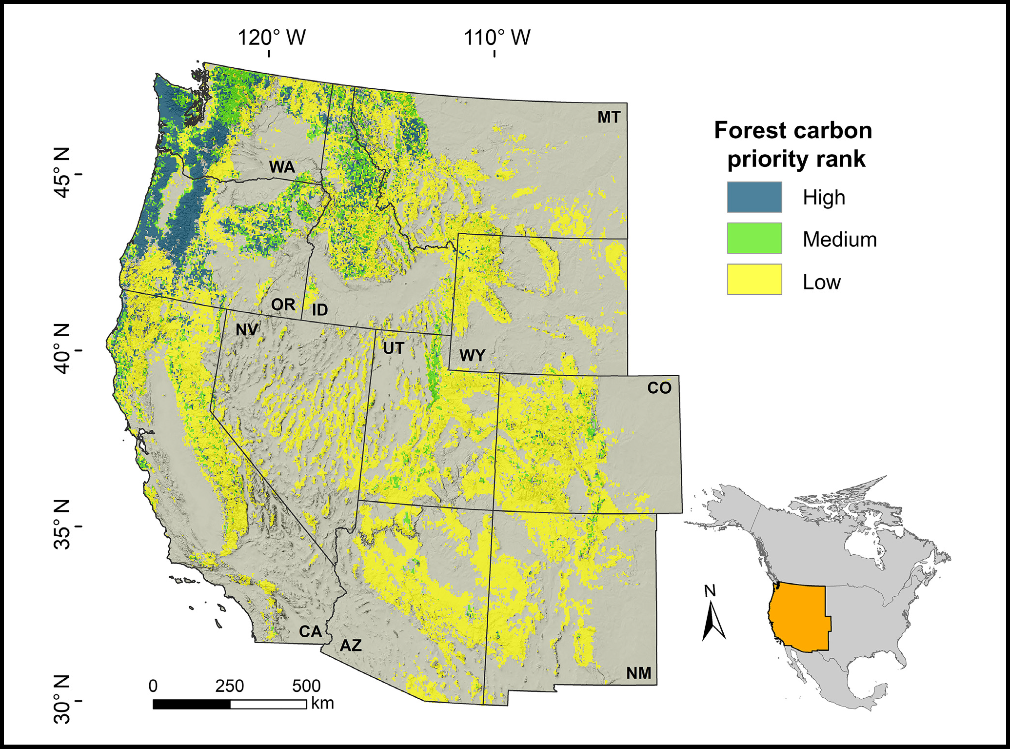
Forest Preservation Ranking and Vertebrate Species Richness, Western USA, 2020-2099
National Aeronautics and Space Administration —
This dataset provides related gridded outputs of future modeled forest carbon sequestration priority and related species richness and habitat suitability for the...
11 datasets found for "Priority Conservation Areas"