
-
Federal
BigFoot Field Data for North American Sites, 1999-2003
National Aeronautics and Space Administration —
The BigFoot project gathered field data for selected EOS Land Validation Sites in North America from 1999 to 2003. Data collected and derived for varying intervals at... -
Federal
TOVS GLA MONTHLY GRIDS from NOAA-11 V01 (TOVSAMNH) at GES DISC
National Aeronautics and Space Administration —
This dataset (TOVSAMNH) contains the TIROS Operational Vertical Sounder (TOVS) level 3 geophysical parameters derived using data from NOAA-11 and the physical... -
Federal
Anthropogenic Carbon Emission System, 2012-2017, Version 2
National Aeronautics and Space Administration —
This dataset provides estimates of hourly carbon dioxide (CO2) emissions from the combustion of fossil fuels at 1-km resolution for the coterminous United States... -
Federal
TOVS GLA MONTHLY GRIDS from NOAA-10 V01 (TOVSAMNG) at GES DISC
National Aeronautics and Space Administration —
This dataset (TOVSAMNG) contains the TIROS Operational Vertical Sounder (TOVS) level 3 geophysical parameters derived using data from NOAA-10 and the physical... -
Federal
TOVS GLA 5 DAY GRIDS from NOAA-10 V01 (TOVSA5NG) at GES DISC
National Aeronautics and Space Administration —
This dataset (TOVSA5NG) contains the TIROS Operational Vertical Sounder (TOVS) level 3 geophysical parameters derived using data from NOAA-10 and the physical... -
Federal
EMIT L2B Estimated Mineral Identification and Band Depth and Uncertainty 60 m V001
National Aeronautics and Space Administration —
The Earth Surface Mineral Dust Source Investigation (EMIT) instrument measures surface mineralogy, targeting the Earth’s arid dust source regions. EMIT is installed... -
Federal
LiDAR Derived Forest Aboveground Biomass Maps, Northwestern USA, 2002-2016
National Aeronautics and Space Administration —
This dataset provides maps of aboveground forest biomass (AGB) of living trees and standing dead trees in Mg/ha across portions of Northwestern United States,... -
Federal
EMIT L2A Estimated Surface Reflectance and Uncertainty and Masks 60 m V001
National Aeronautics and Space Administration —
The Earth Surface Mineral Dust Source Investigation (EMIT) instrument measures surface mineralogy, targeting the Earth’s arid dust source regions. EMIT is installed... -
Federal
DSCOVR EPIC Level 3 PAR Image
National Aeronautics and Space Administration —
DSCOVR_EPIC_L3_PAR-image_01 is a view image showing data from DSCOVR_EPIC_L3_PAR, which is the Deep Space Climate Observatory (DSCOVR) Earth Polychromatic Imaging... -
Federal
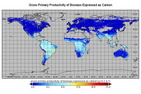
Global Monthly GPP from an Improved Light Use Efficiency Model, 1982-2016
National Aeronautics and Space Administration —
This dataset provides global monthly average gross primary productivity (GPP; g carbon/m2/d) modeled at 8 km spatial resolution for each of the 35 years from... -
Federal
EMIT L2B Methane Enhancement Data 60 m V002
National Aeronautics and Space Administration —
The Earth Surface Mineral Dust Source Investigation (EMIT) instrument measures surface mineralogy, targeting the Earth’s arid dust source regions. EMIT is installed... -
Federal
EMIT L2B Carbon Dioxide Enhancement Data 60 m V002
National Aeronautics and Space Administration —
The Earth Surface Mineral Dust Source Investigation (EMIT) instrument measures surface mineralogy, targeting the Earth’s arid dust source regions. EMIT is installed... -
Federal
HIRENASD Beam FEM
National Aeronautics and Space Administration —
This contains attempts to create BEAM FEM model. I have started a Blog to discuss this... please put your comments there and I will attempt to keep everything... -
Federal
SAFARI 2000 MODIS 500-m Burned Area Products, Southern Africa, Dry Season 2000
National Aeronautics and Space Administration —
The SAFARI 2000 project was selected as the first regional test for a prototype regional 500 m MODIS burned area product. The MODIS burned area product maps the 500 m... -
Federal
VISSR/SMS-1 Visible Imagery on 70mm Film V001 (VISSRSMS1IMVIS) at GES DISC
National Aeronautics and Space Administration —
VISSRSMS1IMVIS is the Visible Infrared Spin-Scan Radiometer (VISSR) Visible Imagery on 70mm Film data product from the first Synchronous Meteorological Satellite... -
Federal
CERES MODIS and GEO Cloud Retrievals in ISCCP-D2like Format Daytime Edition3A
National Aeronautics and Space Administration —
CER_ISCCP-D2like-Mrg_GEO-MODIS-DAY_Edition3A is the Clouds and the Earth's Radiant Energy System (CERES) Moderate Resolution Imaging Spectroradiometer (MODIS) and... -
Federal
TOVS GLA DAILY GRIDS from NOAA-11 V01 (TOVSADNH) at GES DISC
National Aeronautics and Space Administration —
This dataset (TOVSADNH) contains the TIROS Operational Vertical Sounder (TOVS) level 3 geophysical parameters derived using data from NOAA-11 and the physical... -
Federal
TOVS GLA DAILY GRIDS from TIROSN V01 (TOVSADTN) at GES DISC
National Aeronautics and Space Administration —
This dataset (TOVSADTN) contains the TIROS Operational Vertical Sounder (TOVS) level 3 geophysical parameters derived using data from TIROS-N and the physical...

Official websites use .gov
A
.gov website belongs to an official government
organization in the United States.
Secure .gov websites use HTTPS
A
lock (
) or https:// means you’ve safely connected to
the .gov website. Share sensitive information only on official,
secure websites.