
-
Federal
AfriSAR: Aboveground Biomass for Lope, Mabounie, Mondah, and Rabi Sites, Gabon
National Aeronautics and Space Administration —
This dataset provides gridded estimates of aboveground biomass (AGB) for four sites in Gabon at 0.25 ha (50 m) resolution derived with field measurements and airborne... -
Federal
BOREAS TE-23 Map Plot Data
National Aeronautics and Space Administration —
The BOREAS TE-23 team collected map plot data in support of its efforts to characterize and interpret information on canopy architecture and understory cover at the... -
Federal
Forest Inventory and Biophysical Measurements, Brazilian Amazon, 2009-2018
National Aeronautics and Space Administration —
This dataset provides the complete catalog of forest inventory and biophysical measurements collected over selected forest research sites across the Amazon rainforest... -
Federal
LBA-ECO CD-17 Secondary Forest Survey, Para and Rondonia, Brazil: 2002-2003
National Aeronautics and Space Administration —
This data set provides measurements for diameter at breast height (DBH), tree height, distance from tree stems to the furthest canopy element, and a species survey of... -
Federal
Forest Biophysical Parameters (SNF)
National Aeronautics and Space Administration —
The purpose of the SNF study was to improve our understanding of the relationship between remotely sensed observations and important biophysical parameters in the... -
Federal
Biomass of Sacrificed Spruce/Aspen (SNF)
National Aeronautics and Space Administration —
The purpose of the SNF study was to improve our understanding of the relationship between remotely sensed observations and important biophysical parameters in the... -
Federal
BOREAS TE-08 Aspen Bark Chemistry Data
National Aeronautics and Space Administration —
The BOREAS TE-08 team collected pigment density data from aspen bark and leaves from four sites within the BOREAS SSA from 24-May-1994 to 16-Jun-1994 (IFC-1),... -
Federal
SAFARI 2000 Canopy Structural Measurements, Kalahari Transect, Wet Season 2001
National Aeronautics and Space Administration —
This data set contains leaf area index (LAI), leaf inclination angle, and canopy dimension data from study sites along the Kalahari Transect in southwest Botswana.... -
Federal
AfriSAR: Mondah Forest Tree Species, Biophysical, and Biomass Data, Gabon, 2016
National Aeronautics and Space Administration —
This dataset provides plot-level estimates of basal area, aboveground biomass, number of trees, maximum tree height, and basal-area-weighted wood specific gravity... -
Federal
LBA-ECO ND-02 Secondary Forest Tree Heights and Diameters, Para, Brazil: 1999-2005
National Aeronautics and Space Administration —
Understanding secondary successional processes in Amazonian terrestrial ecosystems is becoming increasingly important as continued deforestation expands the area that... -
Federal
LBA-ECO LC-02 Biophysical Measurements of Forests, Acre, Brazil: 1999-2002
National Aeronautics and Space Administration —
This data set provides diameter at breast height (DBH) measurements for 1,063 trees located at the Catuaba Experimental Farm, and 812 trees located in the Humaita... -
Federal
LBA-ECO CD-11 Biophysical Measurements of Logged and Fire-Treated Forests, Brazil
National Aeronautics and Space Administration —
This data set reports the results of vegetation field surveys that measured tree height and diameter at breast height (DBH) in defined size classes at three study... -
Federal
LBA-ECO TG-07 Tree Geometry in an Undisturbed Forest in Cauaxi, Para, Brazil
National Aeronautics and Space Administration —
Canopy measurements in an undisturbed eastern Amazon forest (Cauxi, Para, Brazil. See Figure 1) were derived from a one-time event in 2000 using a hand-held laser... -
Federal
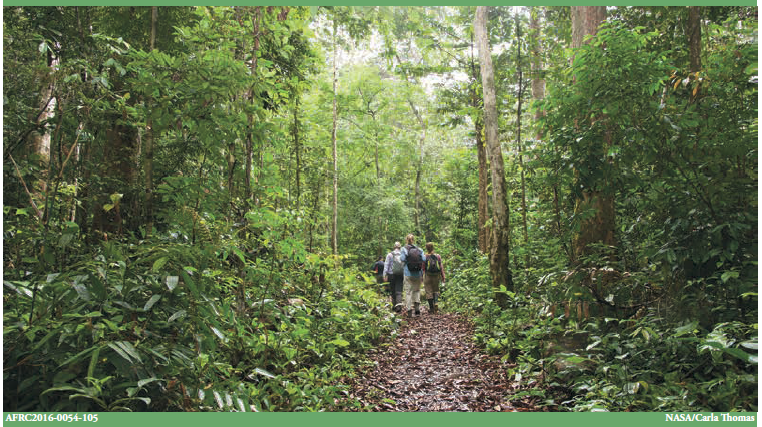
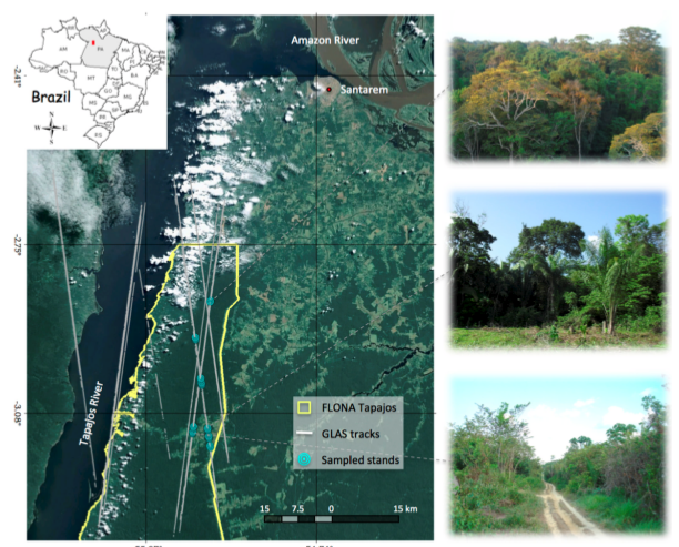
Tree Inventory and Biometry Measurements, Tapajos National Forest, Para, Brazil, 2010
National Aeronautics and Space Administration —
This dataset provides tree inventory, tree height, diameter at breast height (DBH), and estimated crown measurements from 30 plots located in the Tapajos National... -
Federal
ECHIDNA LIDAR Campaigns: Forest Canopy Imagery and Field Data, U.S.A., 2007-2009
National Aeronautics and Space Administration —
This data set contains forest canopy scan data from the Echidna® Validation Instrument (EVI) and field measurements data from three campaigns conducted in the United... -
Federal
SNF Forest Understory Cover Data
National Aeronautics and Space Administration —
The purpose of the SNF study was to improve our understanding of the relationship between remotely sensed observations and important biophysical parameters in the... -
Federal
SNF Forest Understory Cover Data (Table)
National Aeronautics and Space Administration —
The purpose of the SNF study was to improve our understanding of the relationship between remotely sensed observations and important biophysical parameters in the... -
Federal
NPP Boreal Forest: Superior National Forest, USA, 1983-1984, R1
National Aeronautics and Space Administration —
This data set contains two files (.txt format). One file provides ground-based biophysical measurements and above-ground net primary productivity (ANPP) estimates for... -
Federal
Global Mangrove Distribution, Aboveground Biomass, and Canopy Height
National Aeronautics and Space Administration —
This dataset characterizes the global distribution, biomass, and canopy height of mangrove-forested wetlands based on remotely sensed and in situ field measurement...

Official websites use .gov
A
.gov website belongs to an official government
organization in the United States.
Secure .gov websites use HTTPS
A
lock (
) or https:// means you’ve safely connected to
the .gov website. Share sensitive information only on official,
secure websites.