

9 datasets found for ""Hydrologic Units""
-
Federal
Essential Fish Habitat, Pacific Salmon GIS Data
National Oceanic and Atmospheric Administration, Department of Commerce —
This file represents salmonid freshwater and estuarine Essential Fish Habitat (EFH) in the western United States. Congress, through the Magnuson-Stevens Act, defined... -
Federal
SalmonChinook_SnakeRiverspringsummerrunESU_19991025
National Oceanic and Atmospheric Administration, Department of Commerce —
Critical habitat includes the water, waterway bottom, and adjacent riparian zone of specified lakes and river reaches. Adjacent riparian zones are defined as those... -
Federal
NARS data in combination with results data
U.S. Environmental Protection Agency —
Source data from the National Aquatic Resource Survey's National Rivers and Streams Assessment containing benthic macroinvertebrate and fish taxa data and... -
Federal
2002/2003 IfSAR data for Southern California: Digital Elevation Model (NAVD88)
National Oceanic and Atmospheric Administration, Department of Commerce —
This metadata document describes the collection and processing of topographic elevation point data derived from Interferometric Synthetic Aperture Radar (IfSAR)... -
Federal
West Coast Stream Attributes for Salmon Intrinsic Potential
National Oceanic and Atmospheric Administration, Department of Commerce —
The dataset was built using the U.S. National Hydrography Dataset Plus (NHDPlusV2, 1:100,000 scale) stream network and value-added attributes (VAA), the U.S. National... -
Federal
Wetland Salinity Maps of Select Estuary Sites in the United States, 2020
National Aeronautics and Space Administration —
This dataset provides gridded average annual wetland salinity concentrations in practical salinity units (PSU) at 30-meter resolution within 24 coastal estuary sites... -
Federal
2002/2003 IfSAR data for Southern California: Radar Reflectance Image
National Oceanic and Atmospheric Administration, Department of Commerce —
This metadata document describes the collection and processing of topographic elevation point data derived from Interferometric Synthetic Aperture Radar (IfSAR)... -
Federal
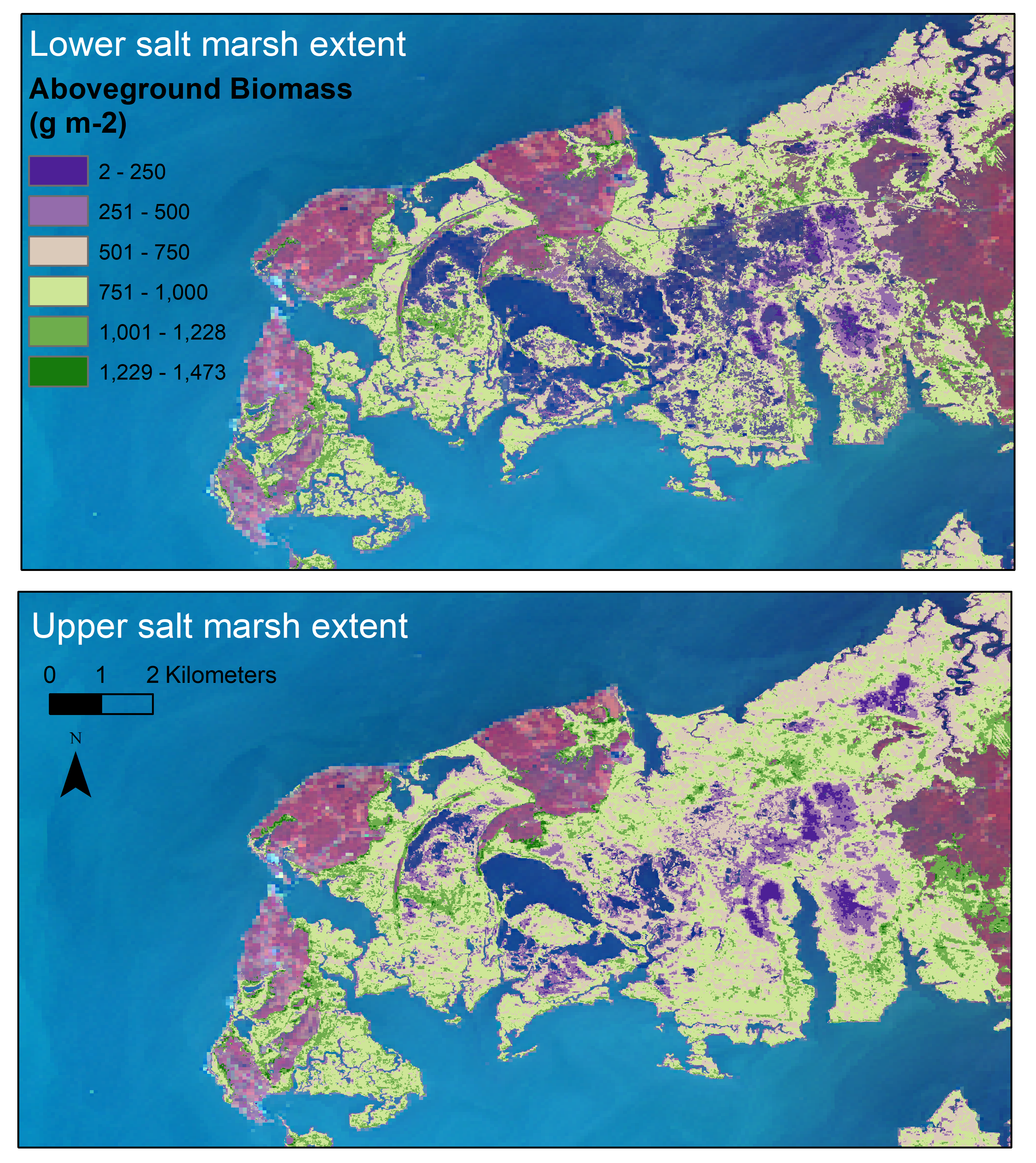
Aboveground Biomass Estimates for Salt Marsh for the Contiguous United States, 2020
National Aeronautics and Space Administration —
This dataset provides estimates of aboveground biomass (AGB) and salt marsh extent in the contiguous United States for 2020 and includes all coastal watersheds across...
9 datasets found for ""Hydrologic Units""